What is this
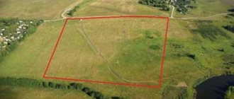
By drawing out the boundaries of a land plot (LP) in kind we mean the position on which the land surveying procedure is based, a type of topographic and geodetic services with the help of which the boundary of the plot is fixed, established and formalized by means of boundary signs. The result of establishing boundary signs is that there is an opportunity for:
- detecting clear boundaries of the site;
- its specified area;
- form;
- location relative to the total mass that currently exists.
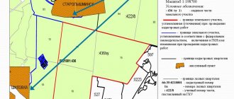
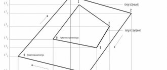
An example of a diagram for the location of turning points of a site.
The listed parameters are quite important, since they are the basis for the emergence of general ideas about the allotment; it is also possible to reflect the visual picture that develops and corresponds to the real location of affairs. In addition, the characteristics of the earth are formed.
In this regard, the land plots acquire legal capacity and also begin to correspond to the context of the provisions that are provided for types of property transactions.
The origin of the concept under consideration is associated with the production process, which consists of the removal of boundaries that have been recorded on paper. This means that they are reflected in the documentation and plans. The points with the help of which the boundaries of the site are determined are reflected there. In this case, nature implies a real context.
To carry out the procedure aimed at restoring the boundaries, it will be necessary to collect complete and reliable information about the allotment, including what data is included in the state land cadastre.
Extracts made from cadastral records are reflected, which are the basis for carrying out activities aimed at preliminary design. It is carried out according to the information presented in the interactive plan.
This means that the required information includes the original documentation regarding the memory, including:
- features by which they can be characterized;
- configuration, coordinates relative to turning points;
- general area;
- Are there any corners and where are they located?
After the preliminary analysis of documents and topographical locations of the land plot has been carried out, they can begin to carry out geodetic work on the ground.
The concept under consideration is relevant both in the field of land management and in urban planning work. This is due to the fact that it is necessary to accurately determine the terrain for the construction of a building, while the construction is quite well financed. The terms restoration of boundaries or installation of signs are also used.
Installation and clarification
The construction of boundary signs is carried out by digging in pillars of a certain type, which were mentioned above. In this case, they are oriented relative to each other. They should be positioned so that the front side with the inscription faces the next column along the border of the site in a clockwise direction. Each boundary sign has a plate that contains the following information:
- installation date;
- sign number.
REFERENCE! The number is indicated in accordance with the boundary plan.
All inscriptions must be made with weather-resistant paint. And this requirement should also be observed when choosing the type of signs, since the durability of the signs depends on the climate of a certain region and atmospheric influences.
Clarification of boundary signs is necessary when:
- disagreements with the owners of adjacent plots;
- making transactions with land;
- loss of the original appearance of the fence or its absence;
- presence of inaccurate information about the coordinates of turning points.
Clarification is also carried out with the help of a cadastral engineer.
Boundary signs carry information about the boundaries of a land plot, thereby representing information value. That is why their safety is regulated by law. In practice, they are rarely encountered, but ignorance is no excuse. Do not forget that land surveying is a combination of not only geodetic work, but also legal work. This means that to make the task easier, you should not deal with this issue yourself.
Reasons
The basis for the procedure for removing boundaries is a statement drawn up by a person who has ownership rights to the plot or an employee of a real estate company who is preparing the land for sale.
As a rule, owners of land plots turn to this type of service when property-related conflict situations arise with persons living in the neighborhood. This may also be the preparation of materials for consideration by the court, or when it is discovered that there are errors in the use of the allotment.
Situations arise when construction of residential premises has begun on a plot of land acquired by a person. After the process of selling the land has taken place, the new owner removes the boundaries of his plot.
Based on the results, it turns out that the person seized part of the neighbor’s memory. To reduce risks in terms of violations of existing standards to a minimum, the process of selling an allotment should be preceded by determining the real boundaries with which the area is provided.
Land surveying
When a controversial situation arises, which is similar to the one discussed above, the realtor may become the one to whom strong claims will be presented, and he may also be liable for property damage for improperly conducting the transaction. This means that when land is being prepared for sale or another property transaction, boundary work is required.
Boundary posts and signs
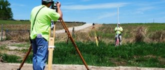
Geodetic work is functionally not only quite complex, but also requires that the cadastral engineer conducting it, who carries out land marking activities, has a fairly high qualification.
Such actions have the distinctive feature of high responsibility. This means that if an engineer makes a slight inaccuracy in a measurement, this could turn into a long-term conflict in the future.
Rules for installing signs
In some cases, companies carrying out geodetic activities provide their clients with guarantees that the error will not be more than 10 centimeters. Carry out markings on the site. After the geodetic survey is completed, the installation of signs begins. They look like special pegs. This procedure has options:
- special stakes are installed, which bear the sign of the company installing them;
- can install simple wooden stakes.
At the initial stage, temporary stakes are installed, which are made of wood, then they are replaced with reinforced ones made of metal.
These differences depend not only on the status of the company carrying out the activity in question, but also on the value terms of the land in the total mass, in which case conflict situations can arise for every extra meter of land.
Boundary signs, which have a permanent meaning, are required in order to carry out the removal of boundaries regarding boundary work on a large land plot. In this case, small stakes may get lost. According to established standards, land survey signs are made of strong and durable materials. They have a standard size.
If the owner is afraid that the signs will be confiscated, he has the opportunity to install anti-vandal signs, which are quite expensive. They are made of metal, their size is smaller than specified in the standards.
The advantage of such signs is that the base that is buried in the ground appears in the shape of an anchor. This means that moving such a sign is quite problematic.
How and who enforces boundaries
The boundaries are fixed by specialists in the field of land measurements - surveyors and cadastral engineers. They go to the area and, using geodetic instruments, based on the information you provide from the Unified State Register (USRN) (extended extract), draw boundaries at the given coordinates. Each turning point of the site is indicated on the ground using boundary signs, which are temporary designations of the boundaries of the sites. It is by these that builders are guided when installing fence structures.
Step-by-step instruction
The survey instructions are presented as follows: at the initial stage, you will need to prepare all the necessary documentation. When the process of restoring boundaries is carried out on a plot that has already been inhabited, which is carried out due to a dispute, the documents include the following:
- boundary work created earlier;
- cadastral passport;
- documentation of legal significance.
Stages of land surveying
When the listed documentation is not available, you will need to prepare an initial act of permission regarding the sale of the allotment or its allocation. It is also necessary to make an extract from the cadastral records, which contain information regarding the location of the site and its characteristics.
Then the cadastral engineer, after studying the presented documentation, has the opportunity to navigate the site. You should contact a company that provides geodetic services. In this case, you should not rush to sign an agreement with the first company.
It is necessary to select several options, conduct a conversation with each of them, and then draw a conclusion which company is most suitable. The services that will be provided are the same everywhere, but the prices for them are quite different.
After considering all the proposals and choosing the main pros and cons of the companies, you can safely choose one of them. After the choice is made, you need to contact the company and submit the necessary documentation.
After the conversation and clarification of all issues, an agreement can be concluded. You can make a list of questions in advance that you need to find out when visiting the company. This is required in order to remember to find out all the points of interest.
Removal act
This document is presented as the most important of all the components of land surveying. It is presented as a basis for protecting the allotment from the legal side. Drawing up such an act is carried out after all the work has been completed, stakes have been installed in relation to all points, the configuration of the allotment points and its area have been determined.
An example of an act of transferring the limits of the memory in kind
The list of information included in the act includes:
- storage area size;
- location relative to the terrain where accurate topographic data is reflected;
- characteristic features of the allotment and its description;
- coordinates relative to each boundary sign that was installed.
With the help of the act, the exact location of all boundary signs is established. It includes a description and coordinates that are established in relation to the recovery on the ground.
Essentially speaking, this act is a document according to which the acceptance and transfer of signs is carried out from the cadastral engineer to the owner of the plot. After the deed is signed, the boundaries of the allotment are under the jurisdiction of the owner and under his responsibility. If the owner's right to land is violated, then defense is carried out in court.
Lawsuit for restoration
The owner has the right to protect the boundaries of the allotment in accordance with the provisions of land legislation, as well as the Constitution. Such powers are subject to protection in court. Often, claims aimed at restoring the boundaries of the plot are filed in a situation where the realtor made a mistake when selling the plot or when conflicts arise with neighbors.
In practice, a situation arose when a person working as a realtor brought a plot of land for sale to show the buyer and offered to measure out 30 m of beds from someone else’s meters and insert stakes. Considering that there was a road and a river on the other sides, the site looked clearer this way.
Example of a claim for restoration of memory zones
However, a person living in the neighborhood decided to file an application to court to restore the violated boundaries. This case was dismissed in court, as the parties were reconciled. The realtor paid monetary compensation for moral damages.
When using a land plot, the process of zone restoration is carried out in a situation where contradictions arise with neighbors regarding the use of the land. When a person realizes that his property rights have been infringed by someone, he has the opportunity to restore justice by filing a claim with the judicial authorities. The claim is filed in the district court in the place where the allotment is located.
Before filing a claim, it is necessary to collect the necessary documentation that confirms that there is an illegal disposal of the plot by other persons who do not have ownership rights to the land.
It will be necessary to review the standards established regarding the use of land and check to what extent they are observed by both parties.
Next, an engineer is invited and carries out the process of restoring the boundaries in the design documentation. After checking the design documentation with the state of affairs existing in real life, if violations are identified, it is required to obtain a receipt stating that errors have occurred.
When drawing up a statement of claim, the characteristics of the allotment are indicated, and the reason for which rights to the land allotment were obtained is indicated.
Then the reason for filing the claim is stated, including what specific violations of property rights are taking place. The plaintiff indicates what actions he took in order to restore his rights, and reflects the reaction to such actions on the part of the defendant.
It is worth noting that each provision reflected in the statement of claim must be supported by evidence that exists, or listed in detail.
The claim is that it is necessary to take actions aimed at restoring the limits of the allotment. At the end of the act, a list of documentation is indicated that is attached to the claim and with its help you can prove the position of the plaintiff. Signed and dated. If the court recognizes the claim, it is possible to restore the rights that were violated.
Cost and terms
The cost of services provided for the removal of the boundaries of the land plot in kind is calculated taking into account the price set for the stakes, with the help of which the corners of the plot are determined. An example can be given that in one of the regions, various companies offer from 500 to 1,500 rubles for each driven peg for the service in question.
Cost of surveying
Also, in the more expensive option, an additional payment of 200 rubles is required for cadastral work, while in the budget option there were no such expenses. Considering that you need to drive in 4 pegs, the difference between prices is significant.
It can also be said that more reputable companies require an advance payment of 70 percent of the total cost. However, there are situations when the pricing policy affects the quality of the work performed.
This means that expensive options are close to established standards, and those carried out for a budget fee - stakes are presented in the form of branches, which are usually installed as temporary ones and are subsequently replaced.
In a situation where the shape of the plot is not the usual geometric shape - but is endowed with an intricate pattern, you will need to drive in enough stakes to mark each corner of the plot. Accordingly, in this case the price also differs, as the complexity of the services provided increases. As a rule, companies say that the price for such services cannot be cheap, since their production uses quite expensive equipment.
The deadlines that are established for the implementation of such work are negotiated with each company separately. This provision, as well as the cost of services, differs quite a lot depending on which company will perform the actions. As a rule, the standard period is 10-15 days.
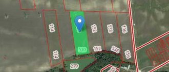
Scheme for setting out the boundaries of the memory
Some companies provide a one-month guarantee for the work, and when the work needs to be done urgently, an additional fee is required. When the borders are restored in kind, you will have to spend another 1-2 days on drawing up the corresponding act.
Despite the fact that the activity itself can be completed during the day, the rest of the time is spent on creating an extract from the cadastre, which reflects real estate data.
ADMINISTRATIVE RESPONSIBILITY FOR THE ABSENCE OF BOUNDARIES
The Administrative Code of the Russian Federation (Article 7.2) obliges persons who own or use land plots to monitor the safety of boundary signs, but it is not always possible to comply with this requirement. Quite often, geodetic signs on the ground turn out to be lost through no fault of the owner of the site, but even in such a situation, it is he who needs to carry out the procedure for placing boundary signs in situ, so as not to be held administratively liable.
You can order the services of specialists from UIA “Chekhov Cadastral Architectural Bureau” by phone or by leaving a request on the website. We guarantee that all work to determine the coordinates of boundary markers will be carried out quickly and professionally, and the cost of locating the boundaries of the site will be acceptable for each owner.
Share on social networks
What the process looks like
The process aimed at restoring the limits begins after: an agreement has been concluded with the company, an advance payment has been made, and a full package of documents has been provided. A cadastral engineer visits the area for the purpose of conducting a preliminary survey.
Installing marks and signs
A geodetic type of survey is also carried out and marks are installed in places and notches are made for further securing. During the entire time that the employees of the geodetic company are analyzing the presented data and creating a theoretical project, the owners must wait for the appointed day when work is carried out on site.
At the appointed time, a meeting takes place with cadastral engineers at the site and topographic marking is carried out. In the presence of the owner, measurements of the plot are taken and its size is determined. On the ground, specialists determine the correspondence of correspondences and deviations between real cases and what is reflected in the documentation.
The result of the work under consideration is the restoration of boundary signs on site. If we talk about how it should ideally be, it is worth noting that each sign should be assigned an individual number. Boundary signs have immunity from third parties. They are transferred against receipt to the owner of the allotment. Then he is responsible for them.
The procedure under consideration is largely carried out in territories that have not yet been inhabited. If restoration is carried out before the sale, it is done by a realtor; after the purchase, it is done by the owner.
Boundary signs
Oct 11,2017 Comments to the post Boundary signs are disabled By admin
Boundary signs: what are they for, is it possible to do without them
All respectable people try not to violate the current legislation, so that later no serious problems arise with law enforcement officers and with various authorities. But as practice shows, our compatriots often suffer from legal illiteracy. Especially when it comes to land legislation.
There are a huge number of violations in this area. They are mainly associated with the unauthorized seizure of other people's land plots. Of course, some people try to cheat and quite deliberately expand the boundaries of their possessions. There are always such craftsmen. And, probably, nothing can be done about this: the current fines do not frighten many of our compatriots much. But basically, citizens simply incorrectly determine the boundaries of their land plot. As a result: self-seizure of foreign territory occurs. Then try to prove that the person did it unintentionally... What to do to avoid unpleasant consequences? We will talk about this in this material. We are confident that you will find our article not only informative, but also interesting.
You can’t do without boundary signs!
There is no region in our country in which cases of unauthorized seizure of land plots have not been recorded. State land inspection employees assure: in almost every situation where violations of the law occurred, there were no boundary signs . Land users either deliberately did not mark the boundary points of their plots, or at some point the boundary signs were destroyed (by someone or something).
As you probably already guessed, boundary signs are objects that mark the turning points of the boundaries of land plots. This could be a familiar iron pole, with a sign with relevant information attached to the top. Even a piece of reinforcement dug into the ground in a hurry will also serve as a boundary mark. Experts divide boundary signs into several types:
- Temporary signs. They are installed on site during construction or repair work;
- Long lasting signs. After surveying, these signs are fixed in a hard surface or ground so that they stand for as long as possible.
By the way, long-term boundary signs can be further divided into certain types. Which is what we'll talk about in our next section.
Types of long-term boundary signs
The first type of long-term signs includes a metal pipe, which is usually laid in the ground to a depth of 80-100 centimeters. For the second, a wooden post (this boundary sign must also be located in the ground at a depth of at least 80 centimeters). The third type includes a metal stamp with a corresponding inscription. It is securely fixed with cement mortar to the bases of pillars, curbs and other structures.
Of course, all inscriptions that are present on boundary signs are applied with high-quality paint that will be resistant to adverse weather conditions: snow, rain, etc.
In order not to deal with all these issues on your own, it is better to immediately contact trusted cadastral engineers. Finding decent specialists is quite easy. Just go online, go to the website zemlemeria.ru, and here you will find all the information you are interested in, including contact details of professionals. Any issues related to your site will be resolved as soon as possible and in accordance with current legislation. Good luck!

