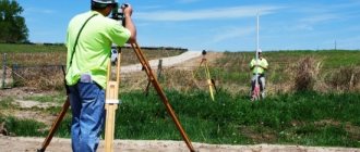
Surveyors, using special instruments, will accurately determine the coordinates of the plot boundaries.
The procedure is preceded by the collection of documents, the conclusion of an agreement with a company or cadastral engineer and agreement with neighbors.
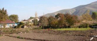
In this article we will look at how you can find out the boundaries of a land plot by address.
In what cases is it necessary
There are several reasons why it is necessary to know the exact boundaries of a property. Sometimes the owner or owner of the land is not satisfied with the information about the actual boundaries . That is, those that were installed “along the boundary”. They may not be precise, unlike legal boundaries.
With the help of precision instruments, a cadastral engineer can establish boundaries with an accuracy of up to a centimeter . The reason for a specialist’s visit may be the cancellation of the results of a previous survey or the merging of areas. Let's consider several cases.
Lack of understanding of real boundaries
One of the reasons for land surveying is the owner’s desire to know exactly where the boundaries of his property lie .
This mainly applies to plots located on the lands of SNT (horticultural non-profit partnerships).
Most of them were allocated for use back in Soviet times.
The measurements were inaccurate and, often, the owners themselves did not really know where the property line was.
Despite the fact that land surveying is an expensive procedure, many have tried to clarify the boundaries by calling a cadastral engineer.
Another example is installing a fence around the entire perimeter of the site . Since the fence is installed for several decades, sometimes for a lifetime, it is advisable not to doubt where it will go.
Making a deal
A change in land ownership is also a sufficient reason to determine the coordinates of the boundaries of your plot.
From a legal point of view, an undemarcated area can be :
- sell;
- give;
- bequeath
In general, dispose of your property in full (if you have taken ownership). The hype that is fueled in the media about the impossibility of making land transactions is artificial.
As a result of the execution of transactions, problems may arise that will prevent the transaction from being completed without land surveying .
For example, if the sale is formalized with the help of a notary who requests cadastral documents for the land. Or an error was discovered in the cadastral documents - the boundaries are crossed.
Areas where land surveying has been carried out are in greater demand than those where boundaries have not been established. The buyer wants to know exactly the area of the property he is buying.
Lack of agreement with neighbors
Disputes with neighbors over land boundaries are one of the most common reasons for starting land surveying. The procedure itself will not dot all the i’s. First of all, there must be a competent approach here. Therefore, it is important to find an experienced cadastral engineer.
Interaction with neighbors regarding boundaries can have 2 stages: negotiations and litigation . It is best to stop at the first one and resolve conflicts peacefully through mutual concessions. To coordinate and sign the relevant act, you will need to call your neighbors.
When relations with neighbors are cool, it is better to inform about the arrival of the cadastral engineer in writing, using a notice.
The notification is sent twice. If they do not come on the appointed day and do not inform about the reasons for their absence, then the boundaries are considered agreed upon.
In controversial issues, the problem of the boundary between plots is decided by the court.
Often, an independent examination is appointed .
The act of coordination with neighbors is part of the boundary plan.
Clarification of the amount of land tax
The tax base for land tax is the cadastral value of the plot. It depends on many factors, including area. Errors may occur when calculating taxes.
This happens especially often with areas that are registered in the cadastral register “without defining boundaries.” When they are clarified, the area may change upward.
In this case, it is necessary to conclude an agreement with one of the companies that are engaged in land surveying and invite a cadastral engineer. He will accurately calculate the area of the plot, and, taking into account all factors, the cadastral value. The updated data is submitted not only to the state cadastre, but also to the tax service.
How to find out the exact dimensions in meters and storage area online?
You can obtain data on the area of a land plot and its exact dimensions in meters without leaving your home. There are several ways to do this.
Search via PKK
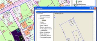
The public cadastral map is an online service through which anyone can find out the size of the land plot, its area and other relevant information. The map is on the Rosreestr website at https://pkk5.rosreestr.ru.
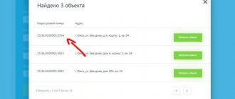
There is a search window in the upper left corner of the PCK. In it you should select the “Plots” section and enter the cadastral number in the empty field. After clicking the “Find” button, the boundaries of the desired area will be highlighted in yellow. The area and address of the object can be seen in the window on the left.
If you require the most current information, you should give preference to an extract from the Unified State Register of Real Estate. Information in the PAC is updated once every 2-3 weeks, during which time significant changes may occur.
Ordering an extract from the Unified State Register in Rosreestr
To obtain an extract through the official website of Rosreestr, you must complete the following steps:
- Open the page of the state portal https://rosreestr.ru/wps/portal/p/cc_present. A request form will appear to receive an extract from the Unified State Register of Real Estate on the main characteristics of the property.
- In the “Object type” field, select “Land”.
- Fill in the “Cadastral number” column.
- Specify region, district.
- Select the type of document transfer: certificate in electronic form by email, paper issuance at a branch of Rosreestr, sending an extract by Russian Post.
- If you plan to order a document via the Internet, you must provide an email.
- Enter the digital anti-spam code.
- Click the phrase “Go to information about the applicant.” On the next page you need to enter information about the person applying for the service.
- In the “Type of applicant” field, you must select a legal entity or an individual. If the extract is not requested by the owner of the land, “Other person” should be indicated in the applicant’s category.
- Enter your full name, passport details, contact phone number, registration address. If the legal representative of the owner will receive the extract, his details must also be included in the application.
- Check the box next to the phrase “I agree to the transfer of personal data to Rosreestr” and click the “Go to documents attached to the request” button.
- Next, you can attach a scanned copy of the power of attorney to receive an extract.
- Click the “Go to data verification” button, make sure there are no errors and click the phrase “Submit request”.
- A message will appear indicating that the application has been accepted. The specified request number should be saved.
- A link to pay for the service will be sent to your email. After clicking on it, the application code should appear in the appropriate field automatically, but if this does not happen, it must be entered manually. Then you need to enter the antispam protection code and click “Check”.
- After this, you need to follow the link “Specify payment code”, enter the combination of numbers from your email and click “Proceed to payment”.
- The statement can be paid in any convenient way from the list: by bank card, through a terminal, from a Qiwi wallet account.
- The extract will be ready within 5 working days and sent by the method specified in the application.
It is more rational to order a paper extract on the Rosreestr website. The document can be obtained in electronic form in a shorter period of time on the Ktotam.pro website.
We talk in detail about what a cadastral passport and an extract from the Unified State Register contain and what information they contain here.
Ordering an extract from the Unified State Register of Real Estate through the commercial portal
The commercial portal Ktotam.pro allows you to quickly obtain up-to-date information about the land allotment in both electronic and paper versions. Ordering a document is carried out as follows:
- Follow the link https://ktotam.pro/?ref=e485dad93a776bdec3c74fbdff68adac.
- Enter the land cadastral number.
- Click "Find".
- After the property name is loaded, click the “Select property” button.
- Next, you have the opportunity to choose an extract option - information about the property or an extended certificate of transfer of rights to real estate. You need to check the box next to the first line and click “Next”.
- You need to indicate the email to which the statement will be sent, click “Next” and pay for the service.
- To manage ordered statements and receive SMS notifications about their readiness, you should activate your personal account by clicking on the link that was sent by email and entering the login and password specified in the same letter.
Most often, the statement arrives within 10-20 minutes , but in some cases the process can take up to 2 days. The application status can be seen in your personal account in the “My Statements” tab.
Ways to define boundaries
There are several ways to define boundaries:
- On one's own . If the boundaries have not changed and the neighbors from adjacent areas are happy with everything, then it is possible to leave the boundaries that were before. This most often applies to SNT sections.
- Coordination with neighbors . It is one of the elements of land surveying. But if you agree with your neighbors on the boundaries and jointly sign the deed, then no additional documents will be required. This will save a lot of time.
- Land surveying . A cadastral engineer or land surveyor will mark the boundaries of your site with pegs.
- Online . Using Rosreestr data, it is possible to obtain a site plan.
Everyone chooses the most acceptable method for themselves.
How to view data by address online
There are three known ways to view data on the boundaries of a land plot:
- On the official website of Rosreestr. In the “Electronic services” section there is a “Online reference information” item. After filling out the application and indicating your email address, the required document will be sent to you.
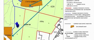
- On the Public Cadastral Map. In the search window, you need to enter the address of your land plot or information about which you want to receive. After the necessary data is displayed on the screen, click the “Information” section, where you can download a free plot plan with the specified data on the boundaries.
- Through intermediaries. This option is not so reliable; it is better to use trusted sources.
Typically, the time limit for sending these documents is indicated: from 5 minutes to 24 hours . But in reality they arrive by email quite quickly, within half an hour.
o How to work with the Public Cadastral Map?
§ How to manage the card?
You can manage the Public Cadastral Map using the mouse.
§ Moving
To move the map, drag it in the desired direction while holding down the left mouse button.
§ Changing the map scale using the mouse wheel
To zoom in on the map, scroll the mouse wheel away from you. To zoom out on the map, scroll the mouse wheel towards you.
§ Changing the map scale using the interface tool
To increase or decrease the map scale by the required number of fixed steps, use the interface tool for changing the scale.
You can move the tool slider or press the “+” or “-” buttons as many times as necessary.
§ Zoom in and move the map with a mouse click
To zoom in on the map by one scale step, double-click on the map with the left mouse button. In this case, the center of the map will shift to the point indicated by the mouse cursor.
§ Zooming in on the selected area on the map
To enlarge a selected area on the map, hold down the Shift key with the Identification tool selected and, while holding down the left mouse button, select a rectangular area on the map. The map extent will change to match the specified area.
§ Extent history management
Map extent is the rectangular area of the map displayed on the screen. During a work session, the system stores information in the form of map extents about all map fragments that the user has created using the moving and scaling functions. The user has the ability to sequentially reproduce the entire history of extent changes in forward and reverse order. In this case, there is a quick transition from one fragment of the map to another. The composition of displayed map fragments does not change.
§ Return to previous extent
To go to the previous extent in history, use the browser's previous page button.
§ Move to next extent
To move to the next extent, use the browser's next page button. The function is available if you previously navigated to the previous extent and after that no other actions were performed on the map.
§ Map content management
§ Selecting a base map
A public cadastral map can be displayed on a variety of cartographic bases. To switch between different map bases, use the Manage Map tool in the Toolbar. Available for selection:
- No – display of the Public Cadastral Map without a cartographic basis.
- Map of Russia (Rosreestr) - displays the Public Cadastral Map together with a map of the area provided by Rosreestr.
- Orthophoto coverages (Rosreestr) - display of the Public Cadastral Map together with orthophoto coverages as part of the cartographic basis of the cadastre provided by Rosreestr.
- Satellite Imagery (Esri) - Displays the Public Cadastral Map along with satellite imagery provided by Esri.
- Satellite images (ScanEx) – display of the Public Cadastral Map together with comic images provided by ScanEx.
In order for the names of geographical objects to be displayed on the map, you must select the “Inscriptions on the map” item in the “Map management” section.
§ Selecting a thematic map
Several types of thematic maps are available for viewing on the public cadastral map. To switch between thematic maps, use the Manage Map tool in the Toolbar. Available for selection:
- No – display of the Public Cadastral Map without a thematic map.
- Cadastral value is a thematic map of neighborhoods and real estate by cadastral value. The thematic map is only available on large scales.
- Cadastral value per meter - a thematic map of neighborhoods and real estate objects by cadastral value per unit area. The thematic map is only available on large scales.
- Types of permitted use - a thematic map of land plots by type of permitted use. The thematic map is only available on large scales.
- Land categories - a thematic map of cadastral blocks and land plots by land category. The thematic map is only available on a large scale.
- Relevance of information - thematic map of cadastral districts by date of update.
- Total number of visits - a thematic map of cadastral districts by total number of visits.
§ Selecting the composition of information displayed on the Public Cadastral Map
The composition of the information displayed on the Public Cadastral Map can be selected using the “Map Management” tool in the Toolbar. The following are available for selection from the drop-down list:
- “Cadastral division, land plots, capital construction objects” - the layer includes the boundaries of cadastral division units, boundaries of land plots, contours of buildings, structures, unfinished construction objects on land plots.
- “Zones with special conditions for the use of territories” - the layer includes the boundaries of zones with special conditions for the use of territories.
- “Territorial zones” - the layer includes the boundaries of territorial zones.
- “Borders” - the layer includes the state border of the Russian Federation, borders between constituent entities of the Russian Federation, boundaries of municipalities, boundaries of populated areas.
- “Cartographic basis of the cadastre” - the layer includes cartograms of digital topographic maps, orthophotomaps, orthophotocoatings.
§ Overview map
An overview map is designed to display the location of the current map extent. The overview map window can be hidden or expanded using a special tool in the lower right corner.
§ Display legend
The legend is intended to display the design styles of objects on the map. To view the legend of the Public Cadastral Map, you must enable its display by checking the box next to “Legend” on the Toolbar. The legend of the Public Cadastral Map is generated dynamically depending on the composition of the displayed layers.
§ How to measure distance on a map?
To measure distance on a map, select the Measure Length tool from the Toolbar. Specify the start, intermediate and end points of the line whose length you want to measure by clicking the left mouse button. If necessary, edit the formed line by moving and adding new vertices. The measured line length will be displayed in the information box next to the last specified vertex. The distance is indicated in kilometers.
§ How to measure area on a map?
To measure an area on a map, select the Measure Area tool from the Toolbar. Specify the vertices of the polygon whose area you want to measure by clicking the left mouse button. If necessary, change the boundaries of the formed area by moving vertices and adding new vertices. The measured area will be displayed in the information box next to the last specified vertex. The area is indicated in square kilometers.
§ How to print a map?
To print a map section, select the Print Map tool.
A new Internet browser window that opens will display a fragment of the map prepared for printing and a field for adding comments to it.
The map fragment prepared for printing can be controlled using the mouse: moved and scaled.
To send the generated image and comments to it for printing, select the “Print” tool.
§ How to get a link to the map?
To get a link to the current map extent, select the Map Link tool, and then copy the address from the address bar that appears.
The link to the map can be sent by mail or saved as a bookmark.
§ How to add objects to the map?
The user can add objects to the map, the location description of which is generated in the form of files in kml or csv formats. The coordinates of objects in the file must be indicated in decimal degrees in the PKK coordinate system (Web Mercator projection (WGS_1984_Web_Mercator_Auxiliary_Sphere)).
When importing objects from a csv file, their description must meet the following requirements:
- An object can be described by one or more turning points.
- One point is a point object.
- Two or more points – a polyline.
- Two or more points (the coordinates of the first and last are the same) – a polygon.
- The X and Y coordinates in the turning point description must be separated by a comma; turning points - semicolons; the fractional part of the coordinates is separated by a dot.
When importing objects from a kml file, the file must be generated in accordance with the requirements of the OpenGIS® KML Coding Standard.
To add objects to the map, you need to drag a file describing their location onto the map area in the application. The map extent and scale will change to show all imported features.
To change the boundaries of an imported object, you need to select it by clicking the left mouse button, move it, or add new vertices.
To enable/disable the display of a layer with imported objects, you must select/uncheck the appropriate o in the list of layers in the “Base Map” section of the “Map Management” menu.