What is cadastral work
Any real estate object, be it a plot of land, a house, an outbuilding, a garage, a bathhouse, etc., in a word, everything that is fundamentally connected with the land, is the object of cadastral work. Before documenting a building or land plot, the law establishes a number of measures aimed at securing the property on the ground and describing its appearance.
It is known that currently there is a Unified State Register of Real Estate (USRN), which contains all the information about this real estate. Since the advent of private property in the 90s, the real estate cadastre (or, in other words, accounting) has changed. New requirements appeared not only for documentation, but also for carrying out measurement work. Work on collecting and compiling documents, as well as work on the ground - all this is cadastral work. Such work is allowed to be carried out only by specialists in the field of geodesy and cadastre, who have a number of permits to engage in this activity. The state, clearing up existing cadastral errors, does not allow anyone to carry out cadastral work. Such types of cadastral work as the preparation of boundary and technical plans, without which it is impossible to register real estate for cadastral registration, require the signature of a cadastral engineer. And becoming a cadastral engineer is possible only after working as an assistant engineer for two years and becoming a member of a self-regulatory organization. The law establishes strict requirements not only for the preparation of documentation, but also for geodetic measurements and equipment.
A list of organizations that have the right to perform cadastral work can be found in the catalog of cadastral and geodetic services providers.
Cadastral engineer. Who is he really?
Main functions of a cadastral engineer in 2021
Share on social networks:
The current legislation provides that survey reports, technical and boundary plans are drawn up by a cadastral engineer, since he is a technical specialist. But his mission does not end there.
Practice has shown that checking completed documentation in Rosreestr is a rather labor-intensive and responsible process. After all, suspensions and refusals result in not only disciplinary liability, but also criminal liability if false information is discovered.
Note! The state registrar gets acquainted not only with the documentation prepared by the engineer. He checks the legality of its issuance and analyzes all the documents included in the application.
Based on this, a cadastral engineer must not only be technically competent, he must understand jurisprudence, geodesy, inventory, and take into account legislative nuances in the field of real estate. In addition, he must take into account the client’s psychology, since he is an intermediary between the state and the customer. Therefore, the work scheme “measurements - drawing - formation of a package of documents for the object” and handing it over to the customer is half the battle. What is the complexity?
Checking primary documents
To carry it out, a request is made to the Unified State Register of Real Estate. An analysis is carried out to see whether all the source documents have been collected and whether they are sufficient for a certain type of work. In general, the check can include up to 30 points. In particular, for premises from a non-residential property, data is required not only about the copyright holder, but also about duplicate objects, as well as about uncertified information from the Unified State Register of Real Estate. In addition, you should attach a floor plan, reconstruction and redevelopment plan, take into account the property’s relationship to cultural heritage, its inclusion in the list of unauthorized construction and other data.
Why is such a complex test needed? All this is required in order to fully complete the customer’s task, avoiding suspension. Often, engineers find out that the property cannot be rented out because the information about it contains illegal redevelopment. Often difficulties arise with the division of a plot for the reason that its boundaries do not have coordinates, i.e. not specified. As you can see, preparing a boundary or technical plan is not enough to complete the tasks set by the client. Therefore, after analyzing all aspects, the cadastral engineer draws up an algorithm for further actions that will allow us to find or develop the missing materials to fully solve the problem.
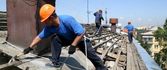
Geodetic survey of the object, measurements
Geodetic measurements are needed to obtain coordinates that are used in drawing up a technical and boundary plan of an object. It happens that a structure crosses the designated boundaries or the neighboring territory is part of another site. In such cases, additional work is carried out. To determine the area and prepare floor plans, interior measurements should be taken. Although these types of work are voluminous and require a lot of time, they are not difficult for technical specialists.
Preparation of documents for registering an object
At this stage, the graphic part of the documentation is drawn up according to the standards. First, diagrams, plans, and drawings are prepared in paper form, then an electronic version is generated (xml format). A technical or boundary plan contains all the characteristics of a given object, graphic materials, applications, that is, all the documents that were used in the preparation process. It should be noted that Rosreestr has strict requirements for most applications. For example, scans must be high quality and in the original format, even if it is A0. If the task concerns a land plot, its boundaries must be agreed upon. To do this, the engineer not only drafts the plan, he also finds interested parties. It happens that you have to send them notices. In the absence of an address, a notice of approval is published in the press.
Submitting a package of documents to the Multifunctional Center and Rosreestr
The documents can be submitted by the engineer himself, by proxy, or by the customer. The disc transfer process is simple. You just need to come to the MFC, fill out an application form, and sign. True, center employees may indicate the wrong object or the wrong service. Therefore, engineers often monitor the filing process so that an incorrectly formulated application does not cause the case to be suspended.
Cadastral registration
The essence of the service: entering real estate data into the Unified State Register of Real Estate (USRN). The engineer must prepare such documentation that would pass cadastral registration without problems.
Common reasons for suspensions include:
- Inaccurate data on land plots;
- Inconsistencies after redevelopment of non-residential premises;
- Failure to comply with conventional signs;
- Inconsistency of building contours;
It happens that there are no specific clarifications on general phrases at all. To find out the reasons, you have to sign up for a consultation with Rosreestr. To wait for an appointment, you need to stand in line for more than one hour. In addition, counseling is scheduled once a week. But that's not the worst thing. As a rule, it is not easy for the customer to understand what the registrar requires of him. Therefore, it will be better if a cadastral engineer is present at the consultation. He will quickly fix the problem. It happens that in order to eliminate it, you need to contact the appeal commission, meet with the leadership of Rosreestr in order to achieve cadastral registration quickly, and not in six months. Most often, the stumbling block is old registry errors made 10 or more years ago.
In addition to the above work, engineers:
- Are engaged in land management examinations;
- Carry out the removal of plot boundary points;
- Provide assistance in checking the compliance of real estate documentation with its actual condition;
- Help the client obtain permits for construction work;
- Develop projects;
- Engaged in coordinating redevelopments;
- Perform real estate appraisals;
It becomes obvious that with such a range of responsibilities, an engineer can be considered a general specialist who knows a lot about cadastral registration, jurisprudence, and negotiations. A competent engineer, before starting work, will carefully study the documentation to avoid suspension during the registration of the object. If cadastral engineers were only involved in preparing technical and boundary plans, drawing up survey reports, and not delving into the essence of the documents submitted by the customer, the result would be unpredictable. By the way, there would be no violation of the law, since it contains only technical instructions regarding the preparation of reports. Of course, additional services are paid separately. But, customers prefer to completely trust a competent specialist in order to quickly get high-quality results.
Types of cadastral works
Cadastral works are services provided in a complex, and they can be conditionally divided into:
Cadastral work to collect and study the information provided:
Before starting to perform tasks, the cadastral engineer must familiarize himself with the submitted documents, and, if necessary, independently or through the customer, request the missing information from Rosreestr authorities or other structures. Next, an agreement is concluded between the customer and the contractor, which specifies the basic conditions, terms and cost of implementation.
Cadastral work on the ground:
To prepare almost all cadastral work, a site visit is required. The land plot must be measured, the structure must also be carefully studied so that information about it is transferred to the technical plan. The cadastral engineer bears individual responsibility not only for documentary work, but also for the clarity of the measurements taken.
Cadastral work on preparation of documentation:
A survey plan, technical plan, and survey report are prepared on the basis of available information by introducing new, updated and supplemented information about the object. Requirements for the development, form and completion of any cadastral official document are prescribed by law.
Cadastral works can also be classified as:
Work with land plots (work on drawing up a boundary plan or related to drawing out boundaries in nature, any work related to the division of plots, clarification of boundaries, etc.)
Work with real estate objects (preparation of a technical plan, drawing up an inspection report on the termination of the existence of a real estate object)
Complex cadastral works (work to clarify the boundaries, as well as the locations of buildings in the entire cadastral quarter, that is, this work is carried out not in relation to one plot of land or building, but in relation to the whole quarter. Customers for complex cadastral works are local governments.)
Responsibilities of a cadastral engineer
The scope of work of a cadastral engineer covers:
- creation of special electronic maps for cadastral authorities;
- land surveying and surveying of real estate objects;
- interaction with customers;
- creation of technical documentation, technical plans for residential and commercial facilities, inspection reports;
- drawing up contracts and estimates;
- coordination of the boundaries of nearby areas;
- preparation and submission of documents for registers and state cadastres.
Got some free time?
Then use it wisely! Get an education while everyone else is running after buckwheat!
Why are cadastral works needed?
The main purpose of cadastral work is to register real estate objects for cadastral registration and register ownership. Federal laws 218-FZ dated July 13, 2015 “On State Registration of Real Estate” and 221-FZ dated July 24, 2007 “On Cadastral Activities” establish requirements for various types of cadastral work. In addition, the legislation establishes uniform rules for registering real estate in the cadastral register. The rules provide for the entry into the real estate cadastre of certain information about the object, which will allow it to be identified as an individual thing. To make such a determination, it is not enough to simply describe the property; you also need to perform a number of measuring actions.
The procedure for performing and content of land cadastral actions
The procedure for performing land cadastral work is regulated by Federal Law No. 28-FZ “On the State Land Cadastre”.
Before registering the results of cadastral work with the cadastral registration authorities, it is necessary to carry out cadastral activities.
In the Russian Federation, it is carried out by cadastral engineers, who must have a professional qualification certificate, and also be a member of one of the self-regulatory organizations in the field of cadastral activities.
Cadastral engineers carry out land works both by order of government bodies and in the process of concluding an agreement with any interested party. The object of land cadastral work can be a specific land plot, a group of land plots within a cadastral quarter or within the boundaries of several adjacent cadastral quarters.
The most common types of ZKR are:
- Establishing the boundaries of a land plot. When performing this type of work, the result of the cadastral engineer’s activities will be the formation of the external boundaries of a plot of land, which will allow it to be distinguished from a group of adjacent plots. In addition, the establishment of the boundaries of the site should be carried out in relation to the boundaries of neighboring sites.
- Clarification of the boundaries of the land plot. This type of work may be required in the event of a technical error identified by the cadastral registration authorities, which consists of crossing the boundaries of one or more neighboring areas. Also, the cause of such an error may be the overlap of the boundaries of the site with the boundaries of lands that have previously undergone the registration procedure. Clarification of boundaries may require their agreement with copyright holders, including in court.
- Division or consolidation of land plots. In cases where instead of one land plot, several plots are formed (division of land), or a number of neighboring plots are combined by the right holders into a single whole, it is necessary to create a completely new land registration object. In this case, the cadastral engineer determines the boundaries of each new land plot based on the terms of the legal act (transaction) that is the reason for such division or merger.
- Allocation of land. If the plot belongs to entities on the basis of common shared ownership, it may be necessary to separate a specific share from the common law. In such a situation, in addition to documentary confirmation of the allocated share, it is necessary to formalize the allocation in kind, i.e. form the boundaries of the area allocated from the total share. The new object will have an independent legal status from the moment it is registered in the cadastral register.
Cost of cadastral works
Carrying out cadastral work requires not only knowledge and skills, but also the availability of permits and licenses. Therefore, the cost of cadastral work is quite decent. It depends not only on the type of work performed, but also on the type of property itself, its design, and territorial location. Prices for cadastral work, as a rule, among cadastral organizations located in the same area, are the same and differ slightly. To calculate, you can use an online calculator.
When ordering cadastral work, you should definitely pay attention to the availability of permits and licenses in order to avoid unpleasant consequences.