The demarcation of land between neighbors is regulated by the Land Code. To carry it out, the procedure must be strictly followed. It is worth remembering that mistakes made during land surveying can be costly not only in terms of lost money, but also in terms of losing in court. If the boundaries of the plots are correctly determined, the setbacks from neighboring plots will be observed during the construction of residential premises. To do this, you need to study in advance how many meters you need to retreat from the neighboring house.
How land surveying with neighbors occurs step by step
The procedure for surveying a land plot with its neighbors is carried out in stages and has its own algorithm for carrying out the work. This procedure must be strictly followed. The legality of the actions taken will depend on this. The phasing consists of the following works:
- contact a cadastre engineer to conclude an agreement for the provision of land surveying services. The specialist will draw up an act on the basis of which the site will be registered;
- notify interested parties. To do this, you must choose a written notification method. Such actions will help in the future if claims arise from neighbors;
- if interested parties notified in advance are absent from the procedure, then there is no point in refusing to carry it out;
- in the absence of the owner of the site, who has not expressed written objections to the land survey, it is necessary to make a note in the approval act. The boundary plan must be supplemented with documentation that will confirm the fact of proper and timely notification;
- the unknown owner of the land is notified by posting an announcement about land surveying in the media. If after a month there is no response, then the approval is made by default.
We recommend reading: “The distance from the house and other buildings to the neighbors’ fence.”
In these situations, land surveying can be carried out pre-trial. When surveying, neighbors' signatures are required!
If, nevertheless, the neighbor expresses his refusal to carry out the procedure and indicates convincing reasons, then determination of the boundaries will become possible only by a court decision. In this way, you can isolate yourself in a private house from annoying neighbors and, for example, you can hide the pool from the neighbors’ eyes.
We advise you to read: ““Measure seven times...”, or how to maintain the distance between buildings on your site and not offend your neighbor.”
How to notify a neighbor (and whether it is necessary) about land surveying
The main thing to remember is to notify your neighbors. The first method to try is personal collection of consents. In this case, you should print out notifications and go around all the neighbors yourself. This method is good when adjacent plots are not in disrepair and the owners are known.
If there is no real opportunity to see the owners of the land, then, if you have information about their residential addresses, you can send notifications by mail. It is better to send by registered mail. The postal service will be responsible for delivering this document.
It is also worth remembering that you will have to notify at least three times. There must be a 3 week interval between shipments.
In the absence of information about the owners, it will be necessary to publish it in the media. You need to perform these steps 3 times. All newspaper issues should be retained. They may be needed if the owner of neighboring lands shows up and, being dissatisfied with the results of the land survey, tries to challenge them in court.
Our recommendations: “Everyone has the right to privacy, or is it possible to install a blank fence between neighboring areas.”
Is the consent of neighbors required when surveying a plot of land?
The neighbor’s consent to land surveying will not be required if the procedure was officially notified through official sources.
If a site is surveyed without the consent of a neighbor, as well as his failure to appear at the procedure itself, subject to proper notification, work can begin. Notification must be made in writing. Compliance with all the rules will allow you to maintain the demarcated boundaries of the plots and will not give you the opportunity to challenge them in court. The presence of notifications is attached to the land surveying act.
How to obtain and draw up consent from neighbors to build a house closer than three meters to the property line
As mentioned above, outbuildings should be located at a distance of 1 m from the border , but the bathhouse should be located at a distance of 8 meters from the fence . If you plan to build any of these objects in violation of building codes, you will have to enlist the support of your neighbors, who will formulate an agreement.
- it is allowed to use any form to compile it, but it is still recommended to view the sample indicated above;
- experts advise additionally contacting a notary to certify it, and this is considered especially important if a neighbor sells his property to another person in the future, and the new owner does not agree with the construction of an object next to his property;
- The consent must contain accurate and reliable information about the sites and the parties themselves so that they can be easily identified.
This is interesting: One-time Payment to Labor Veterans Increase Vologda
What to do if your neighbor doesn't agree
If a neighbor of an adjacent plot does not sign the act of approving the boundaries of the land plot, then the best option would be to go to court. This issue will arise most acutely in a situation where a neighbor arbitrarily seizes part of the lands that do not belong to him and refuses to eliminate the violation. What to do when a neighbor climbs onto my property becomes immediately clear - go to court.
In this case, the court will restore the legal boundaries of the plots and make appropriate adjustments to the documentation.
It is possible to carry out land surveying without obtaining the consent of the owners of adjacent plots in some cases:
- Ignoring by the neighbor notifications about the planned land survey, which were sent to him three times by registered mail;
- The notification was carried out properly and there is appropriate confirmation, but the neighbor did not make any claims;
- The absence of a neighbor for a long time when his whereabouts are unknown or there is information about his departure from the country;
- Availability of a neighbor's permission obtained through an electronic signature. This option can be used if a neighbor has been in another region for a long time and has no real opportunity to come for the procedure.
When going to court, the main reason for filing a claim should reflect the neighbor’s refusal to carry out the procedure. At the same time, it is worth remembering that the plaintiff himself should not violate the rules of exploitation of the territory allocated to him and respect his borders.
What documents are needed to start building a private house, cottage or dacha?
Registration of a land plot should begin by submitting an application to the Ministry of State Property Management (a copy of the passport is attached to the application). If the plot has not been previously privatized, it takes less time to register it. The application review process should take two weeks, but in practice this process takes longer.
- contract of sale and purchase (or donation) of land;
- passport of the land plot;
- permission (petition) from the head of the local administration of the district to provide a site for construction;
- master plan of the site;
- the act of establishing in nature the axes of the building and the boundaries of the land plot;
- topographic survey of the site.
This is interesting: Payments for Internal Troops for the Death of Close Relatives
How to challenge a neighbor's land survey
The placement of a private house and the definition of neighbors' boundaries becomes a frequent subject of dispute. Owners can express their disagreement with the resulting measurement result. Particularly suspicious people always think that they will definitely be deprived of the established markings and their rightful property will be taken away. A conflict also arises if the owners of neighboring plots are not notified of the very fact of land surveying.
An analysis of judicial practice has shown that a neighbor who has seized part of a land plot that did not previously belong to him may face real punishment in the form of a fine. In the case of squatting, subject to bona fide ownership and the absence of disputes or claims from other citizens for 15 years, no fine will be collected. In this case, for example, driving through an unfenced neighbor's garden will not be punishable.
In order to resolve a boundary dispute, you must first use pre-trial settlement of the issue. This path is considered peaceful and easiest. If it is not possible to reach an amicable agreement, then you will have to resort to a judicial solution to the issue. Pre-trial regulation will be expressed in the following actions:
- contact the engineer who provided the survey service and point out errors and inaccuracies in his work;
- collect documentation that can confirm the existence of an error;
- write an application with a request to correct the discrepancy and, with the documents attached to it, submit it to the cadastre chamber;
- wait for a response after 15 days.
The question of how to challenge the land surveying of a neighbor’s land can only be resolved in one way. It is possible to challenge the boundaries of a site only if the result of the survey is invalid. Only interested persons can exercise the right to cancel such a document. First of all, these are the owners. Ownership of a plot can be confirmed by the following documents:
- plot lease agreement;
- agreement for receiving an allotment for unlimited use;
- act of privatization;
- certificate of perpetual inheritable ownership.
Attention! If there are compelling reasons and their documentary confirmation by the cadastral chamber, changes will be made to the current plan. This procedure for solving the problem will be considered administrative.
The trial goes through more stages. In addition, it should be remembered that if at the last moment, due to oral agreements with the owner of the disputed plot, you abandon your claims, then it will no longer be possible to go to court again on the same issue.
The court will also take into account the standards for the construction and location of neighbors' houses. Said proceedings will include the following:
- drawing up a statement of claim;
- supporting the application with the necessary documents confirming the plaintiff’s case;
- payment of state fees;
- notification of the defendant (carried out by a judicial authority);
- consideration of the dispute during civil proceedings (it is possible to hold several hearings and postpone hearings at the request of the parties for additional collection of information or requests from the court);
- making a decision on the case;
- appealing the verdict (10 days will be allotted, after this period the verdict will be considered to have entered into legal force);
- receiving the verdict in your hands.
Important! A court decision will make it possible to force changes in the boundary matter. To do this, you need to submit it to the cadastral chamber and write a corresponding application. Only by such a decision will neighbors be prohibited from entering private territory.
The following documents will serve as the evidence base for resolving the issue of errors in land surveying:
- documents confirming the rights to the disputed plot (title);
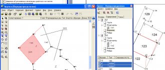
- a diagram showing the location of the disputed plot, as well as the areas bordering it;
- consent of neighbors, documented in writing, or their refusal;
- documents confirming attempts to peacefully resolve the issue (letters to neighbors, applications to the cadastral chamber);
- publication in the media about land surveying or lack thereof.
The judicial authority for filing a claim will depend on the status of the parties involved in the dispute. If both participants are individuals, then the application must be submitted to a court of general jurisdiction. If there is a legal entity as a participant in the process - to the arbitration court.
Rosreestr compulsorily changes information only by court decision. The resolution should be submitted together with the boundary plan, which was considered correct in court. Cancellation of land surveying by a court decision is available only to the owner of the disputed plot, but also to his neighbors if they believe that their interests have been infringed. Registration of a neighboring abandoned plot is possible after contacting the local administration.
How to register ownership of a land plot
The gift agreement is drawn up in writing. It is recognized as valid if there are visas of all parties to the transaction. In addition, the provisions of the contract must not conflict with the requirements of Article 572 of the civil law.
After the collection of documents is completed, it is necessary to transfer the amount of the state fee for registration actions to the budget account. After document analysis by specialists of the registration authority, citizens receive a certificate of ownership of the land plot.
12 Jun 2021 uristlaw 233
Share this post
- Related Posts
- Average Pension in France in 2021
- In 2021, Gazprom Pension for Shift Workers Pensioners
- Law of the Republic of Kazakhstan for 2021 On Obtaining Passports for Children of Chernobyl victims
- Will Pensions for Group 3 Disabled Persons Be Increased in 2021?
Other Possible Problems
- Incorrect definition of plot boundaries. When carrying out land surveying, the rights of neighbors can be infringed;
- occurrence of technical errors when preparing documents. If such problems exist, registration will be denied;
- lack of proper training and experience of the specialist carrying out the work. This happens if the owner decides to save money on a surveying company;
- lack of agreement between relatives who are dividing a single plot. Such land surveying is possible only by court decision.
If you have sufficient communication skills, you can try to solve any problem that arises with defining the boundaries of adjacent areas. If, however, the dispute cannot be resolved peacefully, then the court will be the last resort. A decision that has entered into legal force is binding. This will be the best guarantee of protecting your rights.
Did you like the article? Like ♥, subscribe to our channel and you will be one of the first to know about new publications!
And if you have something to share, leave your comments! Your feedback is very important to us!