The land surveying procedure allows you to establish the exact boundaries of a land plot; subsequently, they are necessary for registering the property with the cadastral service and for issuing various documents on the plot. Land surveying is carried out by a qualified specialist, and based on its results, a site plan is drawn up.
The plan must be sealed and signed by the surveyor. But not all owners know what document is issued after land surveying, what it should look like, and what information it should contain. The owner of the plot will be given such a plan in writing upon request, and he may also request the document to be issued in electronic form.
Features of the boundary plan
Such a document contains important information about land surveying, which can be obtained after carrying out certain geodetic work. Why is this paper issued, what weight can it have:
- Such a document can be used to register a land plot with the cadastre and Rosreestr, if registration has not been completed previously. The boundary plan is included in the package of documents for issuing a cadastral passport and a certificate of land ownership.
- Also, the boundary plan should be in the hands of the owner if he needs to resolve conflicts with neighbors on the property in court, for example.
What documents are issued after land surveying?
If there is information about the coordinates of parts of a land plot, in addition to the three forms listed above, a KP4 form is prepared, which indicates the boundaries of the parts. The land passport is prepared by authorized specialists of Rosreestr (as a rule, this is done by specialists from the Cadastral Registration Department). Currently, the document is provided in paper or electronic form.
Permission for the construction of a country house and individual housing construction projects Issuance of a permit for the construction of a country house The Town Planning Code of the Russian Federation establishes the following procedure for issuing a permit for the construction of a country house.
What it is
Such a plan contains important geodetic data about the plot; it includes two parts - graphic and text.
Each part is one or another data characterizing the land territory.
The text part is information about the initial data about the land and about the implementation of cadastral work. Also from it you can find out information about the owner of the land (customer of the plan), information about the surveyor who carried out the survey.
If the site has separate parts, this is also indicated in the text part of the boundary plan. In it, the surveyor (cadastral engineer) lays out a conclusion on the measurements.
ATTENTION! An important component of the textual part of the plan is the Border Coordination Act.
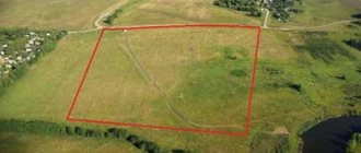
Graphic, as is clear from the name, is a diagram of the allotment indicating its boundaries. The area of the plot is indicated. If certain objects are located on it, they must also be depicted on the map of the territory.
What is needed to carry out
If the owner, a legal entity or an individual, needs to establish the exact boundaries of his plot, he makes an application to call a cadastral engineer. What to do next? We still need to collect some documents. Their list will be slightly different for individuals and legal entities.
What documents are needed for an individual to obtain a boundary plan:
- You will need a document confirming your identity.
- If a trusted person is involved in the land surveying procedure, you will need a notarized power of attorney.
- You also need a document that confirms ownership of the land. This could be a purchase and sale agreement, a certificate of inheritance, etc.
- If the site has not been registered, a corresponding extract from the Unified State Register is needed.
- Cadastre documents.
- A certificate from the BTI, which will prove that there are no built objects on the site. The certificate is provided upon request of the owner.
- If there are objects, you need papers on them.
- If the plot has already been registered, you will need its cadastral plan. It can be issued by the cadastral service at the request of the owner of this property.
When all the documents have been collected, the application has been drawn up, the next steps are to carry out boundary work by a cadastral engineer.
What happens after
A cadastral engineer comes to the site, carries out geodetic work, and collects information on land surveying. Where should I take it? The result of the survey is transferred to the Unified State Register of Real Estate. The USRN must enter the received data into the database, but some more papers are needed confirming the rights to the plot, and other things:
- Civil passport or other paper that identifies the applicant.
- The document according to which land ownership was registered. This could be a gift agreement, a purchase and sale agreement, a will, etc.
- Certificate of land ownership or a standard extract from the Unified State Register of Real Estate.
- If the plot was registered in the cadastral register, you will need an initial cadastral plan.
- An act of border approval is also attached.
Such documents are transferred to the Unified State Register of Real Estate for entering data in person or sent by mail, by a certified letter with acknowledgment of receipt and with an inventory . When sent by mail, documents must be certified.
For convenience, the Register has also developed a form for submitting documents and applications online. If you need to enter data after the land surveying procedure, you should go to the website, open the required tab, and submit the documents.
What documents are issued after land surveying?
Land surveying is an integral process of registering it as property and registering it with the cadastral register. The essence of surveying is that a specialist who has a license for geodetic and cartographic surveys establishes and secures the boundaries of the site on the ground. After all the necessary documents have been prepared and the plot has been registered with the cadastral register, its owner will receive the documents after land surveying and will be able to carry out a full range of actions with his property such as purchase and sale, will, gift or exchange.
- You contact an engineering and geodetic company in your city, which must have a good reputation among clients (in Saransk, this includes Cadastral Center LLC) and enter into an agreement for land surveying.
- You collect the necessary package of documents and notify your neighbors whose land plot borders yours about the land survey.
- The engineers of the geodetic company carry out all the necessary measurements, fix the boundaries and draw up a survey report.
- The number of documents that you will receive after land surveying includes the so-called land surveying file. You must be given 2 copies: one document remains in your hands after land surveying, and the second is submitted to the cadastral chamber to assign a cadastral number to the plot.
Instructions for submitting documents online
The development of the functionality of the Rosreestr website has made submitting documents a convenient and simple process:
- The first step is opening a website. You should find the electronic services section there.
- Next is the “ State registration of rights ” tab.
- A list will open in which you select the “ Actions with registry entries... ” item.
- Then select the item “ Making changes to the record ”.
- In the “ Go to details request a” tab, you need to fill out an application for amendments using the proposed form.
- Documents prepared electronically are attached to the completed application.
What documents are issued after land surveying?
At the end of the land surveying procedure, according to the cadastral plan and extract, the specialist who carried out the land survey of a certain landholding will provide a special document called a land survey plan. It is issued on paper and must contain the seal of the relevant company, as well as the signature of the cadastral engineer. Remember that if the need arises, such a document can also be obtained in electronic form using virtual media.
- title page;
- table of contents (indicates sections);
- initial information about the land (location, border designation, etc.);
- bringing the activities carried out according to calculations and measurements;
- data on the formed allotment;
- information regarding routes to land ownership and nearby plots;
- expert's conclusions.
What documents are issued?
The land surveying procedure allows you to determine the exact, legal boundaries of a land plot . This is of great importance if the owner wants to sell (donate, bequeath the plot), as well as if he is going to build this or that object on it, or conduct some kind of activity.
ATTENTION! After geodetic work, the owner receives an accurate boundary plan. Now he will not make a mistake and will not build a house or other structure outside his land, and will not have problems in the future because of this.
Inconsistency between old and new boundaries
When, during the process of geodetic work, it turns out that the original boundaries of the site do not correspond to what they should be in reality, it is necessary to make changes to the data in the Unified State Real Estate Register database.
IMPORTANT! But first you will need to re-survey, perhaps the cadastral engineer made a mistake.
If the indicators are correct, then the boundaries of the site should be adjusted. Boundaries can be changed for the following reasons:
- If the owner has such a desire and intention.
- By the tribunal's decision.
- When a mistake was previously made by a cadastral engineer.
- When a boundary plan was needed for the sale of a plot, inheritance, or other transactions.
What document is issued after land surveying?
There may be cases when surveyors make mistakes when drawing up a site plan. If such an error is identified, then it is necessary to contact the organization that prepared the survey plan again to carry out a repeat survey. Based on the results of the repeated procedure, the boundaries of the site will be adjusted.
Upon completion of the compilation of the cadastral plan and the delimitation procedure, the surveyor hands over to the owner of the plot a boundary plan, certified by the signature of the compiler and the seal of the geodetic company. The owner of the plot has the right to request a plan in electronic form from the cadastral engineer.
What to remember
Land surveying is a standard procedure that is carried out by cadastral engineers to establish or clarify the boundaries of a land plot.
Land surveying work can confirm existing boundaries, but they can also indicate a discrepancy with those indicated in cadastral documents.
Based on the results of the work, the cadastral engineer draws up a boundary plan. This document confirms the legality of the procedure. The document contains complete information about the allotment.
The boundary plan consists of a graphic and text part; they are both important and give a complete picture of the property.
What documents are issued after land surveying?
There are two ways to submit an application: Method No. 1 – Send by email: , or to the cadastral number of the land plot and your contact information. The application indicates: the number of copies and type of document (paper or electronic); Method No. 2 – Place an order by phone +7 (495) 669‒12‒77 Specialists of the Grand Cadastre company will complete the order and receive the cadastral passport within the deadlines, in a form convenient for you (in paper or electronic form).
- At the site, engineers from the geodetic company will measure the boundaries, record them and draw up a survey report. During boundary checks, engineers will ask adjacent neighbors (if present) if they agree with the boundaries. During the land survey, an act (hereinafter referred to as the land survey plan) is filled out, which indicates the boundaries of the plots. The survey report must be signed by the following persons:
- the owner of the site or an authorized representative;
- adjacent neighbors, if present;
- the engineer who carried out the work;
- a representative of the administration, who will be notified by the geodetic company.
- After all the land surveying work has been completed, on the appointed day, pick up the completed land survey plan of the site from the geodetic company. Below are instructions if the boundaries of the land plot have changed after land surveying.
Changes in legislation
The issue of land surveying has become especially acute since January 2021. Since that time, the presence of a boundary plan has become a mandatory requirement; without this document, the land can no longer be used. Without a boundary plan, starting from 2021, it is impossible to carry out land transactions, build various objects on one’s territory, or put these objects into operation.
If land surveying was previously optional, now those who registered their land before 2008 must undergo this procedure. During the surveying process, documents are analyzed, measuring and computational work is carried out.
The procedure can take up to six months, so you shouldn’t delay starting it. This will allow you to have prepared documents, including a boundary plan, for the execution of a land transaction.
Changes and additions are regularly made to the legislation on land ownership and land management; you need to keep track of them. If any information remains unclear or unknown, you may want to consult with an experienced attorney in the field.


