The most common mistakes when surveying
The difference between a land surveying error and a deliberate unlawful act is in the form of guilt.
The crime provided for in Article 170.2 of the Criminal Code of the Russian Federation implies exclusively direct intent, that is, the offender specifically wanted to introduce false information.
Any of the owners, accounting authorities, engineers and other persons can make a mistake, without even knowing it.
But the fact of violation means the need to restore rights.
The most common mistakes when surveying can be of the following nature:
- incorrectly specified coordinates.
- Insufficiently thorough data analysis leading to inaccuracies.
- Incorrect determination of the exact boundaries of areas.
- Cadastral errors - discrepancy between real and formal (indicated in the register) perimeter lines, imposition of boundaries on buildings and structures.
- Other technical errors, inconsistencies and inaccuracies.
The provisions on cadastral defects are specified in Article 28 of the Law “On the State Real Estate Cadastre”.
Settlement problems
In fact, it is very rare that such issues are resolved without controversy. Although the law provides for the possibility of concluding a mutual agreement between the owners of adjacent plots, in practice rarely anyone agrees to such a move. This necessitates going to court, which lasts for months or even years.
Very rarely are such disputes resolved painlessly, especially when the overlap appears to be significant. In such cases, it is difficult to determine where the error occurred and whose fault it was. Usually, when the cause of an error during land surveying is located, the matter is resolved much faster through authorized government services. This is done by correcting the found error in the distribution.
In this case, each side will receive exactly as much area as will be determined as a result of correcting the error. There is simply no room left for debate. But even in such cases, the parties manage to drag themselves into lengthy legal disputes.
In addition, the overlap of plots may mean incorrectly carried out land surveying of many other plots located in the same cadastral block. For this reason, disputes take on a larger scale, with the participation of a large number of owners.
Because of this, when an overlap is detected, engineers try:
- study the entire map of the quarter;
- raise boundary plans of all areas;
- find the point from which the error originated.
Of course, if the error occurred a long time ago, then it may not be possible to return everything as it was. As a result, the dispute will still have to be resolved by mutual agreement. So it’s better to immediately talk with your neighbors, discuss compromise options and come to a peaceful agreement.
How to detect inaccuracy and who may be to blame for it?
It is not so easy to find out about the presence of a boundary error; the owner can live on the site for a long time without even knowing about the problem he has. To detect it, you need to carefully study the available documentation and cadastral data.
It is not uncommon for a problem to surface only during a conflict between adjacent landowners.
For example, one of them sets boundaries and a fence along them, registers the data, and the other discovers that his plot has been reduced in this way.
The main cause of disagreement may just be a cadastral error.
The following may be at fault for committing an unintentional violation of rights or credentials:
- specialists, surveyors and engineers who make technical and other shortcomings during land surveying;
- employee of the cadastral authority.
Read about what errors in land surveying are acceptable and how to correct discrepancies in this article.
When is pre-trial settlement acceptable?
Pre-trial procedure is possible only if the introduction of changes does not entail harm to the legitimate interests of the owners or third parties who relied on the information contained in the register - in this case, corrections are made only on the basis of a court decision.
In a similar manner, adjustments are made that will result in a change in the area of the land plot by more than 5%.
Thus, if an incorrect survey has been identified, but the owner knows what to do, it will not take him much time to correct the error.
If incorrect land surveying has been identified - procedure
The first step is to draw up an application based on Appendix No. 1 of Order No. 125 of the Ministry of Economic Development of the Russian Federation dated April 13, 2009. The application must be sent to the territorial cadastral authority or to a division of the MFC. Certified copies must be attached to the application:
- Title documents for the property;
- Identification document of the applicant;
- Boundary plan.
It is possible to submit an application through the State Services portal, where you can also find the full list of required documents.
After all the documents required to consider the possibility of making changes have been received, the cadastral authority will make a decision within the established time frame, a copy of which will be sent to the applicant.
What to do if land surveying was done incorrectly?
There are two main ways to restore your rights violated by an error:
- pre-trial (administrative) decision.
- Trial
Pre-trial proceedings
Establishing the truth and restoring rights in a pre-trial manner can significantly alleviate the consequences of a boundary mistake.
A technical error can be corrected by the accounting authority itself, if it discovers it, within 5 days.
After this, the owner receives a copy of the decision and a cadastral passport. In case of disagreement, this decision can be appealed in court. On the other hand, the department does not have the right to independently correct cadastral errors; it can only send the owner a corresponding proposal.
How to correct a land surveying error during pre-trial proceedings? To correct at the initiative of the owner, it is necessary to write a corresponding application in the form of Appendix No. 1 or No. 2, approved by the Ministry of Economic Development by Order No. 125 of April 13, 2009. It is submitted to the territorial accounting authority or to the MFC.
It is also possible to send it electronically through the State Services portal.
All evidence of the validity of the application (document of establishment, confirmation of rights, boundary plans, etc.) must be attached to it.
For plots registered after 2008
To confirm your words, you can hire a specialist - a cadastral engineer, who will draw up a conclusion. The customer pays for the employee, but no state fee is charged for filing the application itself.
The result of the inspection will be issued within 5 (for a technical error) or 10 (for a cadastral error) days. In case of disagreement, the owner (applicant) may apply to the arbitration authority.
Litigation
Many citizens also ask the question: “What to do if the land survey is incorrect, if the error could not be resolved peacefully?” We need to go to arbitration court. The statement of claim must indicate:
- details of the participants - the applicant and the court;
- the essence of the problem, starting from the moment of acquisition of the site until the moment the discrepancy is discovered;
- a complete description of the land plot itself, a boundary plan, any information useful for the business;
- responses from the cadastral authorities or their absence (if there was an administrative proceeding);
- the essence of the applicant’s demands and claims, for example, to correct a cadastral error.
Along with the claim, the same evidence is attached as for the pre-trial proceedings, along with the responses of the registering authorities.
If the court satisfies the requirements, the defendant can be recovered for the losses incurred (for example, remuneration for a cadastral engineer).
Court orders are binding.
Reasons for imposing boundaries
With any type of overlap of areas, the reason lies in a mistake made at some time. Due to the technical complexity of geodetic planning and recording geodetic data, legislation allows for the entry of erroneous information into official databases, including the documentation of individual plots. However, the law does indicate the need to correct such errors when they are discovered.
In practice, the following types of errors are observed that lead to overlap of areas:
- Errors of a technical nature, which are the result of incorrectly filling out data, inattention of responsible employees and unintentional replacement of numerical data in official sources.
- Errors that occur during the actual work of determining geodetic points, cadastral plans and land surveying of individual areas.
Even an error in determining one geodetic point can cause the boundary lines of several areas to shift. In this case, the entire geodetic network within the boundaries affected by the erroneously established point is confused. Therefore, we will have to find out when this was done.
We recommend that you read:
How to carry out land surveying without the consent of neighbors and him
In such cases, it is impossible to detect an error except through practical observation of the boundaries of individual areas. For this reason, they are revealed only when individual owners order boundary work, which becomes a surprise and an unwanted problem for them. After all, most owners order land surveying when it is necessary to sell, donate or carry out other actions with a land plot.
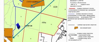
Overlapping areas during land surveying - causes, consequences, solution
The overlap of boundaries is a consequence of boundary errors and one of the possible reasons for refusal of a decree for cadastral registration (clause 1 of Article 26 of Law No. 218-FZ of July 13, 2015 “On State Registration of Real Estate”).
It arises in situations when one of the neighbors of adjacent properties conducts land surveying and registers it, but the second is denied registration.
There are two solutions to this problem - engaging a cadastral engineer to make an opinion, in the absence of disputes between neighbors, and litigation in court if one owner does not agree with the claims of the other.
Costs to correct boundary overlap
The land surveying procedure itself seems to be a costly affair.
The services of cadastral engineers are not cheap, and if this problem arises, it may be necessary to carry out land surveying several times and in relation to several neighboring areas. One land surveying procedure costs approximately 2–2.5 thousand rubles, depending on the region. In Moscow, this amount is much higher and cadastral engineers charge more than 10 thousand for their services.
In addition, collecting documentation and going to court, in addition to the costs of correspondence and transportation, which are simply impossible to calculate, you must pay a fee.
Eg:
- request for an extract from the State Tax Committee – 150–200 rubles;
- The filing fee depends on the amount of the claim.
The amount of the claim in this case is indicated by the cadastral engineer. That is, it is calculated depending on the area that turns out to be controversial as a result of the overlap. The amount of the claim will be the unit cost of the area.
If it is not possible to save on the amount of duty or correspondence costs, then you can save money on conducting preliminary land surveying. To do this, it is worth asking your neighbors whether boundaries have ever been agreed upon or whether there have been disputes between neighbors. This will not only save money, but also pre-coordinate the clarification of the boundaries of the plots with neighbors, which will avoid disputes in the future.
Incorrect boundary division
Improper execution of land surveying is one of the most common causes of cadastral errors. It can be expressed in the incorrect establishment of coordinate points along which the boundaries of the perimeter of the plots pass. In this case, the mistake should be corrected by contacting the cadastre authorities for a commission and geodetic specialist to visit.
Various companies carry out land surveying activities, but the lack of experience or qualifications of their engineers can lead to such a banal mistake, which, nevertheless, can occupy the owner for a long time.
Land surveying will also be incorrect if it does not correspond to the register data (without or with a cadastral error).
Other signs of invalid boundary definition:
- completed without the consent of neighbors, if it was required (are signatures of neighbors needed when surveying?);
- the approval procedure on the part of the engineer is violated;
- a violation of the rights of adjacent land users was committed.
Carrying out incorrect land surveying may lead to refusal of registration and registration of property rights.
Responsibility of persons in case of detection of overlap
Although the legislation does not designate the errors that caused the imposition of plots as guilty actions subject to punishment, the responsible persons still undergo some difficulties:
- If an error occurred as a result of the actions of an employee of the State Control Committee, he is held accountable in the form of disciplinary action in the manner prescribed by labor legislation.
- The cadastral engineer may be deprived of his certificate, and an administrative fine may be imposed on him.
- Neighbors, if the fact of illegal expansion of the boundaries of the site is revealed, will be brought to administrative responsibility.
Expenses of land owners can be recovered from the guilty parties only when the imposition was a mistake of the cadastral engineer.
Only this category of specialists in this field bears property liability.
True, compensation occurs through insurance, so you will have to prove the guilt of the cadastral engineer to insurance agents, and if something happens, through legal proceedings.