Would you like to consult a lawyer for free? Write to the chat on the bottom right or call the hotline, calls within the Russian Federation are free. We accept questions any day of the week.
Land surveying refers to the definition and establishment of land boundaries, as well as their legal consolidation on the basis of certain documents. The land surveying procedure is clearly regulated by the legislative acts of the Russian Federation. The process of determining the boundaries of a land plot takes place in several stages. Each stage takes a certain time, and for some, an exact deadline is set at the legislative level. So, let's take a closer look at how much land surveying is being done in 2021.
What deadline is specified in the law?
At the legislative level, there are no deadlines for carrying out boundary work. The time spent on the procedure depends on the conditions specified in the contract, which is concluded between the customer and the cadastral engineer.
The deadlines for registration in Rosreestr and the cadastral registration process are regulated by Article 16 of Federal Law No. 218 and are:
- cadastral registration of real estate – 5 days;
- state registration – 10 days;
- up to 12 working days when contacting the Multifunctional Center.
The time count begins from the moment the package of documents is submitted to the authorized body or MFC.
Deadlines for land surveying and registration in the cadastre
Federal Law No. 447-FZ dated December 22, 2014 provides that from January 1, 2021, a ban will be introduced on any transactions with plots of land that have not undergone the survey procedure. Thus, the law actually introduces restrictions on the disposal of land ownership.
In addition, without land surveying it will not be possible to dispose of a site in respect of which cadastral registration has been carried out, but there is no information about the coordinates of characteristic boundary points. This regulatory act obliges owners of plots that have not undergone land surveying to complete this procedure by the end of 2021 in order to be able to dispose of the land.
Get an estimate of the cost of this service using our price calculator - here
The timing of boundary work is not fixed in the law, as it depends on the specific terms of the contract concluded by the customer with the cadastral engineer. When determining the deadlines, it is necessary to take into account the monthly period established for notifying the owners of adjacent plots about the approval of boundaries. Thus, the approximate survey period will be 1.5 months.
The deadlines for cadastral registration and registration with Rosreestr authorities are established in Art. 16 of Law No. 218-FZ and are:
- 5 working days – for the cadastral registration procedure;
- 10 working days – for simultaneous accounting and state registration procedures;
- 7 and 12 working days, respectively, if these actions are performed through the Multifunctional Center.
The specified time period begins from the moment the application and necessary documents are submitted to the registration authority or MFC.
Expert advice . After completing work on a new site, the cadastral engineer is obliged to independently send a boundary plan to the cadastral chamber of Rosreestr. Since such a referral is carried out electronically, citizens will be able to receive a written version of the boundary plan only if such a condition is included in the contract with the cadastral engineer.
How much time in advance do you need to notify neighbors about land surveying?
It is necessary to agree on carrying out land surveying with interested parties (neighbors) within the prescribed period, in accordance with Article 39 of Federal Law No. 221, as well as the Methodological recommendations of Roszemkadastr.
All owners of land plots bordering the land surveying site must be informed at least 15 days before the work is carried out.
If it is not possible to personally deliver the notification, then you must send a registered letter to your neighbors. This point is explained in Article 39 of Federal Law No. 221.
It is worth noting that the notification in the letter must be sent at least 30 days before the work to coordinate the boundaries is carried out.
Stages of land surveying
Land surveying is carried out by a cadastral engineer on the instructions of the customer. In order to fulfill the terms of the contract in terms of carrying out work on the site, the cadastral engineer will have to go through the mandatory stages of land surveying, approved by the Methodological Recommendations:
- collection and study of information about the site, as well as about adjacent land plots, based on documents submitted by the customer, a cadastral plan of the territory or an extract from the Unified State Register of Real Estate;
- registration of the land surveying project;
- notification of owners of adjacent plots whose interests may be violated by the establishment of boundaries;
- work with visiting the site, determining boundaries on the ground and drawing up a boundary approval act;
- geodetic work and determination of coordinates of boundary markers;
- establishing the area of the site;
- execution of a graphic drawing of the site with large-scale drawing of boundaries;
- drawing up a boundary plan.
It is the boundary plan that will be the result of the engineer’s work and will be sent to the cadastral authorities to register the site.
Expert commentary . If, based on the results of cadastral registration, an error is identified in the preparation of boundary documents, the cadastral engineer is obliged to eliminate it by carrying out additional work.
Deadline for registering information in the Unified State Register of Real Estate
Registration of data in the Unified State Register is carried out within the period established by law. This point is taken into account in Article 16 of Federal Law No. 218. The administrative document states that cadastral registration of any plots is carried out within five days. The time limit begins from the moment the necessary documents are submitted to the authority.
If the applicant wishes to immediately register ownership of the land plot, then 10 working days are allotted for the operation.
Attention: if the documents are submitted by the applicant to the MFC, then it is necessary to add a couple more working days to the specified deadlines.
Why is land surveying necessary?
Important! Please keep in mind that:
- Each case is unique and individual.
- A thorough study of the issue does not always guarantee a positive outcome. It depends on many factors.
To get the most detailed advice on your issue, you just need to follow any of the suggested options:
- Use the online chat in the lower corner of the screen.
- Call:
For all regions of the Russian Federation: +7 (800) 511-86-74
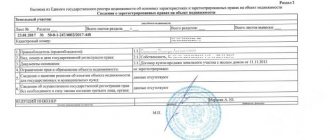
First of all, you and I need to understand what land surveying is and why is it needed? In simple terms, this is a geodetic method of determining the boundaries of a plot of land in a horizontal plane; it is also called land surveying or arpantage. The result of marking the boundaries will be a boundary plan. You can see the typical form of this plan in the picture below.
standard form of boundary plan
Important: To register a land plot in the state real estate cadastre, you will definitely need a boundary plan.
It is worth noting that this is not the only document that you will need when registering ownership of your land.
How long does it take to survey a land plot in 2021?
At the legislative level, the timing of land surveying is not established.
If we take into account practice, the entire process, from submitting documents to registering property rights, takes approximately one month to six months.
The duration of work is influenced by many circumstances.
Land surveying in 2021
The land surveying procedure in 2021 has important features caused by two regulatory documents:
- Federal Law of July 13, 2015 No. 218-FZ;
- Federal Law of December 22, 2014 No. 447-FZ.
Law No. 218-FZ came into force in January 2021 and regulates the specifics of cadastral registration and registration of real estate. Federal Law No. 447-FZ dated December 22, 2014 establishes a requirement to prohibit transactions for areas in respect of which land surveying has not been carried out.
What affects operating time
So, let's consider in detail the factors influencing the time of establishing the boundary on the site. These include:
- Open access to the site (if access to the land is limited, the process may take a long time).
- Availability of the necessary information (cadastral data about the object in the USRN authorities).
- Opinion of the owner of adjacent plots (presence of controversial issues).
- Involvement of special equipment to perform the work (it is necessary to find out whether special technical means are required in order to allocate an area).
What documents will be needed for land surveying?
The lists of documents for filing an application by individuals and legal entities are slightly different.
To register a plot as an individual you will need:
- An identification document of the owner of the plot (passport) or, if the owner cannot order land surveying on his own, a passport and power of attorney of his representative, as well as copies thereof.
- Legal documents. Among them:
- Agreement for the purchase and sale of land (if it was acquired by purchase from another owner).
- Donation agreement (if the plot was donated to the owner by another person).
- Certificate of inheritance (if the land was received as an inheritance by law).
- Resolution of the administration of the subject of the federation on the provision of a plot of land to the customer (if it was transferred for use by the authorities).
- Certificate of state registration of rights (issued when the owner takes ownership of the property in the Rosreestr authorities).
- Documents that include data on the boundaries, size, geographical location and area of the site: cadastral extract from the register, cadastral plan, certificate from the BTI about the absence of buildings on the site or cadastral passport of the building, if available.
- Application for carrying out boundary work.
To order land surveying by a legal entity, you will need the same documents as in paragraphs 2, 3 and 4, as well as:
- Power of attorney confirming the powers of the legal entity.
- Certificate of tax registration.
- Certificate of state registration of a legal entity.
- Extract from the Unified State Register of Legal Entities (Unified State Register of Legal Entities) or from the ERIP (Unified Register of Individual Entrepreneurs).
It is possible that some documents (for example, issued by the Federal Service for State Registration, Cadastre and Cartography, or BTI) will have to be ordered separately. It is best to take care of obtaining the necessary papers in advance and check the list with the contractor, otherwise the land surveying process may be delayed. It is also recommended to make copies of all documents in advance, and when preparing extracts and certificates from the Cadastre and Cartography Service, immediately order 2-3 copies - this should be free and can significantly speed up the process.
How long does the boundary plan last?
It is important to note that not a single legislative act today contains information about limiting the validity period of the boundary plan.
However, it should be understood that the cadastral registration procedure is carried out on the basis of a boundary plan, which must comply with the requirements of legislative acts, changes to which are made quite often.
Duration of legal validity of the boundary plan
It is impossible to say exactly at what period the need to update the boundary plan occurs. Not a single legislative act contains any indication of this. Therefore, we can conclude that the boundary plan has no validity period, and it has legal force indefinitely.
But at the same time, when certain circumstances occur, owners and interested parties face the need to update the boundary plan.
These factors include:
- changing the boundaries of the land plot;
- clarification of demarcation lines;
- change of geodetic points according to the decision of the State Committee for Land Control;
- division, connection of plots, allocation of shares;
- detection of errors in land surveying;
- overlapping areas.
In all such cases, the land surveying procedure is carried out again at the request of the owners and other interested parties or by decision of authorized government bodies.
Another reason for updating the land survey is a change in measurement systems in the geodetic network. Any change in geodetic points or units of measurement entails the need for repeated surveying.
If legal requirements change, the land survey plan available to citizens may also lose its relevance.
We recommend that you read:
The procedure for land surveying in horticulture and the documents required for the procedure
For this reason, it is necessary to monitor all changes that are made to the legal acts (regulatory acts) of the country, as well as to local legislation.
How much does land surveying cost?
The cost of surveying services is set directly by the organization that has the right to perform such work. Therefore, before concluding a contract, read the price list.
The price is formed from the list of works that need to be performed by the engineer. We list approximate prices. They can differ significantly not only in different regions, but also within the territorial unit itself.
- Determining the boundaries of an allotment on the ground will cost between 2-15 thousand rubles.
- Preparation of a boundary plan for a property will cost about 4 thousand rubles.
- Topographical survey costs around 1 thousand rubles.
The average price for land surveying in the Moscow region is from 10 to 30 thousand rubles, in the Leningrad region - around 7-8 thousand, in other territories it starts from 5 thousand rubles.