A detailed sample of a power of attorney for land surveying
If a person for any reason cannot be present during the land surveying process on his own, he always has the opportunity to use the services of outside specialists.
In order for the hired people to be present during the process of this operation, it will be necessary to issue a power of attorney for them, since this requirement is provided for by current legislation.
However, first you need to understand what a sample power of attorney for land surveying looks like and how this operation should generally be carried out in 2021.
How to compose?
It is not at all difficult to draw up a power of attorney to register a land plot for cadastral registration. It is important to take into account some of the features of this type of document, such as a power of attorney, and indicate in it the most specific information regarding both the real estate itself and the duties of the trustee.
Having completed it correctly, you can safely entrust the registration to a person who is ready to take on all the hassle associated with registering land. The power of attorney is drawn up according to the following structure and with the following information:
in the header of the document:
- Title: “Power of attorney to carry out registration actions with a land plot”;
- Place and date of compilation;
The following is the body of the document , where it will be important to indicate the following information:
- Principal details. Full name, address, year of birth, full passport details of the owner;
- Trustee details. Also the most complete information using passport data;
- It is worth stating what actions the power of attorney covers;
- The property to be entered into the cadastral register is indicated;
- For how long is the power of attorney issued?
- Signature of an authorized person with transcript.
By drawing up this simple paper, you can do without the mandatory presence during land surveying and use the services of an authorized person to submit documents to Rosreestr. It is worth remembering that fraud is widespread in the real estate market today. When entrusting registration rights to third parties, it is worth making sure that they are trustworthy. Only a competent lawyer will be able to quickly and without any hassles register the land with the cadastral register.
Read how to revoke a power of attorney here.
Regulations
All actions related to land management are carried out in full accordance with the standards specified in PP No. 396, which was published on June 7, 2021.
In particular, this Resolution establishes a complete list of information about what is specifically included in the list of boundary works:
- establishing boundaries and then agreeing on them with each interested party;
- securing the formed boundaries in a certain territory with the help of special boundary signs;
- registration of cadastral maps and diagrams.
Another document on the basis of which the boundary plan is drawn up is Order of the Ministry of Economy No. 921, published on November 23, 2021. This order includes samples of a boundary plan, as well as a completed approval act. In addition, the document contains requirements that must be complied with during the execution of these papers.
Resolution and order are special documentation that regulates the work of authorized employees of the geodetic service.
Sample power of attorney for land surveying
Documents for the owner
After the specialist has completed the surveying process, the owner of the plot will be provided with a survey file, which must be kept in the land committee of the area where the plot is located.
The case includes the following papers:
- an explanatory note indicating the customer and performer of the work;
Explanatory note.
- list of coordinates of boundary signs;
The act of transferring boundary signs. - assignment from the land owner for land surveying;
Assignment for land surveying. - all notices from owners of adjacent plots;
Notification of owners.
- act of coordinating boundaries with the owners of neighboring properties;
The act of agreeing on the location of the border of a land plot. - site drawing;
- calculation of land area;
- act of acceptance of work by the owner from a specialist.
Certificate of acceptance of land management works.
Only on the basis of a land survey is it possible to draw up all the main papers for land from January 2021.
Previously, the procedure for registering with the cadastre and cartography service and registering property was carried out according to a simplified scheme without establishing the boundaries of the territory.
This was recorded in the cadastral passport: Without establishing boundaries.
Required documents
Before carrying out all the necessary activities, the cadastral officer must receive a complete list of documents for the land for which boundaries will be established.
In particular, you need to provide him with the following documents:
- a certificate confirming the right of ownership of the land territory;
- cadastral passport;
- technical documentation for various buildings located on the territory of the specified site;
- cadastral plan of the territory, including all information about neighboring areas.
Before going to the specified territory to carry out all the necessary operations, the cadastral engineer will have to study the papers provided to him, and then, based on the information received, draw up an action plan, as well as determine the necessary list of methods and techniques that should be applied to this territory. Only after this does the definition of boundaries begin, as well as carrying out measuring operations on the ground.
After land surveying, the owner of the specified plot is required to receive a survey file, which in the future will also have to be transferred to the territorial land committee of the corresponding district.
notices on land surveying
The following documents are included in the case:
- an explanatory note indicating information about the specialist performing all the necessary work and the customer;
- a list of coordinates at which boundary signs are installed;
- assignment from the owner of the site on the basis of which the survey was carried out;
- all notices issued to owners of adjacent territories;
- an act confirming the approval of the boundaries of the land plot with the owners of neighboring territories;
- allotment drawing;
- calculation of the total land area;
- act of acceptance of all work by the owner of the site from a specialist.
act of approval of the boundaries of the land plot
Only on the basis of a completed boundary case will it be possible to complete all necessary documentation for land from January 2021. Before this, the procedure for registering a land plot in the cadastre, as well as the subsequent registration of ownership rights, was carried out according to a simplified scheme without the need to clarify the boundaries of the territory, and a corresponding entry was made about this in the cadastral passport.
Sample cadastral passport for a land plot:
What is coordination of land boundaries?
Coordination of the boundaries of a land plot is one of the procedures for land surveying, which regulates obtaining the consent of the owner of the adjacent (neighboring) land plot to establish boundaries in coordinates, according to the boundary plan.
Why is this needed? For example, you own a plot of land, the boundaries of which are not established in accordance with land legislation, in other words, the plot is not demarcated. An undemarcated land plot means that the boundaries have approximate rather than exact coordinates. Likewise, a neighboring plot of land may have approximate coordinates (borders).
Therefore, in order to reduce conflicts between neighbors, the legislation provides for a mandatory procedure for coordinating boundaries between neighbors whose land plots are not demarcated. In other words, neighbors need to agree on where the common boundary of the plots will be and record this in the act of approving the boundaries.
Sample form of power of attorney for land surveying
A power of attorney is a document that is drawn up by one party to a transaction in the name of another in order for him to represent his legal interests as a proxy in any authorities. The execution of this document is carried out in full accordance with the established form, and according to the law, the preparation of a power of attorney can be carried out in standard written form, or can be certified by a notary.
Today, there are many power of attorney templates depending on exactly what tasks will be assigned to the trustee and in what area he will be involved in performing the necessary operations. Some forms, taking into account the peculiarities of using the document, must be certified by a notary, that is, the execution of this document must be carried out by such a specialist.
A power of attorney to carry out any individual actions on behalf of the person does not require notarization, since, in accordance with current legislation, such a document retains legal force even if it is not registered at a notary’s office.
powers of attorney for land surveying.
The text of the power of attorney may include various information due to the wide choice of options for specifying permissible actions, as well as the available list of rights of the person acting as the attorney, but in any case, the following information must be indicated:
- date of document execution;
- information about the applicant, including his full name, year of birth and passport details;
- information about the authorized person, including the above data;
- an indication that the specified person becomes a representative in various institutions of a certain locality;
- indication of the address of the land plot or real estate for which the power of attorney is being drawn up;
- a list of powers granted to the specified person;
- the term of the power of attorney indicating whether it can be delegated;
- applicant's signature.
Sample certificate of land ownership
Resolutions and orders on land surveying
The Resolution contains information about what is included in boundary work:
- establishing boundaries and agreeing on them with all interested parties;
- securing the resulting boundaries on the ground with boundary signs;
- drawing up diagrams and cadastral maps.
Another document on the basis of which the boundary plan is drawn up is Order of the Ministry of Economic Development No. 921 dated November 23, 2016. It contains samples of a boundary plan and an approval act, as well as requirements that are mandatory when filling out this documentation.
Orders and resolutions are documents that regulate the activities of geodetic services.
Before carrying out measures to establish boundaries, the owner submits an application indicating the object to be surveyed, information about the owner of the land and the purpose of the survey. The document is submitted to the geodetic service for review
. This is where the process of setting boundaries begins.
After accepting the application and considering the case, the cadastre and cartography service enters into an agreement for geodetic work with the owner of the land plot.
Sample application (form) for land surveying.
Agreement for land surveying.
The contract must indicate the essential conditions of the event:
- the parties between whom the transaction is concluded.
- The subject of the transaction is the work that will be performed on the territory, and the methods and methods used for measurements are also explained.
- Duration of the contract: the period of time during which the documentation is reviewed, work is carried out on the ground and the results are recorded in the form of a survey document.
- Responsibilities of the parties: a plan for carrying out all required work and the functions of each party are signed.
- Transaction price: an estimate for land surveying is drawn up.
- Details and contacts of the parties to the agreement.
During land surveying, the presence of the owner of the land territory is required. If the owner cannot be in the process of determining boundaries, then he has the right to send a proxy in his place. This requires the mandatory execution of a document granting certain rights - a power of attorney. It is drawn up in a notary's office and must be certified.
Sample power of attorney for land surveying.
After establishing the boundaries of the land territory and forming a land survey, the technical and cadastral passports should be reissued. If they were not there, then you need to register again.
Even if they were made, but according to a simplified scheme, then it is necessary to make changes to them with the data specified in the survey file.
These documents are valid for an indefinite period, but when information related to the site changes or when transactions are concluded, they require re-registration. You can make a new cadastral passport at the Unified State Register or MFC
. The state fee for such a service will be 200 rubles.
From 2021, it will be impossible to carry out any transactions on a land plot without surveying. If the owner plans to sell, rent out, donate or make a will on the land, then it is better to take care of all the documents for the site in a timely manner.
Before contacting the organization conducting land surveying, you should collect all the required documents in advance, so as not to waste time on this later.
The list of required documentation to determine boundaries may vary depending on the specific situation.
Let's look at what documents are needed to survey a land plot, how a power of attorney is executed, and where to get documents if they are lost.
Design features
For companies, execution of a power of attorney is mandatory, and this document is drawn up for the person who will represent the organization in the process of carrying out various operations. Individuals can also issue a power of attorney for other citizens who replace the owner in the process of resolving various issues related to the determination of boundaries.
A power of attorney must be issued by a notary, indicating information about the applicant and the person to whom the authority is granted. An acquaintance or relative can act as a proxy, that is, any person whom a citizen trusts
. It is mandatory to indicate their passport details, place of registration and date of birth.
If a power of attorney is issued on behalf of a legal entity, the text of the document indicates the full name of the company with TIN and details, as well as the legal address and details of the authorized person.
Execution of a power of attorney and sample filling
Organizations must have a power of attorney issued to the citizen who will represent the legal entity. For individuals, a power of attorney can also be issued to another person who will replace the owner when resolving issues of establishing boundaries.
The power of attorney must be executed by a notary. The document must indicate the principal and the person to whom the authority is granted.
A relative or acquaintance whom the citizen trusts can act as a proxy.
Be sure to include their passport details, date of birth and place of registration.
Also, the power of attorney must include a clause specifying what functions it is issued for. The validity period of the power of attorney is indicated
. Participant signatures must be included.
For an organization, a power of attorney is issued to a person who is authorized to represent the company. The text of the paper indicates the full name of the organization with details and TIN, the legal address of the company and the details of the authorized person.
It is better if the organization is represented by a professional lawyer. The power of attorney must have the signature of the head and the official seal.
agreement for land surveying.
powers of attorney for land surveying.
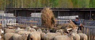
Land surveying in 2021: procedure, conditions, cost
Land surveying in 2021 is an inevitable procedure that is carried out when registering land or other real estate (house, cottage, garage, etc.) for cadastral registration. Land surveying is, in fact, the official determination of the boundaries of land plots, as well as the consolidation of land survey signs
. This procedure is mandatory for land that falls under distribution, is transferred for use from the state reserve, as well as for land that requires division in order to allocate a share.
Also, land surveying in 2021 must be carried out in the case of initial cadastral registration or if there are disagreements regarding the boundaries of the site.
More details about land surveying can be found in the Land Code.
Important: from 2021, preliminary surveying of a land plot has become a mandatory condition for citizens who decide to buy, sell or transfer land by inheritance and if no boundaries have been established in relation to this land.
If you have a question for a lawyer, do not waste time searching for information on your own. Ask it now!
What needs to be done to survey the land
Land surveying in 2021 has not undergone any significant changes compared to previous periods.
All basic requirements and conditions remain the same. To begin land surveying procedures in 2021, you need:
- Collect and prepare all the necessary documents (extract from the Unified State Register, passport) for land surveying.
- Find a cadastral engineer who has the necessary permits and sign a contract agreement with him to carry out cadastral work.
- Receive a technical and boundary plan (usually 1-2 weeks from the date of application).
- Check all received documents, make sure there are no discrepancies with the plan, and if everything is in order, then sign the work completion certificate.
Important: the land surveying procedure can only be carried out with areas that are in your property. Leased land cannot be demarcated.
Co-owners of adjacent plots can also be invited to participate in the land surveying process if any difficulties arise during the land survey procedures.
To identify possible difficulties that impede land surveying, contact our lawyers.
Cost of land surveying in 2021
The cost of surveying is compiled by private cadastral firms themselves, which independently set prices for their services, focusing on the level of supply and demand. But most often the cost is influenced by the region, the type of land, its area and the shape of the plot (the more complex its shape, the more expensive the land surveying will cost).
Before signing a cooperation agreement with the selected land management organization, inquire about its work experience and the cost of services.
Before signing, carefully study all clauses of the agreement, in which you should find information about the rights and obligations of the parties.
The average cost of land surveying in 2021 ranges from 3 to 10 thousand rubles, depending on the area, complexity of the work and the number of adjacent land plots.
Notifying neighbors about land surveying in 2021: is it necessary?
It is very important: before you call specialists to survey the land, notify the neighbors with whom your site borders. Neighbors must confirm that they have no complaints about the survey results
. In 2021, nothing changes in this part.
The neighbor has the right to refuse to sign the land survey act, and this will mean that he does not agree with the new boundaries.
Quite often there are situations in which neighbors quarrel during land surveying. In this case, there are two options: either give in to your disgruntled neighbor, or go to court and prove your case there.
Features of the land surveying procedure
The services of a cadastral engineer include:
- Departure to the site to measure the territory.
- Determining the required coordinates.
- Determination of boundaries and their coordination with neighbors.
If there are no complaints from neighbors, then the land surveying procedure takes only a few hours.
The last stage of the process is the registration of a cadastral passport of the land survey, which can be in electronic form (but you can also order a paper copy). From the day the land is registered for cadastral registration, in 5-10 days the new boundaries will be displayed on the cadastral map.
Power of attorney for division of land and provision of communications
- site drawing;
- calculation of land area;
- act of acceptance of work by the owner from a specialist.
InfoCertificate of acceptance of land management works.
- Only on the basis of a land survey is it possible to draw up all the main papers for land from January 2021.
Previously, the procedure for registering with the cadastre and cartography service and registering property was carried out according to a simplified scheme without establishing the boundaries of the territory
.
This was recorded in the cadastral passport: Without establishing boundaries.
Resolutions and orders on land surveying All activities related to land management are carried out on the basis of Government Decree No. 396 of 06/07/2002. It indicates the procedure for carrying out work that is associated with the formation of new and streamlining of old sites.
Possible difficulties when surveying land in 2021
The main problem in the process of land surveying is the excess of the actual area. According to Federal Law No. 93 (dated June 30, 2021), the size of the plot can be increased, but by a specific minimum size, which is determined by the relevant regulations
. You will have to obtain permission from self-government bodies for land surveying in the direction of increase.
Simply put, if the minimum size was considered to be 600 acres, then you can cut no more than the same size. But this is only theoretical; practice shows that government bodies do not want to sign such acts.
If you still have questions about the land surveying procedure in 2021, ask our lawyers for free by filling out the form below or by chatting.
What is site surveying and how to carry it out
1633
2021-03-13
A specialist who has a license to carry out work knows what land surveying is. Land surveying is the establishment of land (plot) boundaries to determine the area and coordinates.
The concept appeared during the times of Kievan Rus, feudal lords established the boundaries of their possessions. The geodetic method of determining boundaries helped to mark the lands allocated for haymaking, forests, and arable land.
You will learn how to conduct land surveying, which is part of land cadastral relations, thanks to which you can rationally use land resources.
List of required papers
Before carrying out work, the cadastral officer must familiarize himself with the basic documentation for the land where boundaries are to be established.
These papers should include the following:
- certificate of ownership of land territory;
- cadastral passport of ownership;
- technical documentation for all buildings and structures located on this land plot;
- cadastral plan of the territory, which contains information about all adjacent areas.
Before going directly to the area to carry out work, the cadastral specialist studies the provided documentation and draws up an action plan, determines the methods and techniques that should be applied to the given territory. Only after this does he begin to establish boundaries and measure the area on the ground.
How to carry out land surveying
The geodetic method of determining boundaries is carried out in several stages; during the work, the specialist is guided by the Instructions for land surveying. The document describes the order of work, what the engineer needs to pay attention to, and how to correctly complete the measurements.
How to carry out land surveying
:
- Order an extract from the Unified State Register of Real Estate
- Call a cadastral engineer to the area that needs to be demarcated.
- Agree on the procedure with your neighbors.
- Draw up a boundary plan.
- Submit the plan to Rosreestr .
After surveying the garden plot, the boundaries will be entered into the real estate cadastre.
Why is it necessary to demarcate the boundaries of the site?
Why carry out land surveying?
– the procedure is needed to obtain a boundary map, which displays data such as area, coordinates of end points, and territory diagram.
The procedure is also needed to achieve the following goals:
- Identification of the boundaries of the memory, their designation.
- Formation of information in a unified cadastral registration database.
- Conducting transactions related to the allotment (purchase and sale, transfer under a gift agreement, privatization).
The work carried out will help to attach materials to the court case (if necessary) or avoid legal disputes and proceedings, find out the cadastral value of the land .
The procedure and conduct of land surveying
An engineer knows how to properly survey a plot of land; it is impossible to do this on your own. The work consists of five stages.
Stage one - conclusion of an agreement
The work is carried out in accordance with the Instructions approved in 2021. Licensed companies have the right to take measurements; special equipment is used in the process
. Terms, conditions, procedure, obligations of the parties, responsibilities are prescribed in the contract. It is recommended to invite two engineers to carry out correct measurements.
Stage two - surveying
An engineer will help carry out land surveying of the house; the owner provides the necessary package of documents. Please note: all manipulations begin after the work has been agreed upon with the neighbors.
The stage consists of the following types of work:
- Get an extract from Rosreestr
- Land preparation.
- Conversation with neighbors.
- Setting boundaries (an agreement is drawn up with neighbors).
- Determination of coordinates of boundary signs.
- Shooting.
- Preparation of a plan (it specifies the exact boundaries).
The final moment of the stage is the formation of a plan.
Stage three - obtaining a plan
The land survey plan contains a graphic and text part. The results of the work done by the engineers are recorded here.
Stage four – application to Rosreestr
The task of the future owner is to register the property with the cadastral register. To do this, a package of documents is submitted to the registration authority. What you need to provide:
- Application (application is submitted in writing).
- Identification document (only passport of a citizen of the Russian Federation).
- Land survey plan.
- Extract from the Unified State Register of Real Estate for a land plot
If a person is entrusted to act on behalf of the owner, a certified power of attorney is required. The land survey plan can be either on paper or in electronic form. It will take 10 working days to enter data into the state real estate cadastre
.
Stage five – formation of property rights
Is it necessary to carry out land surveying - yes, it is necessary, because without this procedure it will not be possible to legitimize the rights to the plot. Documents confirming ownership can be obtained from Rosreestr or from the MFC
Parts of the document and sample
There are two types of application for land surveying :
- completed on a prepared form;
- written independently in free form.
The form to fill out can be downloaded from the link.
The second version contains the same main points as the first. According to the law, such a document is not filled out on strict reporting forms .
It can be filled out either by hand or by entering data into a ready-made printed form.
Introductory part
The first part is the so-called “head” of the document, which indicates the name of the organization to which the application is being submitted.
Often, in order to avoid mistakes, the applicant receives a ready-made form with the name of the organization already printed. The manager's name is not required
. This is followed by the applicant’s full name and passport details.
Main
The main part indicates the essence of the request . In this case: carry out land surveying
. It is important to indicate here the exact address of the object and its cadastral number.
The next paragraph indicates the method of ownership of the plot: property, lifelong use, lease. After which a document is called that will confirm this fact and its number.
If there is no cadastral number, you only need to indicate the address of the land plot .
Final
The final part, as with most applications, contains the legible signature of the applicant. On the other line is a date indicating the day, month and year when this document was submitted.
The application does not indicate the amount of payment for land surveying work . These figures are entered into the contract.
What documents are needed to register land?
The package of documents depends on who submits the application - an individual or a legal entity. If the owner is an individual, you need to prepare the following documents:
- Passport (original and copy).
- Certificates confirming ownership.
If this is a legal entity, in addition to the above papers, you must attach an enterprise registration card and a document for the building.
Important! The very first step is to order an extract from the Unified State Register of Real Estate, you can obtain it on the official website of Rosreestr - rosreestr.info
How much does a land surveying plan cost?
The price depends on how many areas will be used and how much work will be performed. How much does a land surveying plan cost:
- One plot – amount from 6 thousand rubles.
- Allotment area up to 4 thousand m² - amount from 6 thousand rubles.
- Registration of rights – amount from 9 thousand rubles.
- Preparation of documentation – amount from 14 thousand rubles (this includes registration).
- Shooting of clothes - amount from 14 thousand rubles.
The amount of shooting depends on the scale of the typographic image and how much land it covers.