What is a red line in construction?
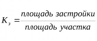
Before starting work on the construction of any buildings on the site, it is necessary to understand where exactly the red building line is. It defines the boundaries of a plot of land and separates it from the adjacent public area.
Red building lines: what are they?
Red lines are needed to indicate the boundaries of land plots. According to the Town Planning Code of the Russian Federation, they mean the boundaries separating blocks and microdistricts from streets, squares and passages in populated areas. The names of the lines are given by the color with which they are usually designated on project maps. Red lines in construction are determined, among other things, taking into account the development prospects of the settlement.
According to the law, when constructing facilities, it is important to comply with a number of conditions:
- Buildings on the site must be located within the red lines,
- The object should be at a distance of 2 to 3 meters from the lines.
However, there is an exception for buildings with premises for public needs located on the first level. They can be built directly along the building line. If the object goes beyond the red lines into public territory (such lands cannot be privatized - Article 85 of the Land Code of the Russian Federation, clause 12), the building may be demolished by court decision.
Boundaries of red building lines
Separate “islands” can be identified on a plot of land, outlined with red lines.
This is possible if the building site has:
- telecommunication lines,
- pipelines and other utilities.
At first glance, it can be difficult to determine exactly where the red line is: there are no marks on the area.
You can obtain information in two ways:
- By contacting the cadastral chamber and requesting a general development plan or a situational plan of the land plot,
- By inviting land management specialists who will determine the boundaries of the site.
Red lines and other lines of urban planning regulation are required to be taken into account and reflected in the following documents:
- General plans, development projects and detailed planning,
- Highway planning projects, locations of squares and streets and engineering/transport communications,
- In the land and urban planning cadastres.
The red line project is subject to mandatory coordination and approval as part of the urban planning documentation.
Distance between the red line and the building line
The possible development line defines the boundaries within which construction is permitted and is measured from the red line. The territory between the red line and the building line belongs to the owner of the site. Sometimes the building line and the red line coincide. The purpose of a building line is that it defines the area on which construction can take place.
The distance from the red line to the building line is regulated:
- town planning code,
- SNiPs.
For example , according to clause 2.14 of SNiP 2.07.01-89, residential buildings with apartments on the first levels are located indented from the red line. In homestead development areas, it is allowed to place residential buildings along the red line, if this is the tradition of local housing construction.
When building houses on personal plots, the recommended distance between the house and the red line (sidewalk border) is 4-5 m.
This distance allows:
- Separate a residential building from a dusty and noisy street,
- Organize the space as conveniently as possible.
Monitoring compliance with the standards is quite simple: to obtain permission to construct a capital facility, you must provide a layout plan for the site. It must indicate the boundaries of the site, the location of the red lines and the designed object.
Minimum fire clearances
This parameter depends on several factors. If we are talking about residential buildings, the distance is determined based on the material of the walls and ceilings of the house.
Determination of minimum fire distances
To ensure fire safety, it is allowed to design and construct buildings at an average distance from each other of 6 - 15 meters. The minimum fire safety distance depends on the materials from which the load-bearing external walls and ceilings of neighboring houses are made. State building regulations provide for the required distances between residential buildings:
- If the walls of neighboring buildings are built from non-combustible materials - concrete, stone, reinforced concrete, brickwork, the minimum fire-prevention distance between them is 6 meters.
- If they have wooden floors - 8 m.
- For wooden houses or those built from other combustible materials - 15 meters.
All calculated distances are measured at the most prominent points. Most often this is a porch or bay window.
Regulatory documents contain recommendations - to place residential buildings offset to the lateral boundaries of land plots. If this condition is met, it will be more convenient for the owners to carry out repair work later. The minimum distance from the outer wall of the building to the fence of the site is 1 - 1.5 meters.
It is recommended to erect buildings for utility purposes in the depths of the plots, separately from residential buildings, at an average distance of 5 meters. Natural wells, composting facilities, summer showers, outdoor toilets, etc. - no closer than 8 meters. The distance to electrical and telephone cables is 60 cm.
To avoid violating the border, when designing and constructing a garage, the distance to the red line is measured with the entrance gate open. It is also necessary to mark the location of the external fence on the project.
Buildings intended for keeping pets or birds can be attached to a residential building. In this case, it is necessary to separate them from the living rooms of three utility rooms (no less). The height of these extensions should not exceed 2.4 meters.
In addition to mandatory standards, there are also additional restrictions on the planning and development of territories for low-rise buildings. These include the requirement to ensure a distance of at least 4 meters between the walls of neighboring buildings and the windows of the residential premises of a given private house.
The commissioning of a new house will be carried out without additional problems if, during its design and construction, all necessary standards regarding distances between neighboring objects are met.
How to determine the red line of a street
Why is the red building line necessary?
When drawing up a construction plan, the concept of a red building line is very often used. This is a special mark that is considered the main one in a specific area of the terrain. Therefore, if the owner of the site is going to erect buildings, he should definitely take into account the red line.
The Town Planning Code provides for the use of the concept of a red line on all areas that in the future are planned to be used for mass development in a populated area.
What is a street red line??
Hello friends! I am glad to welcome you to the pages of my blog. Today we will talk about what a street red line is.
It is also quite popular, especially in an ancient city, which may be located in a warm climate zone near trade land and waterways, to use radial street placement. That is, the paths are clearly directed on different sides from a single center point. This point can be palaces, temples, squares or markets, which are usually located in the middle of the square.
What are red lines and why do you need to know where they are?
When registering rights to land plots and obtaining construction permits in the city of Tula, architects, cadastral engineers, and government officials often use the concept of “red lines”. The purpose of this article is to understand what red lines are and what they affect.
Definition of the "red line". Red lines are lines that indicate existing, planned (changed, newly formed) boundaries of public areas, boundaries of land plots on which power lines are located, communication lines (including linear cable structures), pipelines, roads, railway lines and other similar structures (linear objects).
Red lines separate public (public) areas from land plots developed by private individuals. In other words, the red line separates public lands (places) (streets, alleys, driveways, etc.) from city blocks.
How to draw red lines?
| | 05/27/2015 | Veronica Bozhuk defines red lines as follows: Red lines are lines that designate existing, planned (changed, newly formed) boundaries of public areas, boundaries of land plots on which power lines are located, communication lines (including line-cable structures) , pipelines, roads, railway lines and other similar structures (linear objects).
Thus, “in the red lines” are the streets, and “beyond the red lines” are the neighborhoods. Before the current Town Planning Code was issued on December 29, 2004, the situation was different. Red lines were the boundaries separating the territories of blocks, microdistricts and other elements of the planning structure from streets, driveways and squares in urban and rural settlements.
Those. Until 2004, the territory “in the red lines” meant neighborhoods. Red lines are established by the territory planning project.
What is a street red line?
Architecture and urban planning are among the most ancient industrial sectors, where compliance with all legislative, technical, functional and operational standards and regulatory restrictions is mandatory. Each nation today has its own traditions of the location and mutual localization of streets, squares and other elements of urban planning:
- No less often, especially in ancient cities located in warm climatic zones near trade land and waterways, a radial arrangement of streets occurs when they diverge in different directions from one center.
- In relatively new urban formations, this is generally a rectangular arrangement, where the streets are strictly perpendicular to each other and the intersections form clear right angles.
Basic regulatory documents for private development
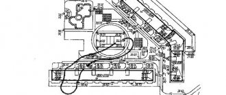
Scheme of the regulatory location of all buildings on private territory
When constructing low-rise buildings and structures and developing a site, you must first of all be guided by SNiP 30-102-99.
In addition to the residential building itself, other outbuildings, trees, shrubs, and various underground communications may be located on the land plot. The relative location of these objects is regulated by sanitary and fire safety rules and regulations.
When planning a personal plot of land, one should proceed from the size of buildings and plants, their relative position, the boundaries of the plot (a fence is usually installed along them) and similar objects on neighboring adjacent plots.
The current rules and regulations contain both recommendations and requirements. Requirements are mandatory, and recommendations are desirable to be followed.
The red line of the street is. Street red line: distance, width and boundaries
The concept of a street red line has been rooted in urban planning for several centuries now. This definition is often found today when drawing up documents of title to property or during construction. Therefore, everyone who decides to engage in construction or register rights to land plots or purchase real estate should understand the essence of the red lines of the street and what they influence.
Definition of the concept
The red line of a street or driveway is an area that defines the existing or planned boundaries of public land. They may contain power lines, communications, communications (pipelines, line-cable structures), as well as highways, roads, railway tracks and other similar objects.
The composition and size of the cross profile may be different for the same categories of streets or roads. The main elements of public areas (roadways and associated bicycle paths, tram tracks, medians, pedestrian crossings) and their size depend on the traffic on the road and its intensity. This factor is also called throughput. The boundaries of the red line of the street separate public areas from land plots allocated for construction by private individuals. This line separates streets, alleys, and passages from city and residential areas.
Red lines and legislation
The red lines of roads and streets are determined by the Town Planning Code of the Russian Federation (GrK RF). According to subparagraph 11 of Article 1 of this document, such boundaries should be understood as a line that defines the territory for the use of an unlimited number of persons. These can be squares, streets, driveways, squares, embankments, boulevards, etc.
The red line of the street is a plot of land that is part of the documentary planning of the territory (Chapter 5 of the Civil Code of the Russian Federation). It is contained in master plans, diagrams and maps of current and planned boundaries of city zones.
The width of the red lines of the street determines the configuration of the boundaries of land objects. This is stipulated in paragraph 7 of Article 36 of the Land Code of the Russian Federation (LLC RF).
The distance of these street fences is determined by the Instruction on the procedure for designing and installing red lines in cities and other settlements of the Russian Federation. It operates in accordance with the approval of the Decree of the State Construction Committee of the Russian Federation dated 04/06/1998 No. 18-30, which does not contradict the Civil Code of the Russian Federation.
Development parameters
The red line of the street, the distance of which is regulated by SNiP RK 3.01-01-2008 “Urban Planning”, determines the development indicators of residential, public and business areas. This document states that structures and buildings should be located in areas designated for the relevant construction. They are located outside the red lines according to the settlement projects.
The layout of the red lines is carried out taking into account the free passage of fire trucks, utility networks inside the sites and other objects.
Residential and public buildings are located indented from the designated areas. The width of the street in the red lines is determined by taking into account the distance from them of at least 6 m for highways and at least 3 m for residential areas.
What do red lines affect?
According to the documents presented above, the real estate property should not go beyond the boundaries indicated by the red lines, and also should not cross them.
If a building or plot of land does cross the line, it ends up on territory that is in public use.
According to paragraph 12 of Article 85 of the Land Code of the Russian Federation, social use plots are not subject to privatization. Therefore, the owner of a structure or land plot does not have the right to privatize it.
Such territories will only be available for rent. But the land along which the red line runs will not be able to become a property. And it will not be possible to appeal the decision of local authorities. Existing judicial practice has proven this more than once.
When is it important to know about red lines?
Citizens planning the construction or reconstruction of various objects must know what the red line of a street and driveway is. Therefore, such enterprises must be carried out in accordance with the established plan for such boundaries.
When constructing a new facility (with a few exceptions), you should immediately calculate the plan of the building or structure so that in no case do they cross the red line. And more often than not, they generally have to retreat from these designated zones.
To avoid problems in the future, designers, developers and everyone involved in the construction or reconstruction of a facility must take this issue as seriously as possible.
How to find out when the red line has passed
When planning the construction or reconstruction of a facility, you should familiarize yourself with the existing red lines running in the immediate area of the work. To do this, you need to obtain information from the Information System for Supporting Urban Development Activities (ISOGD).
Rules to remember
The absence of a clearly regulated distance from the border of the site with a fence to the road does not mean that it is impossible to find a reason for imposing an administrative penalty or demolition on legal grounds. It is enough to carefully study SNiP 30-02-97 as amended for 2021, SP 11-106-97 and SP 53.13330.2011. Codes of practice leave the rightful owner of the site the opportunity to establish the correct distance at the planning stage of the development.
The minimum permissible distances to the road or roadway are included in them in the form of the permitted distance from the house and other buildings. If it is planned to move the fence in order to capture a part of the street territory that does not belong to the owner, the distance to the road increases.
Distance between buildings
But if the house was built at a strict distance, accurate to the centimeter, claims may arise regarding sanitary or fire safety, even if according to building codes everything is considered correct. In incompetent sources you can find advice to obtain legal permission to occupy part of the street.
However, the existing legislation defines the possibility of constructing fences only along the border of the existing plot, which is indicated in the cadastral plans. The fence can only be located on the territory belonging to the owner, and even then claims may arise against it if a fence is installed that interferes with transport on the street or roadway.
The video below explains how to properly place buildings and fences on the site.
Standard distance from the house to the roadway
The standard distance from a private house to the road is at least 5 meters, but it increases if buildings have more than 3 floors and can sometimes reach 8–10 m.
Standard distance from the house to the roadway according to SNiP
The Town Planning Code defines the following value for streets:
- its usual width can be at least 15 meters;
- for the movement of vehicles, a distance between fences of at least 9 m is considered legal;
- the red turn or turn line is at least 6 m (in urban conditions - from 15 m);
- only the passage in the alley cannot be less than 3.5 meters.
| An object | To the lane, m | To the road, m |
| House | 3 | 5 |
| Outbuilding | 5 | 5 |
If the owner has installed a fence in such a way that it violates the permissible width standards determined by the Town Planning Code, neither the ownership of the captured meters nor the installation of special noise shields will be taken into account.
Site boundary
It will be taken into account how many meters from the house to the roadway. Fire standards indicate 50 m, the installation of shields reduces it to 25 m, the distance from the internal passage to the windows of a residential building must be at least 3 m, and the distance from the roadway is doubled.
The absence of norms for the distance from the fence does not mean that if it interferes with the movement of cars or pedestrians, claims will not be made regarding the location of the road and any of the buildings on the site.
Red building line
Residential and non-residential premises, streets and squares of populated areas are not installed randomly. They fit into the master plan developed by the architects and approved by the head of the local administration.
In technical documentation, the concept of “red line” is used. It is well known to the average person, but not every owner of a land plot (LP) has a reliable idea of what it is.
What is the “red development line” (RDL)
The designated concept in all situations of application is based on a single meaning - a border that is not crossed during the construction of buildings and transport connections.
The concept is used in the following cases:
- Determining the boundaries of the line of structures being built in a populated area, street, square, district, etc.
- Dividing the storage area into zones when drawing up design documentation or reading drawings.
- Conditional division of territory with different types of permitted use among themselves.
- Conditional separation of highways, roads, areas from other territories used for development.
In addition, it can mean the structure of the construction of a street or block and act as an organizing principle - a feature that building designers do not interfere with.
The red line concerns not only the conditions of the context of a settlement, in which the municipality and the architectural department allocate zones for the construction of high-rise buildings, two-story, three-story houses or transfer land to owners for individual housing construction (IHC).
Such storage facilities are subject to standards defining the intended uses:
- To ensure the order of public use of land property, and also to preserve the right to use land plots by each owner, without external negative influences.
- Ensure fire (and other) safety for dacha rights holders.
Red line building standards
To establish regulations and standards, regulatory documentation is required.
This includes:
SPOZU – scheme of planning organization of a land plot. A red line is drawn on it, prior to the construction of the facility, separating the area where the buildings will be installed.
GPZU is an urban planning plan for a land plot, which defines the red building lines in detail. In accordance with them, it is permitted to begin, conduct and continue further work.
GPZU of a specific territory is carried out on the basis of an interactive map: after copying a snapshot of the projected area from it, topographic signs are applied on it, placing in their places the multi-storey buildings, sports and cultural complexes, parks, squares, streets and neighborhoods located in the area of the projected territory.
The task of the architectural department is to fit a new property into the existing context of the locality, harmoniously adapting it to the landscape of the zone of permitted use of the land plot.
The red line narrows the user capabilities of the memory, following the established regulations:
- between brick houses - 6 m.,
- brick and wooden house - 10 m.,
- two log houses – 15 m.,
- sheds, garages - 1 m to the boundary.
Inside the site, capital and utility facilities are located at the discretion of the owners. The listed standards are determined by compliance with fire safety.
Regarding the distance between the red line and boundary boundaries, the following regulations were established:
- between the house and the boundary - at least 3 m.,
- between the garage and the boundary - at least 1 m.
Boundary strips are placed between areas, separating them with a fence.
The listed conditions are observed voluntarily by the owners, otherwise - by administrative decree or through the court (see Disputes during land surveying).
How to determine the red building line
The definition of red lines is under the jurisdiction of urban planning departments of municipalities or architectural departments, as, for example, in Moscow.
Citizens who acquire ownership of land plots, before starting to organize work on land plots, are included in the urban planning plan of the region and receive a building permit with an approved project.
Without regulations and the establishment of standards by the municipality, such activities have no right to be carried out.
A project is issued in which the municipality determines and approves all regulatory conditions for carrying out work on the site and planning the placement of objects on it.
SPRZU and GPZU are purchased at the request of the applicant:
- In the local department of cadastre and cartography of the region in the form of an extract plan.
- From the cadastral engineer after carrying out cadastral work on the land plot.
All of the above parameters determine the regulations for the construction of buildings and other structures.
- Article 11 of the Civil Code of the Russian Federation,
- Article 36 of the Land Code of the Russian Federation,
- Article 85 of the Land Code of the Russian Federation,
- Resolution of the State Construction Committee of the Russian Federation dated 04/06/1998 N 18-30,
- Order of the Ministry of Regional Development of the Russian Federation dated December 30, 2010 No. 849.
Compliance with red lines is carried out in cases of construction of any objects, and when planning the general context. Based on the provisions on red lines, the procedure for the construction of settlements is formed. This information should be publicly available for mass information of interested parties.
Other rules and regulations
According to existing sanitary standards, road planning in 2018 and 2021 is carried out bypassing residential buildings. However, there are other situations when such a requirement can no longer be met (for example, in relation to existing buildings and a road that, after expansion, acquired federal status).
Even buildings of public importance can only be constructed outside the roadside area. Federal highways include those roads on which more than 1,400 cars pass per day, and the distance to a residential building from it is regulated by GOST.
Layout of buildings in SNT and individual housing construction
In order to determine the correct distance from the roadway to the fence, there are other criteria:
- it is observed not only within one site, neighboring fences must also be taken into account, the opinion of neighbors, which must be coordinated when moving or moving the fence from the prescribed line;
- the distance takes into account not only how far the fence will stand, but also the distance from the residential building;
- on the territory of a rural settlement, the possibility of access of special equipment for fire extinguishing is taken into account, especially if the structure is wooden (5 m is enough for this);
- when building a fence in a city or village, it is imperative to take into account the class or category of the road, the intensity and frequency of movement of cars along it, both personal and business;
- in towns and villages, the distance must be taken into account, including the need for pedestrian movement, especially if there are no specially equipped sidewalks.
The absence of specified parameters should not mean ignoring other standards, with the help of which the required distance can be easily determined.
The fence must comply with the standards stipulated by SNiP and the Town Planning Code, while not impeding the movement of pedestrians and cars, and comply with fire and sanitary safety standards.