Fortunately, most of them can be detected and corrected in time.
In some cases, a defect or mistake can be corrected without bringing the matter to court, in others, you will need to spend a lot of time on litigation.
Consequences
As a result of the presence of cadastral errors (CR), the property owner may encounter the following troubles :
- Will not be able to sell his property;
- Will not be able to rent it out;
- Will not be able to register an inheritance;
- The real estate tax or land tax will be calculated incorrectly.
Any legal actions related to this site or property will possible until the error is corrected .
Classification
According to their main classification, cadastral errors are divided into two types:
- Technical.
- Registered.
More details about them below.
Technical
This error means a discrepancy between the data entered into the electronic register database and the information contained in paper cadastral documents . As a rule, this is the result of an oversight and a shortcoming of the cadastral authority employees.
These include:
- Typos;
- Incorrectly indicated numbers, arithmetic errors in calculations;
- Incomplete information;
- The address of the object is incorrect;
- Inaccurate information entered into the register based on existing documentary errors in previous documents.
The procedure for correcting such errors, as a rule, does not cause problems. It can be fixed quite simply, and in a relatively short time , which cannot be said about registry errors.
Registered
Here the error lies directly in the paper documentation .
Such errors are typical for cadastral engineers, municipal employees, and land surveyors.
They are expressed as follows:
- Incorrectly established boundaries of plots;
- Incorrectly indicated area of the property;
- Incorrect land surveying;
- Erroneous data in the boundary plan.
This type of cadastral errors (often a registry error is called a cadastral error, without generalizing this term with a technical error) is more serious than a technical error, and it is much more difficult to correct. However, they are also fixable.
Troubleshooting
A cadastral error in the location of the boundaries of a land plot can be corrected pre-trial. But this depends on the date the incorrect information was entered into the register. If the error was indicated in the register before the spring of 2008, then the engineer who came to the site will clarify its coordinates in the cadastral plan. And it indicates exactly where the border between other areas lies. If a site overlaps with neighboring ones, they are moved aside. The owners of such lands are notified about this in a certain manner.
If an error in the data was made after 2008, then resolving the situation unilaterally is impossible. In such situations, it becomes necessary to submit an application to correct the error. Together with the attachment of documentation both for a specific plot and for the land in the neighborhood. It is also necessary to obtain a special act of approval of the boundaries of the land plot from the state body for land resources and contact an engineer to draw up a boundary plan for a specific area. Within one month, the cadastral service issues a decision: to correct inaccuracies in the location of boundaries or to refuse to change them for specific reasons.
How is a defect detected?
The unreliability of cadastral data can be detected by:
- The owners of the property themselves;
- Concerned neighbors;
- Administrative bodies.
Most often, such errors are detected under the following circumstances :
- When making any cadastral changes;
- Obtaining a cadastral passport;
- Obtaining an extract from the Unified State Register of Real Estate;
- Registration of a plot (real estate) with Rosreestr;
- Removal of a property from cadastral registration;
- Upon receipt of tax notices where the tax is calculated based on the incorrect value of the object;
- In controversial situations with neighbors or other interested persons;
- Employees of the state cadastral authorities themselves discovered the error and sent a notification about it.
What to do to fix it
What to do if a cadastral error did occur in your case? Let us consider in detail several of the most common inconsistencies and the procedure for correcting them.
Boundary Overlay
A fairly common cadastral error is the overlapping of two or more adjacent land plots on top of each other.
The reason for this may be inconsistency of legislation .
Before the introduction of Law No. 1453, which prescribed the land surveying procedure according to a unified system of state coordinates, an angular system was used.
Because of this, overlapping land boundaries arise.
Also, the reason for this may be the professional incompetence of the engineers who carried out the land surveying and drew up the cadastral plan.
If a violation is detected by the registry service employees, all work in this area must be stopped until all inconsistencies are completely corrected. If a cadastral error is discovered directly by the owner of the land plot, the cadastral authority should be notified about it and a request for correction should be made.
The correction procedure, depending on the current situation, can be resolved amicably, with the consent of all interested parties, or it can drag on for a long time.
In any case, you will have to do the following steps:
- Write an application to the local cadastral office with a request to correct the cadastral error.
- Notify your neighbors and coordinate with them all the nuances related to border issues.
If both neighbors and cadastral service employees agree with your claims , then there is a high chance that the issue will be resolved quickly and without unnecessary noise. But this happens quite rarely, so in such situations it often comes to litigation. What to do in such cases will be described below.
If, when overlaying sections, a technical error is detected, and not a registry error, then correcting it will not take much time.
Incorrect border location
In general, the boundary location error is similar to the previous one, only here the boundaries of the site do not overlap each other, but are displayed distortedly and have incorrect outlines and coordinates .
Such errors can also lead to a violation of the interests of the owner of the site or his neighbors. Any interested parties can submit a request for its correction.
After submitting an application to the cadastral authority, its employees are obliged to :
- Make a decision about the need for correction;
- Notify the owners and all interested parties of this decision;
- Appoint an engineer to re-survey;
- After carrying out land surveying and all cadastral work, enter updated data into the Unified State Register and notify the applicant about this.
Errors regarding previously registered land plots
Previously registered land plots are those whose information was entered before March 1, 2008 , when the change in land legislation was applied.
All cadastral errors in previously registered areas are corrected using the following algorithm:
- Pre-coordinate all actions with your neighbors. He must agree to change the boundaries;
- If all actions are agreed upon with the neighbors, an application to correct the error is written. Be sure to indicate what exactly the inaccuracy is and enter all the information about the site and its owner;
- The cadastral authority must send engineers to carry out repeated surveying, or a land management examination, and clarify the boundaries;
- In case of disagreement with neighbors or cadastral authorities, go to court.
What to do and where to go if the results are incorrect
In the event that the owner of the land plot or other persons who carried out certain actions to prepare documentation noticed that land surveying errors were occurring, it is necessary to immediately take action and know where to turn.
This is due to the fact that this fact makes many procedures with the site impossible and carries potential problems not only for the owner of the site, but also for the owners of adjacent plots.
Pre-trial proceedings
The procedure for solving problems associated with errors in land surveying consists, first of all, in observing the so-called pre-trial procedure.
In such situations, the owner of the site or another interested party must comply with them, since when going to court it will be necessary to prove the fact of an attempt at pre-trial settlement .
Documentation
In the process of resolving the problem of land surveying errors, the owner or user of the site is faced with the need to have documents that directly give the right to resolve the conflict and the opportunity to prove that the data provided by the cadastral engineer is erroneous.
So, you will need the following papers :
- Documents confirming the identity of the owner of the site;
- Title documents for land plot;
- Boundary plan;
- Order to clarify the boundaries of the site. To obtain such a document, you will need to contact the department of the Department of Land Resources , which relates directly to the locality or area where the site is located, during the survey of which errors were made.
Procedure
The pre-trial settlement procedure involves a list of the following actions:
- Contact the Department of Land Resources . As a result of such an action, the owner of the plot or the person who has the right to use it is given an order on the basis of which it is possible to revise the previously received boundary plan and draw up a new one in which the noticed errors and inaccuracies will be eliminated;
- Ordering a boundary plan . To do this, you can contact the surveying department of the state BTI or a geodetic organization. In the first case, drawing up a plan may be somewhat cheaper; when using the second option, it is more likely that the procedure will go much faster;
- Contact the Cadastral Chamber . Such a point will be the final stage of eliminating the error and it includes submitting an application to enter updated data on the basis of a new boundary plan.
According to the governing legislation, a response regarding the possibility of making changes will be provided within 15 days .
Litigation
If it is impossible to eliminate the land surveying errors, the owner of the site has to resort to initiating a solution to the problem that has arisen in court.
In such a situation, it is necessary to understand in what cases it is actually permissible to go to court to correct errors made during land surveying:
- If the body that carries out cadastral registration has refused such action to the owner of the plot due to the presence of errors;
- If the cadastral registration authority has decided to refuse to make changes to the boundary plan containing errors;
- If there is a conclusion that an error was identified during the surveying of the site itself or a neighboring plot.
Documentation
The list of necessary documentation for filing an application with the court is similar to the list that will be required during a pre-trial settlement.
In addition to it, you will need the statement of claim , which will reflect information about the land plot in relation to which there is a need to make changes to the coordinates of the boundaries.
You will also need data on the basis of which you can conclude that such information according to the old boundary plan is erroneous.
In the claim, the owner of the plot directly reflects a request to forcibly oblige the cadastral chamber to make changes to the national register.
Additionally, you will need to provide an extract from the state. register of data where the site is currently entered, as well as the engineer’s conclusion about the discrepancy between the actual boundaries and those established in the boundary plan.
Procedure
The trial procedure will consist of the immediate acceptance of the application and attached documents, their careful analysis and identification of the possibility of scheduling a trial.
Next, the court determines the date on which the meeting will be held, which in most cases is open , at which all documents are considered, the parties’ arguments are presented and, if necessary, witness testimony is heard, which can be useful in determining the need to make changes.
Subsequently, a decision is made, on the basis of which the owner can contact the chamber to enter updated data .
How to fix it without going to court
So, let’s highlight the main aspects in solving problems related to cadastral errors, for which going to court is not required. As already written above, the main condition for correcting cadastral errors out of court is complete agreement with neighbors and cadastral services .
- An engineer should be invited to carry out cadastral work and draw up a new boundary plan.
- Notify local municipal authorities about the establishment of new boundaries of the land plot.
- Draw up an act agreeing on new boundaries with neighbors. It is compiled with the participation of a cadastral engineer and all interested parties.
Indicate in the act:
- Address of the land plot;
- Information about the owner of the plot and his neighbors;
- Data on neighbors' memory;
- Confirmation of neighbors' consent to the new boundaries of land plots;
- Date and signatures of all parties to the agreement.
Judicial practice in disputes regarding registry errors within the boundaries of land plots
Analysis of judicial practice is one of the ways to identify the uncertainty of land law norms and allows you to overcome it through specification.
A special place and the maximum number of disagreements still fall on disputes over the boundaries of land plots; in this article I would like to dwell on disputes related to the correction of registry errors.
This category of disputes began to be formalized and systematized from the beginning of the Federal Law of the Russian Federation of July 24, 2007 No. 221-FZ “On the State Real Estate Cadastre”. The specificity of the dispute lies in the fact that this industry requires special knowledge and is associated with many rules and regulations established by law, sets of rules and regulations that have a narrow professional profile. Very rarely such issues can be resolved pre-trial; disputes often involve the interests of a fairly large group of persons, for example, a cadastral error can affect entire partnerships of real estate owners with a large number of participants. There is a lack of certainty in resolving the issue of correcting registry errors.
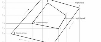
The most common registry error is the inaccurate determination of the coordinates of a plot of land; a cadastral engineer carries out a land surveying procedure, within which the boundaries of a land plot may be determined inaccurately or erroneously. As a result, the area of the land plot declared during surveying does not correspond to the actual one, or the boundaries of neighboring plots intersect, the boundaries of one overlap the boundaries of another, sometimes completely, there are also a lot of technical errors, typos, when employees of the authorized organization make mistakes when entering data into the electronic system and in fact, we get a discrepancy between the actual and electronic coordinates of a particular area.
Analysis of judicial practice in this category of disputes revealed the following problems:
- the need to specify evidence of the presence of a registry error;
- the need to clarify the method of protection in the presence of a registry error.
Before the court in cases of eliminating registry errors, it is necessary to establish the fact of the presence of a cadastral error in the registry and determine the method for correcting it.
In case No. 305-ES 18-20155
SNTSN "LETO" (hereinafter referred to as the plaintiff) filed a claim with the Arbitration Court of the Moscow Region against TU Rosimushchestvo in the Moscow Region and Rosleskhoz with claims to correct a cadastral (registry) error in describing the location of the boundaries of the land plot. The arbitration court believes that the case materials do not contain evidence of a cadastral error when registering a forest plot for cadastral registration. In this connection, the requirement to correct a cadastral (registry) error cannot be satisfied, including taking into account the circle of persons to whom these requirements are stated
In the Determination of November 12, 2021 N 305-ES 18-20155, the Supreme Court shared the opinion of the Arbitration Court, guided by Articles 4, 12 of the Civil Code of the Russian Federation, paragraph 2 of Part 1, parts 4, 5 of Article 28 of the Federal Law of July 24, 2007 No. 221- Federal Law “On the State Real Estate Cadastre”, Article 61 of the Federal Law of July 13, 2015 No. 218-FZ “On State Registration of Real Estate”, refused to satisfy the request to correct the cadastral (registry) error.
This is far from the only example of the lack of adequate evidence from the judicial authorities. Defines a registry error, timing and ways to correct it N 221-FZ “On the State Real Estate Cadastre”.
According to Art. 28 of the Federal Law of July 24, 2007 N 221-FZ “On the State Real Estate Cadastre”, a cadastral error in the state real estate cadastre is an error reproduced in the state real estate cadastre in the document on the basis of which information was entered into the state real estate cadastre.
Unfortunately, apart from classification into two types of errors, the Federal Law does not indicate how its presence can be proven.
Also, an entire Chapter 7 218-FZ (as amended on December 25, 2018) of the Law “On State Registration of Real Estate” is devoted to the registry (cadastral) error, which came into force with all amendments on January 2, 2019, defines a registry (cadastral) error as a distortion of factual information in the information about the property, reproduced in the register, describes the procedure for correcting errors, the timing of correction, but does not provide any indication of evidence of the presence of a cadastral error.
However, established judicial practice contains information about the evidence taken into account by the courts.
On December 26, 2021 N 308-ES 18-21839, the judge of the Supreme Court of the Russian Federation issues a ruling to refuse to transfer the cassation appeal of the Rosreestr Office for the Krasnodar Territory for consideration at a court hearing of the Judicial Collegium of the Supreme Court of the Russian Federation.
The courts of the first and appellate instances, having examined and assessed, according to the rules of Article 71 of the Arbitration Procedure Code of the Russian Federation, the evidence presented in the case materials, guided by Articles 12, 304 of the Civil Code of the Russian Federation, Articles 3, 22, 61 of the Federal Law of July 13, 2015 N 218-FZ “On State registration of real estate”, came to the conclusion that it was necessary to satisfy the stated requirement in order to restore the rights and legitimate interests of the applicant based on the following: the Company proved the presence of an error in the information of the Unified State Register of Real Estate regarding the configuration, location of boundaries and area of the land plot with cadastral number 23:47:0118018:348 owned by the applicant; establishing the location of the boundaries of the specified plot in accordance with the characteristics defined in the boundary plan prepared by the cadastral engineer does not affect the rights of adjacent land users.
Those. The evidence in this case was the boundary plan with the conclusion of the cadastral engineer.
The second important issue is the need to choose the right method of protection in the presence of a registry error.
Methods for protecting civil rights are listed in Art. 12 of the Civil Code of the Russian Federation, paragraph 14 mentions “other methods provided for by law,” one of such methods of defense is a claim to correct a cadastral error.
However, the current practice is contradictory, citizens do not always correctly interpret the concept of “cadastral error” and the courts often refuse, citing the choice of the wrong method of protecting the violated right.
There are often incorrectly formulated requirements for correcting cadastral errors and they often confuse the correction of cadastral errors and the establishment of boundaries of land plots, as an example, consider
Resolution of the Arbitration Court of the Moscow District dated 09/07/2018 N F 05-14340/2018 in case N A 41-84601/2017 Requirement: To correct a registry error in the location of the boundaries of a land plot, to exclude from the Unified State Register of Information about the coordinates of turning points of the boundaries of the plot.
LLC "Metinterpromstroy" filed a claim against the Federal Treasury Institution "Federal Administration of Highways "Central Russia" of the Federal Road Agency, the courts of the 1st and appellate instances refused. The Supreme Court agreed with them and also rejected the plaintiff’s appeal, citing:
Correction of a registry error is carried out if such correction does not entail the termination, emergence, or transfer of the registered right to the property.
The courts came to the rightful conclusion that since the Unified State Register of Real Estate contains no information about the boundaries of the land plot owned by the defendant, therefore, there is also no registration error.
Under such circumstances, based on the subject and grounds of the plaintiff’s claims, the cassation court agrees with the conclusion of the first and appellate courts that the plaintiff chose an improper method of protecting the right, which is an independent basis for refusing to satisfy the demands.
A claim to correct a registry error is necessarily different from a claim to establish boundaries. These are different methods of protecting rights that are used in different situations. An incorrect choice between them may be grounds for refusal of a claim only on the grounds of choosing an inappropriate method of defense. The similarity between both claims is that as a result of their satisfaction by the court, the boundaries of the land plot are corrected. The difference between them is that if a claim to correct a cadastral error corrects boundaries only in the State Property Committee, that is, corrects only virtual, paper boundaries in cadastral registration, then a claim to establish boundaries corrects the real boundaries of a land plot on the ground (moving a boundary line, a fence between sites, etc.). Judicial practice proceeds from the fact that a cadastral error does not imply the resolution of any controversial issue affecting the rights of a person in relation to a property, but is intended only to eliminate the discrepancy in the information on the basis of which the information was entered into the State Property Committee. A dispute over the boundaries of land plots cannot be resolved by filing demands to correct a cadastral error
To summarize, we can unequivocally state that the issues of specifying the norms of land law are debatable.
Judicial practice on disputes regarding the correction of registry errors is not uniform, but increasingly the Supreme Court leaves decisions of lower authorities in force, without changes.
Arbitrage practice
If agreement has not been reached with the neighbors on all fundamental points, or if the cadastral authority refuses to correct your mistakes for one reason or another, then you will have to solve the problem using judicial practice.
The defendants in this case may be neighbors, Rosreestr employees and other interested individuals.
The statement of claim must indicate :
- Information about the plaintiff;
- Information about the defendants;
- Information about the error due to which the litigation occurs;
- How and under what circumstances the non-conformity was identified;
- Actions taken to try to resolve the problem out of court;
- The desired result you are trying to achieve in court (for example, new boundaries, indicating preferred coordinates);
- The name of the judicial institution to which the claim is being filed.
List of required documents:
- All available initial documents related to cadastral work and registration in the Unified State Register of Real Estate;
- An extract from Rosreestr containing the alleged error;
- If the Unified State Register of Real Estate agrees with your claims, then there must be a special notification from them describing the discrepancy;
- Written objections from neighbors when trying to settle a dispute out of court.
If the court renders a verdict in your favor and obliges the relevant services to correct all inaccuracies, then the following events should follow:
- The applicant or the bailiffs present the judicial act to the defendant in the claim and to the employees of Rosreestr;
- The cadastral authorities dispatch an engineer to carry out land surveying work and eliminate errors;
- The updated data is entered into the electronic database of the Unified State Register of Real Estate within 5 days;
- All parties to the legal dispute must be notified of the changes made;
- Rosreestr employees notify the court of the execution of the court order and the elimination of all inaccuracies.