published: 11/24/2017
There are often cases when the boundaries of a land plot are not established. In some cases, we are talking about previously registered land plots, sometimes unregistered in the state real estate cadastre. The legislation of the Russian Federation distinguishes several categories of land plots; this article will consider two of them: unregistered and previously recorded.
Unregistered land plots include those that are not registered with the state cadastral register in the manner prescribed by law. Such land plots do not have a cadastral (conditional) number and are not registered in the state real estate cadastre; accordingly, the state real estate cadastre does not contain any information about them.
The situation when a land plot is not registered with the state cadastral register could arise as a result of changes in legislation, including in connection with the adoption of the Land Code of the Russian Federation, Federal Law of July 24, 2007 N 221-FZ “On the State Real Estate Cadastre”, Federal Law of July 21, 1997 N 122-FZ “On state registration of rights to real estate and transactions with it.” In particular, these may be biased reasons - information about the state registration of a given land plot has been lost, or objective reasons - the land plot has never been the object of land relations either before or after the adoption of the Federal Law of July 24, 2007 N 221-FZ “On the State Real Estate Cadastre” "
Is it necessary to register a plot of land with the cadastral register?
By virtue of the direct instructions contained in paragraph 1 of Article 37 of the Land Code of the Russian Federation, only land plots that have undergone state cadastral registration can be the object of purchase and sale.
State cadastral registration of land plots in accordance with the provisions of Art. 70 of the Land Code of the Russian Federation is carried out in the manner established by Federal Law dated July 24, 2007 N 221-FZ “On the State Real Estate Cadastre”.
In accordance with Part 1 of Art. 23 of Law N 221-FZ, registration of a real estate property, recording of changes to a real estate property, recording of a part of a real estate property, recording of the address of the copyright holder or deregistration of a real estate property are carried out if the cadastral registration body makes a corresponding decision on the implementation of cadastral registration.
Thus, state cadastral registration of a land plot is mandatory in order for the plot to become an independent object of land relations. Without compliance with this condition, the circulation of such a land plot is not provided, legal confirmation of rights and securing information about it is difficult. The legal protection of rights to such a land plot also seems questionable.
Accordingly, in this case, it will not have legal significance whether the boundaries are established for such a land plot or not, since without registration with the state cadastral register, the turnover of the land plot is impossible.
Simplified procedure for registering plots for SNT
Under the dacha amnesty, it is possible to register the right to land plots in the SNT in a simplified manner.
The dacha amnesty is suitable for those land users who:
- are members of a partnership, but do not have a document;
- There is a legal document, but it does not indicate the type of right.
Federal Law No. 404-FZ of December 8, 2021 extended the dacha amnesty until March 1, 2026.
Under the dacha amnesty, without establishing boundaries, a gardener can put a plot of land on the cadastral register and register the right to it.
Privatization under the dacha amnesty will take place free of charge if the plot used by the gardener is formed from the general plot of SNT, provided to the gardening partnership before October 30, 2001.
Link to document:
Unregistered land plot. Arbitrage practice.
As an example, we can cite the Determination of the Moscow City Court dated March 15, 2016 N 4g-2095/2016, in which the court established that the land plot was provided to the plaintiff by the state farm for temporary use, the plaintiff did not apply to the executive committee with an application to provide ownership of the plot, therefore , as of 1998, the plaintiff lost the right to use the site due to the expiration of the temporary use period and the lack of documents confirming its extension.
At the same time, the Moscow City Court indicated that the land plot was provided to the plaintiff by order of the state farm for a vegetable garden; The plaintiff did not present any other title documents for the site. The entry in the household register indicates that the plaintiff owned the land plot for 10 years after its provision in 1988. The right to the plot was not registered in the district land committee, a certificate of ownership of the specified plot was not issued, and the land plot was not included in the State Property Committee. Thus, there are no grounds for satisfying the claim to establish the boundaries of the land plot, recognize the ownership of it and correct the cadastral error.
A similar conclusion is made in the Appeal Ruling of the Moscow City Court dated November 16, 2015 in case No. 33-41571/2015, in which the court indicated that if the land plots are not formed with boundaries established and are not registered in the cadastral register in accordance with the Federal Law of July 24. 2007 N 221-FZ “On the State Real Estate Cadastre”, they do not have all the characteristics of an individualized thing and cannot be the subject of civil law relations.
At the same time, the position expressed in the Ruling of the Supreme Court of the Russian Federation dated December 6, 2005 N 4-B05-42 seems interesting. In particular, the Supreme Court of the Russian Federation recognized as unfounded the conclusion that, in accordance with Art. 130 Civil Code of the Russian Federation and Art. 1 of the Federal Law of July 21, 1997 N 122-FZ “On state registration of rights to real estate and transactions with it”, a land plot does not relate to real estate, the rights to which are subject to state registration, and, as a result, cannot be considered an object of real estate and the subject of any transaction, if its boundaries are not described and certified in the prescribed manner, since such a conclusion contradicts the content of Art. 130 Civil Code of the Russian Federation and Art. 1 of the said Federal Law. There is no provision in these articles that a land plot cannot be considered a real estate property if its boundaries are not described and certified in the prescribed manner.
Indeed, at the same time, it should be taken into account that with the introduction of changes to the legislation, for the purposes of state cadastral registration, information on the registration of land plots that arose before the entry into force of the Federal Law of July 24, 2007 N 221-FZ “On the State Cadastre” is valid real estate”, as well as at the time of transitional provisions. This conclusion was made based on the following.
In accordance with paragraph 1 of Article 45 of the Federal Law of July 24, 2007 N 221-FZ “On the State Real Estate Cadastre”, state cadastral registration carried out in the manner prescribed by law before the entry into force of this Federal Law or during the transition period of its application, taking into account those specified in the article 43 of this Federal Law are recognized as legally valid, and such objects are considered real estate objects recorded in accordance with this Federal Law.
You may be interested in real estate registration services.
According to paragraph 11 of Article 45 of the Federal Law of July 24, 2007 N 221-FZ “On the State Real Estate Cadastre”, the absence in the state real estate cadastre of cadastral information about a previously registered land plot provided for personal subsidiary plots, dacha farming, vegetable gardening, horticulture, individual garage or individual housing construction to the extent required in accordance with Part 4 of Article 14 of this Federal Law is not a basis for refusing to issue a cadastral passport for such a property.
Registration of a land plot with the Federal Registration Service
The issuance of a certificate of ownership has been discontinued since 2016. It has been replaced by an extract from the Unified State Register of Rights. Registration of a land plot in the cadastral register also implies mandatory registration of property rights. To do this, you need to contact the employees of the Federal Registration Service (Office of the Federal Registration Service) with documents. After reviewing them, receive an extract certifying ownership.
For a positive answer, you must write an application and attach the following documents:
- justification of ownership;
- cadastral passport;
- identification;
- duty payment receipt;
- land survey plan.
Cadastral registration of previously registered land plots.
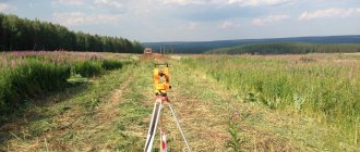
Another category of land plots - previously registered - includes those land plots that were subject to cadastral registration, but the boundaries of such land plots on the ground were not established or were established in a way that does not allow their location to be determined with sufficient accuracy.
In particular, these may be the cases:
- lack of information in the state real estate cadastre about the coordinates of characteristic points of the land plot boundary;
- when the coordinates of characteristic points of the border of a land plot contained in the state real estate cadastre are determined with an accuracy lower than the standard accuracy of determining coordinates for lands of a certain purpose;
- when the coordinates of any characteristic point of the border of a land plot contained in the state real estate cadastre do not allow one to unambiguously determine its position on the ground (the state real estate cadastre contains several values for the coordinates of the specified characteristic point).
For example, the location of each such land plot may be a specific cadastral quarter or a settlement consisting of several cadastral quarters.
At the same time, the lack of information about the boundaries of such a plot does not allow certain types of cadastral activities to be carried out in relation to it. Therefore, such land plots have limited properties and cannot be used on an equal basis with those land plots for which the boundaries are defined.
At the same time, one should take into account the position set forth in the resolution of the Presidium of the Supreme Arbitration Court of the Russian Federation dated June 24, 2014 N 4890/14 in case N A67-1041/2013, according to which the courts’ conclusion that the division of a previously registered land plot is incorrect put on the cadastral register without establishing boundaries, are hampered in their entirety by the requirements of paragraph 6 of Article 11.4 of the Land Code of the Russian Federation, part 3 of Article 25 of the Law on the Real Estate Cadastre.
How to apply for registration of a site
Only Rosreestr and its territorial bodies can carry out state cadastral registration of plots and register rights to them. The corresponding application, together with the attached set of documents (land plot plan, document confirming the identity of the applicant, etc.) can be submitted to the relevant authority in several ways: - through an application to the MFC. The application can be submitted to any territorial MFC at the location of the object, or to an extraterritorial MFC if the object is located in another region; — to the territorial office of Rosreestr in person or by post; — through the State Services portal or the Rosreestr website. In this case, an electronic digital signature is required.
Lack of boundaries of a land plot: documentation.
If there is no information about the boundaries of the land plot, a corresponding note is made in the state real estate cadastre. In particular, according to clause 13 of Appendix 3 to the order of the Ministry of Economic Development of the Russian Federation dated August 25, 2014 N 504 “On approval of forms of cadastral passports of a building, structure, unfinished construction site, premises, land plot, cadastral extracts of a land plot, a building, structure, an object of unfinished construction and a cadastral plan of the territory" (registered with the Ministry of Justice of Russia on November 12, 2014 N 34670) in the absence of information about the coordinates of the characteristic points of the boundaries of the land plot, also if the coordinates of the characteristic points of the boundaries of the land plots contained in the State Tax Code are determined with accuracy Below the standard accuracy of determining coordinates for lands of a certain purpose, in column 15 of the cadastral passport the words are indicated: “The boundary of the land plot is not established in accordance with the requirements of land legislation.” If the boundaries of a land plot cross the boundaries of adjacent land plots, the words: “The boundary of the land plot crosses the boundaries of land plots (land plot) with cadastral numbers (cadastral number) _____________” are indicated.
You may be interested in the service: Representation in court in civil cases.
What information about the site is entered into the Unified State Register of Real Estate?
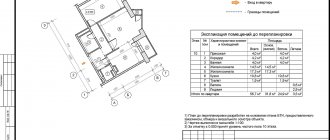
Information about land plots that are entered into the Unified State Register of Real Estate through state cadastral registration is divided into two types: basic and additional. The main ones: its cadastral number, area, description of location and boundaries, information about the previously assigned state registration number (if any), cadastral numbers of the original plots, cadastral numbers of buildings/structures within the boundaries of this plot, number of the cadastral quarter in which the plot is located and etc. Additional: cadastral value, category of land, type of permitted use, address, information about forests, water bodies, etc. within the boundaries of the site, restrictions, encumbrances, etc.
Judicial protection of the rights of owners of land plots without a cadastral number.
At the same time, the absence of information about the boundaries of land plots in the state real estate cadastre does not prevent the owners of such plots from filing adverse claims in defense of their rights. This position was formed due to the Determination of the Supreme Court of the Russian Federation dated October 20, 2015 N 14-KG15-7 (Judicial Collegium for Civil Cases), in which the Supreme Court of the Russian Federation indicated that, based on Part 9 of Art. 38, part 1 art. 45 of the Federal Law of July 24, 2007 N 221-FZ, land plots, cadastral registration of which was carried out before the entry into force of the said Federal Law, and land plots in respect of which cadastral registration was not carried out, but the ownership right was registered, are considered taken into account, and their boundaries - determined in accordance with the requirements of the legislation in force at the time of the formation of these sites.
The fact that the boundaries of land plots are not established in accordance with current legislation does not prevent owners from protecting their rights by filing a claim to remove obstacles to the use of land plots.
Registration of land ownership
Guarantee of protection of the owner's rights - clear boundaries of the area, assigned an individual number. The procedure for registering land ownership has nuances. It depends on the time of registration of the site and the dacha amnesty. Each case requires its own set of documents. You should pay close attention to this, as missing papers may be the reason for refusal.
According to the dacha amnesty
According to Law No. 93-FZ of June 30, 2006, since September 2006 cadastral registration has been carried out according to a simplified scheme. The dacha amnesty involves the registration of land acquired before 2001.
To carry out the procedure you need:
- Prove the legality of land ownership or take an extract from Rosreestr about the absence of a cadastral number. The site must not be leased or owned. It is important to exclude neighbors’ territorial claims to this area.
- Carry out land surveying, set clear boundaries of the plot, get a plan. If the land was taken into account earlier, its boundaries need not be determined.
- Contact the registration authority with the collected documents to add the plot to the register.
- Submit an application to the Federal Registration Service to update the information in the Unified State Register of Real Estate.
- After the procedure, receive an extract on the right to the object.
Previously registered in the Unified State Register of Real Estate
This category includes plots that were registered before 03/01/08, as well as lands where ownership is registered, but the information is partially entered into the cadastre.
In order for the Unified State Register to record information about such an allotment, it is necessary:
- Submit an application to the State Property Committee to enter new information, attach a package of papers related to the owner and the object.
- If necessary, clarify the boundaries of the site and carry out land surveying.
- Update information in the Unified State Register of Real Estate after registering the land.
- Obtain an extract from the State Register confirming ownership
The new bill will solve the problem of the lack of description of the boundaries of the land plot
Currently, a large number of land plots on the territory of the Russian Federation, information about which is contained in the state real estate cadastre, do not have an accurate description of the boundaries. Often these are boundaries that are described verbally, schematically, without coordinates or with coordinates in a non-existent coordinate system or with low accuracy. As a rule, the reason for this situation is the fact that previously the legislation did not provide for mandatory and uniform description of the boundaries of such land plots.
The lack of a description of the boundaries of a land plot significantly complicates the civil circulation of real estate. Since the ability to fully dispose of plots without precise boundaries is difficult and not always possible, copyright holders ensure that the boundaries are clarified at their own expense as necessary (for example, during alienation, pledge).
The above approach will not be used for long, since from 2018 transactions with land plots without established boundaries will become impossible. This conclusion follows from an analysis of the provisions of the Draft Federal Law “On determining the exact boundaries of land plots and the location of buildings, structures, unfinished construction projects and on introducing amendments to certain legislative acts of the Russian Federation.”
At the same time, Article 25 of the bill proposes to prohibit, from January 1, 2021, any disposal (coordination of disposal) of land plots for which the state real estate cadastre does not contain information about the location of boundaries established in accordance with the legislation of the Russian Federation.
This bill is aimed at implementing the Order of the Government of the Russian Federation dated December 1, 2012 N 2236-r “On approval of the action plan (“road map”) “Improving the quality of public services in the field of state cadastral registration of real estate and state registration of rights to real estate and transactions with it " Thus, paragraph 21.4 of the said order provides for the exclusion from January 1, 2021 from the legislation of provisions allowing the entry of information into the Unified State Register of Rights to Real Estate and Transactions with It in the absence of information on the coordinates of characteristic points of the boundaries of land plots in the state real estate cadastre.
This legislative initiative is certainly relevant, however, the method of its implementation does not seem to be very successful. This is due, firstly, to the short transition period for registering land plots, low awareness of land owners about upcoming changes, and secondly, to the lack of necessary conditions and resources for the implementation of state cadastral registration measures.
You may be interested in: Registration of premises for cadastral registration.
The legislative framework
Additions and changes are constantly being made to legislation, and if you do not keep track of them, you may encounter some difficulties when registering a site. If you plan to engage in this process yourself, you should first familiarize yourself with the innovations.
Thus, from January 1, 2021, a ban was established on the disposal of territories whose boundaries are not displayed in the cadastral database. That is, land surveying is a mandatory procedure. Lands not registered in the Unified State Register of Real Estate may be transferred to the full disposal of the local administration.
There is another change in the legislation - when calculating land tax, the cadastral valuation will be taken into account. Now government agencies will determine the value of real estate. Government institutions have a direct interest in replenishing the local and regional budget.
The plots are registered in accordance with all legal norms, making it easier to defend with neighbors in case of disputes. Having all the legal and legal evidence in hand, you can protect yourself and your interests in court.
Judicial practice on the status of land plots without borders
Judicial practice related to the state registration of land plots, the boundaries of which are not defined or are not defined specifically enough, is multifaceted. For example, in the Resolution of the Arbitration Court of the Moscow District dated July 20, 2016 N F05-9957/2016 in case N A40-189908/15, the court rejected the arguments of the Rosreestr Office for Moscow that there is no information about the coordinates of the characteristic points of the boundaries of the disputed land plot, since from section sq. 5 and apt. 6 “Description of turning points of the boundaries of a land plot”, indicated in the cadastral plan of 2005 and the cadastral extract of 2015, the state real estate cadastre contains information about the coordinates of characteristic points of the boundaries of a land plot with cadastral number 77:04:0001017:106.
Thus, the court rightfully recognized as legitimate the description of boundaries that existed before the introduction of Federal Law No. 221-FZ of July 24, 2007 “On the State Real Estate Cadastre.” Argument of the Office of Rosreestr in Moscow about the possibility of refusal of state registration by virtue of clause 1 of Art. 20 of Federal Law No. 122-FZ of July 21, 1997 “On state registration of rights to real estate and transactions with it” was rejected by the court. At the same time, by virtue of this article, state registration may be refused in the absence of information about the coordinates of the characteristic points of the boundaries of such a land plot, as well as in cases where one of the boundaries of such a land plot intersects one of the boundaries of another land plot in accordance with those included in state real estate cadastre with information about the latter.
You may be interested in: Representation in arbitration court.
Is it possible to register a plot of land without land surveying?
Until 2021, it was possible to register land if the territory was surrounded by a fence. Now land surveying is a mandatory procedure. To register a plot of land with the cadastral authority, you must provide the registrar with a boundary plan.
The land user must remember that if he carries out all these measures in a timely manner, no further disputes will arise with neighbors of adjacent territories. It will also be possible to minimize the risk of claims to part of the site from third parties.
Why can they suspend or refuse the procedure for registering a land plot?
When applying for cadastral registration services, you may be faced with decisions of the registration authority to suspend or refuse.
Clause 1 of Art. 26 of Federal Law No. 218-FZ of July 13, 2015 establishes an exhaustive list of grounds on which suspension of the provision of public services is possible. Among them, the most common are:
- application from a person who does not have the authority to perform accounting;
- lack of a complete set of documents;
- the materials submitted for registration have inaccurate or controversial data;
- the applicant does not have rights to the property.
If the registration authority identifies one of the grounds for suspension, an appropriate decision is made and communicated to the applicant. The maximum period for eliminating deficiencies is three months.
The reason for refusal can only be failure to comply with requirements, which was the basis for suspension of cadastral registration. This exceptional position is enshrined in Art. 27 of the Federal Law of July 13, 2015 No. 218-FZ.
What is land overlay and how to fix it
Despite modern technical measurement devices used in cadastral registration, in practice situations arise in which land plots overlap or inaccurate data is entered into the Unified State Register. Object overlap represents the mismatch and intersection of the boundaries of registered objects.
If the boundaries of your plot are incorrect and as a result it overlaps with another, contact a cadastral engineer and carry out work to clarify the boundaries. He will draw up a boundary plan, in which he will indicate that it has been prepared in connection with the correction of the error. After this, you should contact Rosreestr with an application for cadastral registration in connection with a change in the description of the boundaries of the object. The application is accompanied by a boundary plan, drawn up with amendments. The error will be corrected by clarifying the boundaries of the property. Based on the results of consideration of the application, Rosreestr will make a decision on making changes.
If the boundaries of a neighboring plot are incorrect and its owner does not agree to a voluntary change in the contour, the dispute will have to be resolved in court. The court decision is the basis on which the cadastral error will be corrected; Judicial practice does not establish the facts of violation of the rights of the plaintiff as a basis for the imposition of land plots. This position is established by the Ruling of the Supreme Court of the Russian Federation dated December 16, 2014 No. 18-KG14-159 - the mere fact of overlapping the boundaries of the defendant’s land plot with the boundaries of the plaintiff’s land plot does not prove a violation of the latter’s rights.