A register error is an error made by a cadastral engineer in a technical plan, a boundary plan, a survey report, or an error in the documents provided to the Unified State Register of Real Estate and on the basis of which the registration was made.
Get an estimate of the cost of this service using our price calculator - here
A technical error is an error made when entering data into the Unified State Register by Rosreestr or the Cadastral Chamber.
The procedure for correcting errors can be carried out not only at the request of the copyright holder, but also on Rosreestr’s own initiative. It is much more difficult to correct registry (cadastral) errors that may affect the rights of owners. To eliminate such inconsistencies in the Unified State Register, it may be necessary to go to court and carry out additional and repeated cadastral work.
Read the article where the concept of cadastral and technical errors is defined, how they can be identified and corrected, and what documents may be required for correction.
Dear Clients!
The information in this article contains general information, but each case is unique. You can get a free consultation from our engineers using one of our telephone numbers - call:
8 Moscow (our address)
8 St. Petersburg (our address)
All consultations are free.
What are technical and cadastral errors?
One of the main principles of maintaining the Unified State Register is to indicate in the register accurate, complete and reliable information about real estate, the rights of citizens and legal entities. persons, encumbrances and transactions. To implement this principle, the state transferred the authority to prepare documents for registering the Unified State Register of Real Estate to professional specialists - cadastral engineers. They prepare documents for real estate objects and changes in their characteristics. Data from this documentation is transferred to the Unified State Register by Rosreestr employees.
The definition of technical and cadastral errors is contained in Art. 61 of Law No. 218-FZ (). Errors of a technical nature occur when transferring data to the Unified State Register and are expressed in the form of clerical errors, typos, and inaccuracies. Entering erroneous information results in non-compliance with the Unified State Register, but the rights of owners are rarely affected.
The concept of a registry error is also contained in Art. 61 of Law No. 218-FZ. It consists of transferring to the state register the original error made during cadastral work, reproduced in the boundary plan, technical plan, or act. Correction almost always requires additional or repeated work, clarification and approval of boundaries. If an error may harm the interests of other persons, its correction is permitted only through the courts.
Expert commentary. You can find two different definitions - “cadastral error” and “registry error”. In fact, these are two equivalent concepts, although the official term according to Law No. 218-FZ is precisely a registry error. The cadastre in Russia has not been maintained since 2013, but the definitions associated with it are still used in business and ordinary circulation. When completing and submitting documents, you must indicate the official name “registry error.”
Get an estimate of the cost of this service using our price calculator - here
The procedure for correcting technical and registry errors includes analysis of the Rosreestr notification and filling out an application from the owner.
What is a technical error?
A technical error appears in the process of interdepartmental interaction in the bodies of Rosreestr and the Cadastral Chamber with the direct participation of their employees. In other words, this is a mistake by representatives of the government agency authorized to maintain the State Real Estate Cadastre. These include typos, incorrect definitions of cadastral value, grammatical, arithmetic errors, etc. - in general, everything that is filled out by Rosreestr employees and entered into the State Property Committee, except for the coordinates of the site boundary points, for which the cadastral engineer is responsible. Although, if the boundary plan submitted by the cadastral engineer and the cadastre have different coordinates, this will most likely be recognized as a technical error.
Do not confuse a technical error with a cadastral error. There we are already talking about the incorrect location of the boundaries of the property. A cadastral error cannot be corrected without a cadastral engineer.
What are the consequences of EGRN errors in 2021?
Technical errors may not have any impact on the rights and interests of owners or other persons. However, Rosreestr is still obliged to notify them, even if it corrected inaccuracies on its own initiative. Technical errors can lead to the following difficulties:
- inability to register a transaction and transfer of rights to an object (for example, a technical error in the cadastral number of a land plot will not allow registering an agreement for its sale);
- problems with internal real estate accounting for enterprises;
- it is impossible to request information on the Unified State Register, since the application for an extract will contain obviously inappropriate data.
If a technical error leads to the termination, transfer, emergence or change of rights, it can be corrected through the court. This is necessary to protect the interests of citizens or organizations. An example of such an error could be registering an object to a person who is obviously not the copyright holder. Also, due to a typo or arithmetic error, the area and size of objects may increase or decrease. This does not entail a change in rights, but also requires correction.
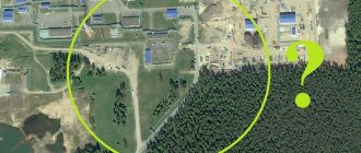
The procedure for correcting a registry error depends on its nature. Inconsistency may include overlapping or crossing boundaries, improper coordination of a building on a site, or an inaccurate description of the location of objects. In fact, such a discrepancy entails the need to correct the error of the cadastral engineer who drew up the boundary or technical plan. For the copyright holder, non-compliance with the Unified State Register also entails the impossibility of completing transactions and problems in confirming rights.
Types of technical and registry errors
Law No. 218-FZ and Orders of the Ministry of Economic Development of the Russian Federation provide several examples of registry errors:
- overlapping or crossing the boundaries of nearby areas;
- incorrect determination of the coordinates of a site or building;
- incorrect description of the location of the object;
- lack of coordinates for boundary points;
- incorrect configuration description.
The reason for such shortcomings may be negligence during cadastral work, inaccuracy or inconsistency of equipment errors, and other factors. We recommend that you always pay attention to the work experience of cadastral engineers. Only in this case the risk of identifying errors will be significantly reduced. ]Smart Way[/anchor] employs only reliable, proven and experienced engineers who have completed thousands of jobs.
We have already discussed above what the definition of a technical error includes. In this case, there are no complaints about the work of cadastral engineers, since technical errors arise through the fault of the registrars. This is explicitly stated in Art. 61 of Law No. 218-FZ. All types of technical errors will be eliminated without carrying out cadastral work, since technical and boundary plans contain correct information.
Expert commentary. An application to correct a technical error can be submitted at any time, i.e. immediately after its detection or later. We recommend that you immediately go through this procedure in order to bring the documents and information of the Unified State Register into compliance. Our specialists will help you fill out the application correctly, describe Rosreestr’s error, and obtain an extract with the appropriate data.
Flow diagram for correcting technical and registry errors of the Unified State Register of Real Estate.
How to fix a technical error
Let's look at how to correct a technical error in the Unified State Register of Real Estate. This can be done by Rosreestr employees who discover discrepancies during inspections, updating databases, accounting and registration of other objects. No later than 3 days after discovering deficiencies, the registrar must make a decision to eliminate them. In a similar way, a decision is made upon the application of the copyright holder, or after receiving a judicial act. Within 3 days after updating the USRN data and eliminating deficiencies, the registrar is obliged to send a notification to the owner.
The procedure for eliminating cadastral errors
Let's look at who should correct the cadastral error and how to do it correctly. An error in the cadastre and its correction are permitted by decision of the state registrar, unless this entails the transfer, emergence or cancellation of rights. Also, the registrar who discovers a discrepancy notifies the copyright holder, the cadastral engineer, about this. If the correct information is not received within the appointed time, the discrepancy will be eliminated independently or by going to court.
Application for correction of a registry error to Rosreestr
An application can be submitted not only by the copyright holder, but also by another person whose interests have been violated. For example, this could be the owner of a nearby plot, if the discrepancy with the Unified State Register lies in the overlap with the boundaries of his land. You need to write an application to Rosreestr about a cadastral error, taking into account the following nuances:
- if a cadastral engineer discovers an error, he will indicate this in the conclusion of a technical or boundary plan, immediately eliminate the discrepancy or indicate the reasons why this cannot be done;
- if the owner has identified deficiencies in the Unified State Register, he can order a technical plan or boundary plan with the correct data from an engineer;
- if the copyright holder has received a notice of the need to eliminate deficiencies, he also orders cadastral work through an engineer.
The procedure for adjusting data in the Unified State Register to correct registry errors is regulated by Order of the Ministry of Economic Development No. 173. The regulatory act allows for adjustments only if this does not cause damage to persons who referred to unreliable registry data. In all other cases it is necessary to go to court.
Documents to correct errors in the Unified State Register can be submitted through the online services of Rosreestr.
Correction of a cadastral error in court
Can Rosreestr independently correct errors in the cadastre and sue? Yes, such power is regulated in Art. 61 of Law No. 218-FZ. Registrars file a lawsuit if the copyright holder does not provide documents with the proper information within three months, or if there are reasons to believe that their independent correction will cause damage.
The statement of claim to eliminate the registry error is filled out according to the data of the Unified State Register of Real Estate, the boundary plan, and the technical plan. The engineer can also prepare a separate report for the court, where he will describe the work performed, provide justification and recommendations for correcting inconsistencies. Services to support these procedures can be ordered from ]Smart Way[/anchor].
Step-by-step instructions: how to correct a cadastral error in the location of the boundaries of a land plot?
If registration actions are suspended, a procedure should be started to correct the cadastral error in the boundary plan.
Don't know what a boundary plan is? In this article you will find the necessary information. And also in our other works you will learn:
- what types of boundary plans are there;
- how to get a boundary plan.
In cases requiring judicial intervention, a certificate from the court confirming the filing of a claim is brought to the cadastral chamber that suspended the registration.
In this case, the suspension may be extended up to 3 months.
Jurisdiction
An application for consideration of the problem that has arisen should be submitted to the district court of general jurisdiction at the location of the land plot . If necessary, the statement of claim may be submitted to the jurisdictional authority at the location of the cadastral chamber.
Grounds for filing a claim
A statement of claim may be accepted for consideration provided:
- refusal by the registration authority to carry out registration;
- refusal on his part to check credentials to identify an error;
- refusal to correct the error.
Filing a claim to correct a cadastral error in the boundary plan
The application is drawn up in the prescribed form, corresponding to the requirements of Article 125 of the Arbitration Procedure Code of the Russian Federation. In the upper right corner of the application the following is indicated:
- name of the court;
- Full name of the judge accepting the claim;
- information about the parties.
After the name of the document, indicated in the center of the sheet, the reason for the claim is indicated: “ Statement of claim for the requirement to correct a cadastral error .” Next comes the main text. Here are the facts of the case:
- Information about the land plot, its technical and cadastral characteristics, location.
- The circumstances under which the cadastral error was identified, what it consists of.
- What legal consequences or material damage (for example, failure of a property transaction) did it lead to?
- An attempt by the copyright holder to correct the violations through pre-trial settlement of the claim. Their result.
- A request expressed to the court for permission to correct the violated rights to establish reliable boundaries of the land plot.
- In conclusion, a date and signature are given and a list of attached documentation is given.
Required documents
The following are attached to the application:
- certificate of ownership;
- cadastral passport of the land plot;
- boundary plan;
- the act of agreeing on boundaries with neighbors;
- extract from Rosreestr on the characteristics of the storage device;
- refusal of Rosreestr to correct the error;
- receipt of payment of duty.
Sometimes you have to obtain a certificate about the location of the plot from the local Department of Land Management. For representatives acting in court on the side of the claimant, a notarized power of attorney is required.
Terms of consideration
No more than two calendar months from the date of filing the claim. May be extended if the court requests additional grounds to confirm the validity of the claim.
State fees
A receipt for payment of a fee in the amount of 300 rubles is attached to the statement of claim. If the court decision is positive, 350 rubles are paid to Rosreestr when registering the plot for cadastral registration or 2 thousand rubles when registering a property transaction.
Evidence base
Attached to the statement of claim, subject to documentation. Documents used here confirm:
- presence of false information;
- the legality of the request to correct the error.
For example, documents and certificates confirming the correctness of boundaries . It is acceptable to use an extract from the administrative archive or household ledger, which may reflect the required information. Evidence may include acts of new land surveying and evidence from:
- cadastral engineer;
- neighbors;
- previous copyright holders, etc.
The main points in confirming the legitimacy of the claim may be the opinions of experts on land management work.
Determination of the parties to the claim
The plaintiff in the procedure is an interested person whose civil rights were violated as a result of an error. The defendant is an authorized official who made an error or refused to correct it.
What documents are needed to correct a cadastral error?
An application to Rosreestr to correct a cadastral error is not the only document that the copyright holder must prepare. Documentation for correcting a registry error may include:
- technical plan (for buildings, premises);
- boundary plan for correcting registration errors for plots;
- act of approval of boundaries;
- statement of claim;
- judicial act.
Samples of a claim to correct a registry error and a number of other important forms and forms can be found in the table below.
How to fix it without going to court
So, let’s highlight the main aspects in solving problems related to cadastral errors, for which going to court is not required. As already written above, the main condition for correcting cadastral errors out of court is complete agreement with neighbors and cadastral services .
- An engineer should be invited to carry out cadastral work and draw up a new boundary plan.
- Notify local municipal authorities about the establishment of new boundaries of the land plot.
- Draw up an act agreeing on new boundaries with neighbors. It is compiled with the participation of a cadastral engineer and all interested parties.
Indicate in the act:
- Address of the land plot;
- Information about the owner of the plot and his neighbors;
- Data on neighbors' memory;
- Confirmation of neighbors' consent to the new boundaries of land plots;
- Date and signatures of all parties to the agreement.
List of useful documents
Documents for download:
| No. | Document | Link |
| 1 | Completed sample application for suspension | |
| 2 | Application for amendments to the Unified State Register of Real Estate | |
| 3 | Applications for state registration | |
| 4 | Application for additional documents | |
| 5 | Application for termination of state registration | |
| 6 | Sample application to Rosreestr to eliminate an error | |
| 7 | Sample USRN extract | |
| 8 | Sample application for error correction |
Timing and cost
Through Rosreestr, correction of registry errors or technical deficiencies is carried out free of charge. Elimination occurs no later than three days after receiving the relevant documents and information and making a decision. Please note that notification of the need to correct an error in the cadastre must be executed within three months. If during this period the copyright holder has not provided the necessary data and documents, the registrar corrects everything himself (if the law allows) or goes to court.
Elimination of a registry error in court requires payment of a state fee. Citizens pay 300 rubles, and organizations 6,000 rubles. When filing a claim, Rosreestr does not charge a state fee. Services for carrying out cadastral work, preparing boundary and technical plans are paid for under an agreement with the engineer.
Time frame for fixing the error
Technical errors are corrected within 5 working days after the Rosreestr body receives a court decision or an application from the owner. The same time must be taken when making a decision to refuse to correct an error. If you do not agree with the refusal, go to court.
One day after the decision to eliminate or refuse is made, the applicant is sent one copy of the decision and an extract from the Unified State Register of Real Estate for the property via the email specified in the application or to the applicant’s postal address.
A technical error can become a headache for a property owner, as it can interfere with the disposal of the property. Carefully study cadastral documents to avoid problems in the future.
Prices for services
Our prices and services
If you ordered cadastral work from ]Smart Way[/anchor], the risk of errors being detected will be minimal. We are among the leaders in the cadastre, design and real estate markets, and we guarantee the quality of work. Our services for eliminating USRN errors include:
- request and preparation of documents to correct cadastral errors, including boundary and technical plans;
- support of administrative and judicial procedures;
- assistance in preparing and amending transaction agreements;
- other types of services that are required to apply to Rosreestr.
Preliminary information about our prices and services is presented in the table below. Exact prices can be clarified by calling the numbers listed on the website.
| No. | Service, document | Price |
| 1 | Support in Rosreestr when eliminating errors | from 7000 rub. |
| 2 | Support in court when eliminating errors | from 25,000 rub. |
| 3 | Preparation of technical plans to eliminate errors | from 8000 rub. |
| 4 | Making boundary plans to eliminate errors | from 12,000 rub. |
| 5 | Preparation of a cadastral engineer's report | from 15,000 rub. |
Procedure for preparing an amended invoice
A corrected invoice is a new invoice (not an addition - like an adjustment invoice) that is issued in place of the incorrect document.
The method of compilation - paper or electronic - does not matter in this case. Moreover, the corrected invoice is not assigned a new number and date, but the number and date of the original invoice are indicated (that is, the indicator of line 1 remains unchanged). At the same time, line 1a of the invoice is filled in, which reflects the serial number and date of correction. The remaining indicators of the new copy of the invoice, including new (initially not filled out) or updated (changed), are indicated in accordance with this document (paragraph 3, clause 7 of the Rules for filling out the invoice). And one last thing. The stated procedure also applies when making corrections to an adjustment invoice (if significant errors are identified in a previously drawn up document) (clause 6 of the Rules for filling out an adjustment invoice).
Let us summarize the preliminary results. Summarizing the above, we will show schematically the differences between adjustment and corrected invoices.