Home / Real estate / Land / Land survey / Boundaries of the land / Changing the boundaries of the land
Back
Published: March 26, 2017
Reading time: 12 min
0
1131
Disputes regarding rights to land plots and the boundaries established on them are quite common in current judicial practice.
Their occurrence may be due to various reasons: the lack of a land surveying procedure, boundary signs, or an actual violation of the property rights of one of the owners.
In any case, to establish the real boundaries of real estate, a special procedure will be required - restoration of the boundaries of the land plot , the features of which will be discussed further.
- Legislative regulation
- Essence and reasons for the procedure
- Rules and procedure for restoration Preparatory stage
- Field stage
- Office stage
How to restore the boundary plan of a land plot
Cadastral work
is the performance by a cadastral engineer of real estate in accordance with the requirements established by the Federal Law, of work that results in the preparation of documents (landmark plan, technical plan, survey report) containing information about such real estate necessary for cadastral registration.
Cadastral registration
- actions of the authorized body (Federal Service for State Registration, Cadastre and Cartography, formerly Rosnedvizhimost) to enter into the State Real Estate Cadastre (GKN) information about real estate that confirms its existence with characteristics that allow such property to be defined as an individually defined thing, or confirm the termination of the existence of such real estate, as well as other information about real estate provided by law.
Legislative regulation
Restoration of the boundaries of the land plot is carried out in accordance with the general rules and requirements established for cadastral and geodetic work.
In particular, general legislative regulation is carried out by the Land
Code of the Russian Federation and Federal Law “On Cadastral Activities”.
In addition, the provisions of all other regulations that affect this procedure are taken into account.
These may be government regulations, orders of individual ministries, federal and regional laws, state standards and regulations, etc.
The main responsibility for compliance lies with the contractor, who must be familiar with all legal requirements.
If a claim is drawn up and filed in court, the provisions of the Civil Procedure Code will apply. In particular, they will concern the rules and requirements for drawing up a claim, the features of its filing and the entry into force of a court decision.
What is a land plot plan and its differences from a boundary plan?
The boundary plan indicates only information about the boundaries , which are schematically highlighted on it with a red line. Used when information about the location of their passage is required. Used when marking construction and determining red indentation lines. The same applies when drawing up an act of coordination of boundaries with neighbors or resolving disputes.
Also, the conclusion of the cadastral engineer is a special point in the text part of the document . Here the work performed is summed up and the actions performed during the execution of the order are listed. For example, a method for preparing technical specifications is indicated, with nuances determined by the characteristics of the memory. Next, the form of conducting geodetic research and reconciliation of the information obtained, issued in the form of a cadastral extract, is determined. If the appropriate formulas were used in the calculations, they are also entered in the indicated paragraph.
Land surveying
According to the current Federal Law, a boundary plan is documentation that was drawn up on the basis of a cadastral plan for a specific plot of land or a cadastral extract about a certain territory. The cadastral extract contains all the necessary data for inclusion in the state real estate cadastre. This document also contains specific information about one/several plots of land being formed or about its part/parts, or new data about one/several plots of land.
A boundary plan will allow you to display the exact and documented boundaries of your property on the ground. A plot of land that does not have precise boundaries on the ground cannot be graphically displayed on a map. Therefore, if you do not have a boundary plan, then you will not be able to become the owner of a cadastral passport for a land plot . It is issued by the Rosreestr branch in Tula and the Tula region, in Kaluga and the Kazhu region. Cadastral passport , which is required when registering property rights, selling, buying, donating, inheriting and any other transactions, is an important document for the owner of the territory. If there is no land surveying, then any action of the owner with the land plot will be illegal.
We recommend reading: How are salaries paid to rural teachers?
Land survey plan
Any new information about the formed or updated land plots and their parts are displayed in the boundary plan - a document necessary for the implementation of state cadastral registration. In some situations, a properly drawn up land surveying plan will help solve a complex problem. For example, if the cadastral chamber refuses to issue a cadastral passport on the basis that the border of your land plot intersects with an adjacent plot, the boundary plan will become the basis for correcting this discrepancy.
The production of such a document requires compliance with certain regulatory requirements, qualifications and good knowledge of land law, so we recommend that you seek help from the specialists of the Guild of Engineers. We will prepare your documents quickly and efficiently!
Why is clarifying site boundaries so important?
In the absence of reliable information about the boundaries of the site, the owner may have serious problems when carrying out a number of procedures:
— execution of a purchase/sale agreement, such an agreement is invalid and will definitely be challenged in court, since the new owner will not be able to register ownership of such a plot
— a boundary plan for combining plots, dividing a plot and its redistribution are impossible without establishing precise boundaries
- without accurate data on the boundaries, the plot cannot be inherited or a deed of gift can be issued for it
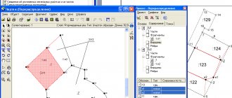
Boundary plan of the land plot
Land surveying, being one of the land management procedures, includes a certain set of works. They are carried out to restore or consolidate, as well as establish limits, determine the location and area of territories allocated to the ownership of citizens. Upon completion of this work, a boundary plan for the boundaries of the land plot is drawn up. This technical document is drawn up on the basis of the cadastral diagram or an extract from it about the corresponding plot. Let us next consider how a land plot plan is drawn up. An example document will also be given in the article.
This part reflects information about the specific territory allocated for possession. The data is located in cadastral documentation or an extract from the scheme. The graphic part depicts or clarifies/restores the boundaries of one or several sections. The same section should show access to the created plots. This could be an entrance, a passage from those areas that are considered common. Accesses must be shown even if they are established through an easement.
Cadastral registration of land plots
Land documentation Restoration of land documents is a very lengthy and labor-intensive process, for the successful resolution of which you should clearly understand the types of land documentation. Please attach a newspaper with your advertisement and a copy of all remaining or restored land documents to your application. including a copy of an identity document; if there is a power of attorney - a copy of the power of attorney and an identity card of the authorized person.
Restoring the boundaries of a land plot consists of three stages, the first of which is preparatory. During this stage, the terms and cost of the work are agreed upon, an order is placed and a contract is concluded. The customer also receives the necessary consultations.
So-called “pink” or “blue” certificates for land plots issued a long time ago are often lost or damaged.
It is possible to sell a plot of land without presenting a boundary plan to the buyer, subject to his consent. In this case, it is advisable to reduce the price of the plot, taking into account the fact that the buyer will restore this document at his own expense. However, buyers usually try to familiarize themselves with the documentation on the land plot as fully as possible before purchasing it.
How long is the boundary plan valid and how much does it cost to get it?
- when changing location;
- when the area changes (then the boundaries automatically change);
- if the land plot was divided into several smaller pieces of land;
- when the merger of the land plot in question with the neighboring one took place. As a result, they formed a new area, the boundaries of which changed, etc.
For individuals and organizations, prices are also different: for citizens, a boundary plan will cost several times less. In addition, all prices for this type of work are regulated at the state level, so geodetic companies strictly adhere to them and do not have the right to set prices above the maximum.
We recommend reading: Is It Possible to Sell an Apartment Less than 3 Years Owned?
How to survey a land plot in 2021?
Instructions 1 If your land plot is leased and you have lost the lease agreement, contact the land committee working in the local administration.
They must be agreed upon with the owners of neighboring plots. This procedure will make it possible to delimit individual plots prior to cadastral registration with the subsequent consolidation of ownership.
But in some cases, the authority does not have information about the plots. For example, this is possible if the document for the plot allocated in 1992 is lost. In this case, you will have to visit the local government authorities that are in charge of this territory. The institution has a special committee dealing with land issues. Data is stored in archives.
A specialist will look at the specifics of your situation and tell you what to do to ensure the optimal solution to the problem. If disputes arise, lawyers are ready to represent your interests in court in the Moscow region.
Restoring the boundaries of land plots, filing a claim
After preparing the boundary plan, you need to contact the land cadastral chamber to register the land plot you own for cadastral registration. The Cadastral Chamber, in turn, will suspend cadastral registration. And they will suspend it on the grounds that one of the boundaries of your land plot will intersect one of the boundaries of your neighbor’s land plot.
According to paragraph 9 of Article 38 of the law, when clarifying the boundaries of a land plot, their location is determined based on the information contained in the document confirming the right to the land plot, or in the absence of such a document, from the information contained in the documents that determined the location of the boundaries of the land plot when it was formed .
What to do after land surveying and what does the survey document look like?
Land surveying activities are regulated by legislative acts prescribed in the Land Code of the Russian Federation.
Before restoring documents on the ownership of a land plot, it is necessary to determine the type of lost paper.
After approximately 18 calendar days, you should be issued a cadastral passport with established boundaries for your land plot. In case of receipt 18 calendar days after submission of the boundary plan, a suspension in the implementation of cadastral registration (the probability of which exists, but is very small). Receive a document stating the reason for the suspension and contact us immediately.
Newly issued documents may have marks indicating that they are valid replacements for lost ones. There will be a new date of receipt and a note about the loss of the previous copy.
Procedure for drawing up a land plot plan
Cadastral engineers carry out restoration of the boundaries of a plot of land in the presence of boundary disputes and at the request of interested parties in the event of loss (complete or partial) of mandatory boundary signs and other signs of the territorial boundaries of the land plot owned by them.
Establishing and securing the boundaries of a plot of land on the ground is carried out by cadastral engineers when individuals and organizations receive new plots of land, as well as when dividing and merging existing plots and when making transactions with them.
How to get a land survey plan
- Collection and analysis of information about the property;
- Notifying owners, interested individuals and organizations whose rights and interests may be affected about the upcoming land survey;
- Coordination of territory boundaries and other controversial issues;
- Geodetic survey of a real estate property;
- Analysis of the cadastral result;
- Drawing up and execution of a boundary plan;
- Submission of documents to the cadastral registration institution;
- Obtaining a cadastral passport, plan and extract on the location of the object;
- Signing the boundary plan and affixing the seal of the responsible engineer.
- Certificate of ownership of the property, as well as other title documents;
- Extract from the unified state registration database of property rights;
- Applicant's passport;
- Technical documentation from the Bureau of Technical Inventory on the absence or presence of buildings;
- Cadastral plan or extract.
Boundary plan of the land plot: requirements, preparation, preparation
The boundary plan, the formation of a land plot is within the competence of which, must meet the requirements of several regulations at once: civil, forestry, water, land, urban planning, etc. For violation of the legislation of the Russian Federation when creating the plan, penalties may be imposed on its compilers.
The requirements for the boundary plan are quite serious; it must be drawn up in two versions: paper and electronic. It can be adjusted on the media at any time, which is very convenient. After compiling it, you will need to submit the document to the local cadastral registration authority.