Standards for building density coefficient according to SNIP
Currently, certain development indicators are used in different territories:
- when reconstructing houses, a value of 0.6 is used;
- regarding apartment buildings – 0.4;
- for houses equipped with adjacent plots – 0.3.
When a territory of public importance is being developed, other indicators are used:
- if the building has a universal value – 1;
- during the construction of specific buildings - 0.8;
- industrial buildings – 0.8;
- scientific buildings – 0.6.
When calculating the coefficient on industrial construction sites, there is no need to take into account test sites where experiments are carried out and other special areas. The indicators listed above take into account the level of necessary infrastructure, as well as the availability of facilities that are needed to provide social services
When reconstructing the old quarter, the following features must be taken into account:
- If the area is calculated by the number of citizens, then there are at least 20 square meters per person. Only living space is taken into account.
- When an area contains both apartment buildings and private houses, it should be assumed that the area consists only of apartment buildings.
- If less than 3 thousand people live in a territory, then the entire area is considered as one. This does not take into account the size of the area of the settlement.
What is the built-up area?
Design and construction
It happens that the building is located on supports. In this case, the building area includes all the space underneath, including passages. How to determine the number of storeys of a building? All floors are considered above-ground, including the attic, technical (in the case when the level of the top of its ceiling is located 2 or more meters above the planning level). The underground (of any height) and the interfloor space do not apply to above-ground floors if its height is less than 1,000 m. 8 m. There are cases when different parts of the building have different numbers of floors.
Sometimes a building may be located on a site that has a slope, then on one side the number of them may be large. In this case, the number of storeys is calculated separately for each of the parts. According to other rules, parameters are calculated for summer cottages and gardening partnerships.
General numbers and parameters
The building density is determined by the perimeters of objects and the lines between them. When renovating existing housing stock, very difficult conditions usually arise.
Calculation and strict compliance with the necessary standards and requirements are mandatory. But the legal aspect (primarily the norms of construction, architectural and other fundamental rules of development) always intersects with the “non-legal”, but essential aspect - the interests of residents. Moreover, the latter have a very specific material expression as homeowners and subjects of very specific rights to proper comfortable living.
The requirement of “non-visibility” must be ensured - a special custom in residential construction, meaning the impossibility of seeing the interior of another building from the windows of one building. However, in practice, especially with linear development of high-rise buildings of the same type, this requirement is forgotten.
Lines from the perimeter of industrial buildings to residential buildings and socially significant objects, as well as to the boundaries of preschool and general education organizations, health care, cultural and recreation centers are usually designed to be more than fifty meters.
Limit parameters of permitted construction according to PZZ, GPZU
In addition to the types of permitted use, PZZ (GPZU) fix the maximum parameters for the development of a land plot.
So, what are the maximum development parameters according to land use and development rules? There are only three parameters:
- Building density (how many square meters of ground area can be built on one hectare of land). For example, density 000 will mean that 25,000 sq.m. can be built on 1 hectare, and 2,500 sq.m. on a land plot of 10 acres.
- Building height (in meters), for example 20 meters
- Development percentage (as a percentage of the total land area). For example, if the building percentage is 20%, and the plot has an area of 000 sq.m., then the building can be placed on no more than 2000 sq.m. The remaining 8,000 sq.m. must be free from development.
A more precise definition can be found in the PZZs themselves (for example, PZZ g.
Moscow): Limit parameters of permitted construction, reconstruction of capital construction projects, which include: 1) development density of a land plot - the ratio of the total floor area of all capital construction projects that are located and (or) can be located on a land plot (in square meters) to area of the land plot (in hectares), where: - the total floor area of a capital construction project means the total area of all ground floors of a capital construction project (including the technical, attic, and also the ground floor, if the top of its floor is above the average planning level of the ground at least than 2 m), which also includes the area of mezzanines, galleries and viewing balconies and other halls, verandas, loggias and balconies; external glazed galleries, as well as transitions to other buildings, measured in the dimensions of the external walls according to the external measurement; - the area of multi-light premises, as well as the space between flights of stairs wider than the flight width of more than 1.5 m and openings in floors with an area of more than 36 sq.m should be included in the total floor area of the building within only one floor; 2) the maximum number of floors or the maximum height of buildings, structures, structures, where: - the calculation of the number of floors of buildings, structures, structures is carried out in accordance with the provisions of the relevant set of rules, depending on the type of capital construction project; - maximum height of buildings, structures, structures - the vertical linear dimension of a building, structure, structure from each existing land mark within the boundaries of the land plot in accordance with the Unified State Cartographic Basis of the City of Moscow to the highest elevation of the structural element of the building, structure, structure (flat roof parapet; cornice, ridge or pediment of a pitched roof; dome; spire; tower; the highest structural elements of a building should also be considered exits to the roof, superstructures for placing technical equipment, made in permanent structures; in relation to religious buildings - the cross apple in relation to Christian churches, bell towers and belfries, kullas - in relation to mosques, taking into account minarets, the upper elevation of the dome, spire and other vertical structural elements - in relation to synagogues and other religious buildings), while roof antennas, lightning rods and other engineering devices when determining the maximum height of a building, structure, structure are not taken into account; 3) the maximum percentage of development within the boundaries of a land plot - the ratio of the total area of a land plot that can be built up with capital construction projects (hereinafter referred to as the development area), to the entire area of the land plot, where the determination of the development area of buildings, structures, structures is carried out in accordance with the provisions the corresponding set of rules, depending on the type of capital construction project. To change the rules of land use and development, you can use the service of our company for
Building area and usable area - what are the differences?
These are two different concepts. The built-up area is the area occupied by a structure on a particular site, and the usable area is the living space inside that structure. It is worth adding that there is also a concept - total built-up area. This is a collection of areas located on the floors of a building. Floors are structures located above and below ground level, such as attics, terraces and the like. The building area is used by the government when investors want to construct a building without permission and with a construction notice. Projects of houses up to 35 m2 are just such buildings where the building law does not determine the development of such a building.
What is included in the living area of the house
If the structure contains niches less than 2 m high, then they do not need to be taken into account as part of the living space of the room. If the area of the space under the stairs is less than 1.5 m, then it is also not taken into account in the process of assessing the size of the building. Living space represents the total area of each residential and non-residential premises with rooms, kitchens, vestibules, corridors, hallways and built-in closets. Previously, in the process of calculating the total area, it was necessary to take into account street areas, terraces, verandas, loggias, balconies, but today this rule no longer applies.
Living area is the total size of living rooms, which are taken into account in the documentation as premises intended for permanent residence. These include the following premises:
- Bedroom.
- Living room.
- Kitchen.
- Children's room.
- Study.
- Wardrobe.
How to calculate the future development of a land plot?
Quarterly development of the area involves the location of buildings in strict accordance with the street landscape close to city roads. The construction of houses in microdistricts has a more favorable condition. All work is accompanied by a departure from previous standards due to the distribution of the load over the area of the land plot
But here it is important to comply with technical and economic indicators, one of which is the territory density formula
The formula is calculated in two directions:
- Gross method: The percentage coefficient is taken as the basis. It is calculated as the ratio of the size of the built-up area to the size of the entire microdistrict or street. The percentage received affects the scale of the construction complex.
- Net method: The calculations include the area of the plot being built up and the territory on which the apartment buildings are located. The residential area of a microdistrict is calculated based on the total size of the microdistrict minus the area occupied by the socio-cultural areas of the quarter.
The density calculation procedure is suitable for all types of blocks and neighborhoods. The universal formula allows you to determine the most accurate percentage of free and occupied territory. Based on the data obtained, the construction company will be able to plan the scale of its work without compromising urban planning regulations.
How to calculate the percentage of site development
Fireplaces and heating stoves, which were mentioned above, are indicated by decorative elements and are therefore not included in the calculations.
Regarding all open spaces (terrace, balcony, loggia), the space is measured between the walls of the planned building and the fences, that is, the internal contour is taken. When measuring the entire building, the building area is calculated equal to the dimensions of the horizontal section made by the height of the plinths and protruding external elements.
The number of floors of any building also has its own nuances and definition.
Maximum built-up area of a land plot
06 June 2015, 22:09 This is one of the most important parameters when developing the concept of a future warehouse, production or logistics complex.
When designing in the Moscow region, it is necessary to be guided by the following: - the development coefficient of a land plot is the maximum possible territory of a land plot that we can occupy with warehouse or industrial buildings being erected; When determining the maximum development area of a land plot for an industrial or warehouse complex, it is necessary to multiply the total area of the land plot by the development coefficient, thus we will obtain the total development areas of all buildings of the future complex. Development coefficients for land plots of industrial territories in the Moscow region (excerpt from regulatory documents) Types of objects Development coefficient for land plots, not more than (percentage) 1.
Warehouse facilities 60 2. Production facilities: Depending on the purpose of future production From 45 to 60 Thus, we draw the following conclusions: The maximum development area of the land plot of a warehouse complex is 60% of the total area of the territory, production varies from 45% to 60%, depending from destination.
This value must be taken at the earliest stages of design, when developing the stage of pre-design decisions and at the stage of preparing presentation materials for the town planning council.
The optimal development ratio when designing a master plan for a logistics complex is 50% to ensure maximum convenience for maneuvering areas for freight transport and permanent and temporary parking areas.
It is also necessary to provide space for engineering and auxiliary structures of the logistics complex, such as: checkpoints, pumping stations, hydraulic fracturing stations, fire tanks, administrative buildings, solid waste sites, sites for technological maneuvering of trucks, parking for passenger vehicles and storm drainage treatment.
B) In the case of discharge of treated stormwater onto the terrain, obtain
“Permit to discharge pollutants into the environment”
, which is issued by the Department of Natural Resources on the basis of the “Calculation of Permissible Discharge”.
Percentage of land plot development for individual housing construction
It is important to respect the legitimate rights and interests of neighbors.
It is prohibited to clutter their territory with your own buildings, as well as to install fences that will interfere with the development of agriculture in the neighboring territory by cluttering structures and creating shadows.
When determining the maximum development area of a land plot for an industrial or warehouse complex, it is necessary to multiply the total area of the land plot by the development coefficient, thus we will obtain the total development areas of all buildings of the future complex.
residential buildings or outbuildings.
Building area
An above-ground floor is considered to be a level with the top of the floors located above two meters. Underground and interfloor spaces below 1.8 meters are not considered above-ground floors.
If a building consists of several parts with different numbers of floors or is located on a sloping area, which necessitates the construction of several floors, all its parts are calculated separately.
Multi-storey apartment buildings also have their own characteristics.
The total area is determined here using reduction factors:
- for a loggia - 0.5.
- for terraces and balconies - 0.3;
Multi-level apartments, as a rule, are equipped with inter-apartment staircases. If the height of the flight is more than 1.6 meters, its footage must also be taken into account. The dimensions of a residential building are determined by summing up the data obtained from measurements on each floor.
What is the built-up area?
Design and construction
It happens that the building is located on supports. In this case, the building area includes the entire space underneath, including driveways.
How to determine the number of storeys of a building? All floors are considered above-ground, including the attic and technical (in the case when the level of the top of its ceiling is located 2 or more meters above the planning level).
The underground (of any height) and the interfloor space if its height is less than 1.8 m do not apply to above-ground floors. There are cases when different parts of the building have different numbers of floors.
Sometimes a building may be located on a site that has a slope, then on one side the number of them may be large. In this case, the number of storeys is calculated separately for each of the parts. According to other rules, parameters are calculated for summer cottages and gardening partnerships.
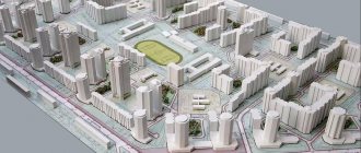
Calculation of building density of a land plot
Association of specialized lawyers Sign up for a consultation Describe the situation and receive a free analysis of the prospects for your case within 30 minutes Order Building density in populated areas plays a big role.
As a rule, density is calculated in thousand.
sq. m. per 1 hectare of land. The most optimal density indicator should be no less than 20% and no more than 55%.
However, in practice these values may be subject to gradation. So, for example, in some areas it can reach 80-90%. In this case, when deciding to build a new building, you can increase it by adding several floors.
But in other zones (most often the outskirts) the density indicator can be significantly lower than 20%.
In this case, some financial problems can be observed, since the maintenance and maintenance of transport and engineering infrastructure will be very expensive. And don’t forget about the road surface; the construction and repair of roads in areas with low building density is very rarely done, which affects the quality characteristics of the roads.
must be carried out by competent specialists to avoid problems. Our office will provide you not only with assistance in calculations, but also with qualified legal support.
Find out on our website: . Land law Land management Land ownership Land supervision Categories of land Call us: +7 (499) 322-28-05 Or on the website and we will contact you Make an appointment Place of work
Percentage of land plot development
Construction coefficient (development coefficient, Building Ratio) is a coefficient established by law that determines the total area of buildings on a land plot (in m2). Electricity at the border of the site.
The landscape is calm. Technical planning has been carried out over the entire area of the plots, the elevation difference is less than 0.5%. There is good year-round access to the border of the plot; roads are cleared of snow in the winter.
On both sides the plots are adjacent to the forest.
The Lutosnya River is 300 meters away. Transport accessibility: regular bus No. 50 from the railway station. “Lobnya”. The plots are located at a considerable distance from the highway, far from noisy cities, in a picturesque and environmentally friendly area of the Moscow region. A wonderful place for summer holidays and year-round living for the whole family.
Site development coefficient
The residential area of a microdistrict is calculated based on the total size of the microdistrict minus the area occupied by the socio-cultural areas of the quarter.
Attention: New objects affect the final indicator of the area occupied by residential buildings.
Therefore, it is important here to take as a basis the updated indicator of the mathematical formula, taking into account the total number of buildings located in the microdistrict.
The density calculation procedure is suitable for all types of blocks and neighborhoods.
The universal formula allows you to determine the most accurate percentage of free and occupied territory. Based on the data obtained, the construction company will be able to plan the scale of its work without compromising urban planning regulations. The formula shows the relationship between occupied and free area of the territory.
Source: https://rusdolgi.ru/procent-zastrojki-uchastka-kak-schitat-29860/
Calculation of building coefficient, building area, area and percentage of greenery
1. The area of the territory within the project development boundaries is 39.00 hectares. The territory within the project development boundaries includes two territorial zones: CO-1 and R-1. Calculation of the development coefficient, building area, for the CO-1 zone. The area of the block (in red lines) is 41193 m 2 1.
The total area occupied by buildings and structures Szastr n. - the area occupied by preserved (previously designed) buildings and structures located on the territory within the boundaries of the block Szastr project. - area occupied by the designed buildings and structures located on the territory within the boundaries of the block Szastr = 9878.40 +3375 = 13253.4m 2 2.
How to calculate the building area of a house. How to calculate the building area
Fireplaces and heating stoves, which were mentioned above, are indicated by decorative elements and are therefore not included in the calculations.
Regarding all open spaces (terrace, balcony, loggia), the space is measured between the walls of the planned building and the fences, that is, the internal contour is taken. When measuring the entire building, the building area is calculated equal to the dimensions of the horizontal section made by the height of the plinths and protruding external elements.
Read more: Payment of dividends in LLC to the sole founder
How is building density calculated?
The development of the area, which is carried out quarterly, is small in size and located next to highways and streets. All necessary facilities and service enterprises in this case are located in remote areas. To get to them, you need to cross highways.
The current development is focused on building microdistricts at once, the size of which exceeds the area of neighborhoods and has more advantages. Outdated areas with block-by-block development are subject to regular improvement. To determine how convenient the location of all necessary institutions and the ideal development are, technical and economic indicators are used.
These indicators also include building density, which is calculated by various formulas - gross and net.
- Calculation of building density using the gross method:
- It is presented as a ratio of the entire area of the territory that is intended for development to the area of the required block or microdistrict.
- Expressed as a percentage.
- Calculation of building density using the net method:
- It is represented by the ratio of the entire area of the site, which is intended for development, to the area of the necessary populated part of the block, in the sense, to the area that is occupied by apartment buildings.
- The area under apartment buildings is expressed by the difference between the total area of the microdistrict and the area indicator for various structures, buildings and enterprises for public, cultural and educational purposes.
These and other technical and economic indicators will allow you to correctly make calculations for the necessary structures, buildings and enterprises for public, cultural and educational purposes in a certain microdistrict.
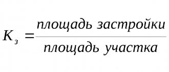
Development coefficient formula
This coefficient shows the proportion between the parts of the site that are built up and the parts that are devoid of buildings (for landscaping, economic activities, open parking). The building coefficient can be calculated using the formula:
KZ = Pz/Pu, where
- Pz – building area (along the outer boundaries of the walls), m2;
- Pu – area of the territory, m2.
Comment on the formula:
- The significance of the coefficient is taken on the basic principles of characterizing the density of the layout in relation to TKP 45-3.01-116 and the ratified basic plan.
- The value of the coefficient cannot be equal to 0 and cannot be greater than 1 (with coefficient KZ = 1, the building boundary will coincide with the boundary of the territory).
When planning the construction of a building, various aspects are considered. They relate not only to the specifics of construction, but also to making a profit.
You can get the maximum benefit if you use the available site for construction optimally, that is, install all communications, allocate space for utility rooms and other required buildings. And the remaining territory should be managed so that it brings the main profit from the project. In many ways, one of the indicators that helps to achieve a better result when planning is the development coefficient.
Dear readers! Our articles talk about typical ways to resolve legal issues, but each case is unique.
If you want to know
How to calculate the percentage of land plot development
Development – construction of structures on the territory of an entire populated area or area. All development rights are secured by articles contained in the Civil Code.
In order for all construction requirements to be met, it is necessary to adhere to the standards and the planning project. There are three types of buildings: continuous, row and open.
It happens in order to get more living space and to make a considerable profit.
Building density – what is it?
- Building density is also referred to as building percentage or building coefficient. It characterizes the total area of all floors of the building, parts of the structure that are located on the ground and buildings within the dimensions of the external walls, which falls on a unit of territory of the site or block. Measured in thousand m2/ha.
- There is also a definition of “building density of a block or residential area ”.
This is the total area of all floors of the structure, parts of which are located above the ground within the dimensions of the external walls, also includes built-in and attached non-apartment area, which is measured in m2 and accounts for 1 hectare of a block or residential area.
The building density can range from 20% to almost 60%.
The density of development varies depending on where it occurs. It is also worth considering that the greater the density, the larger the base of the area on which construction will take place. When ordering a drawing, architects must indicate the highest level of density.
Building coefficient
The development coefficient is the correspondence between the area of the building and the area of the land.
- This indicator regulates the density of buildings and the congestion of the engineering and transport complex.
- An acceptable coefficient is 0.5 . This means that there must be free territory on the site. Without taking this into account, a colossal load is created on the site.
- The building factor includes the maximum permissible number of floors in a building.
- The value of this indicator is determined by authorized persons of the land and architectural departments of the area where the development will take place.
- The calculated indicator must be included in the construction documentation of the land - the register passport. It should also reflect all the necessary information about the intended purpose of a certain territory, the possibility or impossibility of constructing buildings on it and the optimal permissibility of floors, and do not forget to indicate the area of the buildings.
If the developer violates the established standards and the coefficient exceeds the specified value, then he will have to comply with the civil and land legislation of Russia. In this case, the construction is considered illegal and is subject to further destruction.
How is building density calculated?
The development of the area, which is carried out quarterly, is small in size and located next to highways and streets. All necessary facilities and service enterprises in this case are located in remote areas. To get to them, you need to cross highways.
The current development is focused on building microdistricts at once, the size of which exceeds the area of neighborhoods and has more advantages. Outdated areas with block-by-block development are subject to regular improvement. To determine how convenient the location of all necessary institutions and the ideal development are, technical and economic indicators are used.
These indicators also include building density, which is calculated by various formulas - gross and net.
- Calculation of building density using the gross method:
- It is presented as a ratio of the entire area of the territory that is intended for development to the area of the required block or microdistrict.
- Expressed as a percentage.
- Calculation of building density using the net method:
- It is represented by the ratio of the entire area of the site, which is intended for development, to the area of the necessary populated part of the block, in the sense, to the area that is occupied by apartment buildings.
- The area under apartment buildings is expressed by the difference between the total area of the microdistrict and the area indicator for various structures, buildings and enterprises for public, cultural and educational purposes.
These and other technical and economic indicators will allow you to correctly make calculations for the necessary structures, buildings and enterprises for public, cultural and educational purposes in a certain microdistrict.
Development coefficient formula
This coefficient shows the proportion between the parts of the site that are built up and the parts that are devoid of buildings (for landscaping, economic activities, open parking). The building coefficient can be calculated using the formula:
KZ = Pz/Pu, where
- Pz – building area (along the outer boundaries of the walls), m2;
- Pu – area of the territory, m2.
Source: https://kalibr20.ru/urkons/kak-poschitat-procent-zastrojki-zemelnogo-uchastka/
Development rules and rights
The Civil Code determines the legal mechanism, the socio-economic situation forms the goal, and planning projects determine exactly how and what exactly needs to be built.
The correct development and implementation of a territory development plan significantly affects:
- for the execution of engineering structures;
- to organize transport infrastructure;
- to assess economic feasibility;
- on other important aspects.
Territory development plans ensure the compatibility of new and reconstructed buildings with the existing infrastructure, as well as an adequate standard of living for the population.
In residential areas, the construction of transit passages through courtyard areas is prohibited
The location of areas of social and business significance is important: medicine, culture, trade, catering, etc.
Basic Rules.
- Provide citizens with everything they need.
- Reify the normal and natural functioning of the development.
- Create opportunities for comfortable living.
- Organize transport services in all necessary directions.
Industrial territories by production category are located taking into account financial efficiency, safety, ecology and sanitation standards, in particular, transport services for workers, supply of raw materials and materials, shipment of products. In any case, industrial enterprises are located outside residential areas.
The calculation of the residential zone is done for 20 years.
building density %
Population density is the main indicator of the intensity of residential development
territories. This indicator is regulated by SNiP 2.07.01-89*, “...population density, as a rule, should not exceed 450 people/ha.”
Recommended population density for areas of different urban planning
values of climatic regions - IV, IIB and IIB north of 58° N. latitude. and part of subdistricts IA, IG, ID and IIA south of 58° N (Novosibirsk).
Urban planning value of the territory Recommended density (gross)
High 420 people/ha
Average 350 people/ha
Low 200 people/ha
The boundaries of the settlement territory of the microdistrict should be established along red lines
main and residential streets.
Indicators are also used
Building density is the proportion of the built-up area.
Residential density (gross) – the amount of housing (i.e. the amount of total area in residential buildings) per 1 hectare of the microdistrict in the red lines.
Housing stock, sq. m.
PZhF (gross) = —————————-
S micro., ha
Housing density (net) is the ratio of the housing stock to the residential area of a microdistrict.
Housing stock, sq. m.
PZhF (net) = ————————-
S micro residential, ha
Characteristics of residential buildings of various heights.
Low-rise buildings
It is most widespread in rural settlements, small towns and in the peripheral or suburban areas of large cities (in the USA, about 80% of the population lives in their own homes).
Advantages: connection with the land, individual architecture and layout, opportunity
subsequent modification (completion) of the house, own parking space, etc.
Disadvantages: low population density, extended transport and engineering infrastructure
communications, high cost of construction and maintenance, increased time for
pedestrian movements.
To increase population density and use blocked or carpet
development, such development eliminates the disadvantages and retains all the advantages
low-rise housing. Low-rise, high-density buildings are increasingly being used for the development of urban areas, since their density is comparable to multi-storey buildings.
Mid-rise residential development (3 – 5 floors)
A very widespread type of urban development.
Advantages: - it is possible to achieve high density while maintaining contact with
earth.
If we talk about a typical 5-story building of the 50s and 60s. in the USSR, then its main
The disadvantage is the monotony and aesthetic inferiority of the living environment.
Calculation of building density of a land plot
Association of specialized lawyers Sign up for a consultation Describe the situation and receive a free analysis of the prospects for your case within 30 minutes Order Building density in populated areas plays a big role.
sq. m. per 1 hectare of land. The most optimal density indicator should be no less than 20% and no more than 55%.
However, in practice these values may be subject to gradation. So, for example, in some areas it can reach 80-90%. In this case, when deciding to build a new building, you can increase it by adding several floors.
But in other zones (most often the outskirts) the density indicator can be significantly lower than 20%.
In this case, some financial problems can be observed, since the maintenance and maintenance of transport and engineering infrastructure will be very expensive. And don’t forget about the road surface; the construction and repair of roads in areas with low building density is very rarely done, which affects the quality characteristics of the roads.
Find out on our website: . All articles Land law Land management Land ownership Land supervision Categories of land Call us Or on the website and we will contact you Make an appointment Place of work
What is the coefficient for?
In addition to the purpose indicated above, the density coefficient is one of the main standards determined by the state, which must be adhered to when carrying out construction work.
We recommend that you read:
- In general, this coefficient has the following features:
- The coefficient indicator is the main calculated characteristic of the density and congestion of a land plot and infrastructure.
- The acceptable coefficient value is always 0.5, which means that there must be areas free from buildings on the territory of the land plot.
- The coefficient includes the maximum number of storeys of the future structure.
This coefficient is determined by employees of specially authorized departments of local administrations: architectural service and land management department.
The coefficient indicator must be indicated in the documentation of construction work, including the design and engineering diagram of the future building.
In addition, the construction plans must define the part of the territory that remains free from buildings. It is also necessary to indicate the future intended purpose of these parts.
Failure to comply with the requirements entails liability for the perpetrators - the owner of the site and the construction company. Such a building will be declared illegal and demolished by court decision.
Check the development percentage of your site!
When building a house, if your budget allows, you want to build a bigger house. If the land plot is small, then there are cases when the house occupies most of the plot.
This can lead to troubles when registering and registering the right to a house. The development percentage is the area of a land plot that can be occupied by real estate.
The percentage of development depends on the location of the land plot in the relevant territorial zone established by the Land Use and Development Rules (hereinafter referred to as the Land Use Rules), the area of the land plot and the type of its permitted use, as well as the purpose of the capital construction project.
Rules of land use and development - a document of urban planning zoning, which is approved by regulatory legal acts of local governments, regulatory legal acts of state authorities of the constituent entities of the Russian Federation - the federal cities of Moscow, St. Petersburg and Sevastopol and which establish territorial zones, urban planning regulations, application procedures such a document and the procedure for making changes to it. You can download the PZZ for your city or municipality on the website. We have already mentioned the downloading algorithm in one of our articles, we will leave a link to it below. The percentage of development of a land plot must be taken into account when creating a capital construction project.
The value of the percentage of development is established by the PZZ. For example, in the Rules for Land Use and Development of the Synod Municipal Formation of the Voskresensky Municipal District of the Saratov Region in the territorial zone Zh-1 (Zone of Individual Residential Development), the maximum percentage of development of a land plot should not exceed 60 percent. Now let’s look at a specific example. The land plot with cadastral number 64:09:060601:1061 has an area of 1170 sq.m., and the house on it (external contour) is 700 sq.m. This means that the percentage of development of the site is 59.8%, this corresponds to the PZZ, since the threshold of 60% is not exceeded. The area of the building is calculated along the external perimeter, taking into account all protrusions. If the area of the property exceeds the maximum percentage of development, actions to implement state cadastral registration and (or) state registration of rights will be suspended by the cadastral chamber.
Therefore, take this parameter into account during construction. Also read:
How is the built-up area of a residential building calculated?
The building area is the area occupied by the constructed building. This concept is used in territorial planning.
To determine the building area, the ratio of the total area of the building territory and the area occupied by buildings on the same site is taken.
That is why the building area cannot be identical to the area of the building site, especially taking into account the green areas, paths and car accesses located on it.
What is the built-up area?
The building area is the territory occupied by erected buildings . It is smaller than the total area, since the second concept includes all passages, roads and landscaping areas. It is calculated based on the horizontal projection of the structure on the surface of the foundation.
This term refers to the cross-sectional area of a building in the horizontal plane. The section is made along the base, taking into account all protruding areas.
What is included in the construction area:
- horizontal cross-sectional area of the building's basement;
- porch with ramp;
- terraces and verandas;
- balconies and protruding parts of the roof supported by supporting pillars.
The construction of buildings in the Russian Federation is regulated by building codes and regulations (SNiP) . They also contain a definition of “permitted construction area”. We are talking about the territory that is permitted for development.
For different types of territories, this indicator is calculated individually, but in most cases it does not exceed 30% of the entire site.
The construction area of the warehouse territory is larger than the area of residential buildings. That is why, before starting construction, you must find out how to calculate the building area.
How to determine the building area of a residential building
To carry out the calculations correctly, you should first find out the type of objects being built . According to SNiP, the built-up area of residential buildings must be equal to the horizontal sectional area calculated along the outer perimeter of the house contour. These parameters should include all protruding areas and floors, including architectural parts with supports.
One of the frequently encountered queries when carrying out such calculations is the question of whether the blind area is included in the building area. A blind area is a waterproof covering around a building.
It is included in the area of hard surfaces, and therefore does not apply to the building area. Along with it, the territory of hard surfaces includes roads, sidewalks, sports grounds, parking lots, etc.
It is recommended that you hire a professional to determine the maximum building percentage that is allowed by regulations. They will help you carefully study the site and calculate the most optimal ratio of the areas allocated for the construction of buildings and the general territory.
Experienced professionals will provide a ready-made architectural plan, which indicates the dimensions of the required buildings, and a floor plan.
What is the difference between the built-up area and the total area
The total area differs from the building area in scale . The total area includes the parameters of all rooms and areas of the site. To calculate the total area of a residential building, the values of all premises in the building are summed up.
The space of apartment buildings is divided into useful and residential . The construction area of the residential part includes all living quarters in the house with a ceiling height of 2.2 m. Such rooms are intended for living. And usable area includes territory not intended for living.
We are talking about auxiliary premises located inside the house. These areas include:
- verandas;
- loggias;
- built-in cabinets;
- storerooms;
- vestibules.
The size of the residential premises is calculated after finishing work is completed . It includes the floor area excluding the baseboard. If the room has a fireplace or stove, they are also not taken into account when calculating the area.
To calculate the area of a terrace or balcony, only internal parameters without fences are taken. To calculate the total area of a residential building, the areas of residential and auxiliary areas are added up.
Calculation of the building area of multi-storey buildings
When calculating the building area of a building, its number of floors is also important . In this case, only above-ground floors with ceilings higher than 2 m are taken into account.
These can be attic and technical floors, if the height of their ceilings complies with the standard. Interfloor areas and underground areas with ceilings at a level of 1.8 m do not apply to above-ground floors.
If a building consists of several parts of different floors or is built on a site with a slope that led to the addition of additional floors, then all parts of the house are counted separately.
To calculate the building area of multi-storey buildings, reduction factors are used:
- 0.3 – for balconies and terraces;
- 0.5 – for loggias.
Also, the calculation features are also typical for multi-level apartments, since they have internal stairs between floors. The footage of the staircase is taken into account only if the height of its flight is 1.6 m or more.
To calculate the built-up area of a multi-story building, measurements from each floor are added up. Measurements of loggias, balconies and staircases in the house are also taken into account.
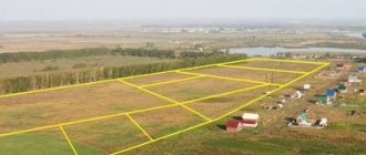
Plots provided to citizens for various purposes of use
Depending on the purposes of land use, plots may have different areas. In each region, these values are established based on their urban planning regulations and regulations adopted at the regional or local levels.
So, for example, in the territory included in the Moscow region there are the following norms for the area of plots:
- For construction classified as individual housing, from 0.2 hectares to 60 acres are allocated;
- To create a personal, peasant, as well as farm and complex enterprise - from 2 to 40 hectares;
- For gardening - from 6 to 15 acres, and for vegetable gardening - from 4 to 10;
- For the construction of buildings within the framework of dacha construction, the legislator allocates plots of area from 6 acres to 25 acres.
These standards are established by the Law of the Moscow Region 63/2003-OZ dated June 17, 2003 “On the maximum size of land plots provided to citizens for ownership on the territory of the Moscow Region.”
If we are talking about the use of a plot without transferring it into ownership, then the maximum values for the size of the area of such plots should be established by municipalities.
Thus, in the Voskresensky district of the Moscow region, plots with an area of 0.06 hectares to 0.15 hectares are allocated for use for individual housing construction; in the Istra district, the values for this purpose of use are similar, and in Klinsky - from 0.05 to 0.3 hectares.
At the same time, in some areas a division is made into lands located within the boundaries of the municipality and beyond them, as, for example, in the Volokolamsk region, where in Volokolamsk a plot with a maximum size of 0.02-0.12 hectares is allocated for individual housing construction, and in rural areas settlements - from 0.02 to 0.25.
The size of the area of land plots that are transferred into the ownership of citizens of the Russian Federation changes depending on the purposes of using such plots. The procedure for determining these values is formulated in the Land and Town Planning Codes of the Russian Federation.
Source: https://RosComLand.ru/zemelnyj-vopros/ploshchad-zemelnogo-uchastka-eto-2.html
Building coefficient
quoted1 > > Development - construction of structures on the territory of an entire populated area or area.
All development rights are secured by articles contained in the Civil Code. In order for all construction requirements to be met, it is necessary to adhere to the standards and the planning project.
There are three types of buildings: continuous, row and open.
- There is also a definition of “building density of a block or residential area.” This is the total area of all floors of the structure, parts of which are located above the ground within the dimensions of the external walls, also includes built-in and attached non-apartment area, which is measured in m2 and accounts for 1 hectare of a block or residential area.
- Building density is also referred to as building percentage or building coefficient. It characterizes the total area of all floors of the building, parts of the structure that are located on the ground and buildings within the dimensions of the external walls, which falls on a unit of territory of the site or block. Measured in thousand m2/ha.
The building density can range from 20% to almost 60%.
It happens in order to get more living space and to make a considerable profit.
The density of development varies depending on where it occurs.
It is also worth considering that the greater the density, the larger the base of the area on which construction will take place. When ordering a drawing, architects must indicate the highest level of density. Take a look at the article about. – this is the correspondence between the area of the structure and the area of the land.
How to calculate site development
- Development project.
- Petition addressed to the head of the district.
- Registration of the object in Glavgosarkhstroynadzor.
- Resolution of the State Administration on permission for construction.
- Floor plans.
- Situational plan of the building, which displays the location of the object in connection with populated areas, energy, heat and water supply networks, and sewerage.
- A copy of documents confirming land ownership.
- Topographic survey of the site.
- The act of establishing the boundaries of the site.
- Situational site plan.
- Permits for connecting communications.
- Purchase and sale agreement for the plot.
- General plan of the site.
The design of the basement, floors, facade, floors, roof system, roofing, foundations with architectural and construction units and details is submitted as a separate folder.
Building coefficient: what is it, how is it calculated and its norm
When planning the construction of a building, various aspects are considered. They relate not only to the specifics of construction, but also to making a profit.
You can get the maximum benefit if you use the available site for construction optimally, that is, install all communications, allocate space for utility rooms and other required buildings. And the remaining territory should be managed so that it brings the main profit from the project. In many ways, one of the indicators that helps to achieve a better result when planning is the development coefficient.
Dear readers! Our articles talk about typical ways to resolve legal issues, but each case is unique.
If you want to know
Ratio norms
In the regulatory and technical documentation “Code of Rules. Urban planning. Planning and development of urban and rural settlements" establishes standard indicators for the density of development of territorial zones.
According to Appendix B, the indicators are as follows:
| Territorial zones | Building coefficient | Building density coefficient |
| Residential | ||
| Development of multi-apartment high-rise residential buildings | 0,4 | 1,2 |
| Development of multi-apartment multi-storey residential buildings, reconstructed | 0,6 | 1,6 |
| Development of low- and medium-rise apartment buildings | 0,4 | 0,8 |
| Development of blocked residential buildings with adjacent land plots | 0,3 | 0,6 |
| Development of one- and two-apartment residential buildings with private land plots | 0,2 | 0,4 |
| Social and business | ||
| Multifunctional development | 1,0 | 3,0 |
| Specialized public development | 0,8 | 2,4 |
| Production | ||
| Industrial | 0,8 | 2,4 |
| Research and production | 0,6 | 1,0 |
| Communal and warehouse | 0,6 | 1,8 |
The given indicators must be taken into account before the construction of buildings and premises. Their violation entails the recognition of the building as invalid. And those who are interested in construction are obliged to conduct their work in accordance with the norms of civil and land legislation.
Otherwise, the constructed facility will disrupt the city’s infrastructure and therefore must be demolished.
Calculation of coefficient
Now let's look at how to calculate the building density coefficient.
As already mentioned, the density coefficient is used in the construction of buildings in microdistricts, that is, public facilities. In this case, private individuals are not allowed to make payments. This is done by employees of authorized government services, who use two methods for calculations:
- gross - implies the ratio of the total area of the planned building and all the territory necessary for the life support of a residential area. Expressed as a percentage;
- net calculation - is made by relating the entire area of the building to the area of the necessary residential premises. In this case, the area of buildings intended for residential apartments is taken into account. To calculate the area of residential buildings, the area of buildings and other social, economic and cultural facilities is subtracted from the total area of a block or district.
The formula for the area utilization coefficient looks like this:
KZ = PZ/PU,
where KZ is the development coefficient;
PZ - building area (outer surface of the walls of buildings in m2);
PU - area of the plot (the territory of the plot is formed according to cadastral indicators).
When planning microdistricts and blocks, the calculations use the total floor area of all ground structures (m2), which is per unit of territory (ha). Accordingly, the unit of measurement for the density of residential development of a land plot is m2/ha.
Conclusion
Building density is one of the most common indicators used in planning and designing buildings. In urban planning practice, it characterizes the intensity of use of territories. All types of blocks or neighborhoods require the use of a density ratio calculation procedure.
The ergonomics and degree of compliance with the standards of the building being constructed depend on it. The same can be said about planning construction on a separate site. A private house is also characterized by the presence of outbuildings outside the house, as well as an area allocated for a garden, vegetable garden and other needs of the owner.
Didn't find the answer to your question? Find out how to solve exactly your problem - call right now:
+7
It's fast and free!
Concept and meaning
What is the building area, which should be determined for both the residential building and the land for construction work? It represents indicators determined parallel to the horizontal base, which includes the protruding part of the territory. These indicators will be enough to develop the allocated areas. It is necessary to understand that such an area can be calculated taking into account several indicators at once.
It is not enough to determine the size of the territory that, in principle, is in the possession of a person. It is also important to identify protruding points. Not each of them, even if it is included in the total area, will be part of the development. If the house has a porch or other platforms, as well as driveways, they must be recognized as included in the building area. It is believed that when a house has balconies that are not secured by any load-bearing pillars, then, on the contrary, they should not be taken into account in the process of calculating the area. Accordingly, by design, buildings may require more territory than the calculated areas.
To regulate the activity of calculating areas, it is necessary to take as a basis the Building Codes and Rules, which were adopted in 2003 and can be applied to both private houses and residential multi-apartment buildings.
To find accurate indicators for area, you need to determine what needs to be calculated.
We are talking about several types of building areas, which include the following:
We recommend that you read:
What does a building spot mean?
- Total area. This is the sum of all area indicators. This should include the area of rooms, all internal and external premises, protruding parts and other elements that are important for establishing the indicator in question.
- The area of the room only. It is determined after finishing the internal walls, and the baseboards will not be taken into account. If this is not an apartment building, but a private one, then if there is a stove, it will not be included in this area, but only if it is part of the overall heating system.
- Living area. Here only those rooms that are recognized as residential will be taken into account; other rooms in the building will not be included in the sum of these indicators.
- Usable or usable area. It includes everything from rooms to balconies. However, some objects, such as elevator shafts and ramps, will not be included here.
If you hire specialists, they will be able to establish the necessary indicators through the use of special equipment. However, it is possible to calculate the area yourself if you have the necessary means for this on hand.
Calculation of building coefficient, building area, area and percentage of greenery
Page 4 of 5 1. The area of the territory within the project development boundaries is 39.00 hectares. The territory within the project development boundaries includes two territorial zones: CO-1 and R-1. Calculation of the development coefficient, building area, for the CO-1 zone. The area of the block (in red lines) is 41193 m2 1.
Total area occupied by buildings and structures Szastr = Szastr n. + Szastr project. where Szastr is the area occupied by preserved (previously designed) buildings and structures located on the territory within the boundaries of the Szastr project quarter. - area occupied by designed buildings and structures located on the territory within the boundaries of the block Szastr = 9878.40 +3375 = 13253.4 m2 2.
Total area of all floors of buildings and structures Stotal built-up = S total built-up n. + S general jammed project. where S total construction existing is the total area of all floors of preserved (previously designed) buildings and structures located within the boundaries of the block .S total construction project. - the total area of all floors of the designed buildings and structures located within the boundaries of the quarter Stotal built-up = 25719.6+6750=32469.6m2 3.
Development coefficient Kzastr = Szastr/ S where S is the area of the block S built up is the total area occupied by buildings and structures Kzastr = 13253.4 / 41193 = 0.3217 = 0.32 4.
Development density coefficient Building density = Stotal development/S where S is the area of the block S total development is the total area of all floors of buildings and structures Building density = 32469 / 41193 = 0.7882 = 0.79 Conclusions: 1. Development coefficient – 0 .32 or 32% does not exceed
Maximum built-up area of the land plot.
06 June 2015, 22:09 This is one of the most important parameters when developing the concept of a future warehouse, production or logistics complex. When designing in the Moscow region, it is necessary to be guided by the following: - the development coefficient of a land plot is the maximum possible territory of a land plot that we can occupy with warehouse or industrial buildings being erected; When determining the maximum development area of a land plot for an industrial or warehouse complex, it is necessary to multiply the total area of the land plot by the development coefficient, thus we will obtain the total development areas of all buildings of the future complex. Development coefficients for land plots of industrial territories in the Moscow region (excerpt from regulatory documents) Types of objects Development coefficient for land plots, not more than (percentage) 1.
Warehouse facilities 60 2. Production facilities: Depending on the purpose of future production From 45 to 60 Thus, we draw the following conclusions: The maximum development area of the land plot of a warehouse complex is 60% of the total area of the territory, production varies from 45% to 60%, depending from destination. This value must be taken at the earliest stages of design, when developing the stage of pre-design decisions and at the stage of preparing presentation materials for the town planning council. The optimal development ratio when designing a master plan for a logistics complex is 50% to ensure maximum convenience for maneuvering areas for freight transport and permanent and temporary parking areas.
It is also necessary to provide space for engineering and auxiliary structures of the logistics complex, such as: checkpoints, pumping stations, hydraulic fracturing stations, fire tanks, administrative buildings, solid waste sites, sites for technological maneuvering of trucks, parking for passenger vehicles and storm drainage treatment.
“Permit to discharge pollutants into the environment”
, which is issued by the Department of Natural Resources on the basis of the “Calculation of Permissible Discharge”.