Land valuation
Our experts will help you figure out who is to blame for the fact that the goods you purchased have deteriorated, the services turned out to be of poor quality or do not correspond to those stated in the advertisement or contract, and what to do in this situation.
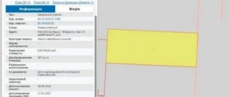
Land valuation is the determination of the value of one or more plots of land using various valuation methods.
A land plot is a part of the surface of the earth that has boundaries certified and described by a government official in accordance with the established procedure, as well as everything that is above and below the lines of the land plot, excluding cases described in federal laws on the use of airspace, subsoil, etc. .
The valuation of a land plot is always associated with one of the rights to land: ownership, lease, easement.
The cost of land depends on many factors. First of all, this is the location of the site, as well as the state of the land market. The valuation of land also depends on the availability of communications and the possibility of connecting them to existing networks in the case of real estate construction. Of considerable importance are the data of engineering-geological and engineering-geodetic observations, which show the composition and characteristics of the soil and information about the terrain. This data can be useful both during construction and in calculating possible costs associated with construction.
When assessing land, its functional purpose and the possibility of changing it are taken into account.
The most common types of functional purpose of land plots:
- Agriculture;
— Individual residential construction;
- Industry;
— Gardening;
— Resort lands, etc.
It happens that just changing the purpose of a land plot led to an increase in its value by an order of magnitude.
To determine the most effective way to use land, you need to keep in mind:
— Location of the site;
— Purpose and permitted use of these lands;
— Predominant land use methods in the area where the site is located;
— Possible changes in the land market;
— Expected conditions of operation and profit;
— Current use of the land.
To estimate the value of land, the following three approaches are used:
Profitable – the net income from the use of a plot of land is taken into account;
Comparative – the costs of similar plots are compared;
Costly - the costs of possible improvements to the land are calculated.
Most often, the comparative method, also called the market method, is used in valuation. Thanks to the comparative method, the market price of the plot is determined, which is necessary, for example, for purchase and sale transactions and other transactions on the land market. In the case where the site generates income from economic activities or from rental, a profitable approach is used. A cost approach is usually necessary when assessing a site that requires improvements or reclassification of use.
THE NEED FOR LAND ASSESSMENT
The land is the basis of all life processes of society occurring in the political, economic, social, industrial, communal, environmental and other spheres. In this regard, it has value and adequate valuation of land is one of the most important conditions for the normal functioning and development of the economy and society. The need for the results of an objective assessment of land (land plots) is felt by both state and municipal executive authorities in order to effectively manage land resources and implement rational land and tax policies.
As market relations develop in modern Russia, land gradually becomes a commodity, that is, an object of economic turnover, and like any commodity, land must have a consumer and market value. The land market, taking into account its scale and the huge unsatisfied demand of the population and legal entities, has great prospects for development and transition to a qualitatively new level of relations between its subjects. The pace of its development largely depends on the improvement of the legal framework and the mechanism of land relations.
The strategic goal of state policy in the field of land and other real estate is to provide conditions for the effective use and development of real estate in the interests of meeting the needs of society and citizens.
Land in the Russian Federation as a natural resource, real estate and the main means of production is subject to valuation.
An appraisal is an estimated or expert value of a real estate property, or any proprietary interest in it, carried out by an authorized person, a specialist in the analysis and evaluation of real estate.
An assessment process is a specific sequence of procedures used to obtain an assessment. The process typically culminates in an appraisal report, giving probative value to the value estimate. The report on the work carried out to obtain an assessment contains a description of the property and a description of the circumstances or limiting conditions under which this assessment retains its value. The report must contain a detailed description of the property being appraised and the date of the appraisal. The report also includes the necessary supporting information and a description of the analysis performed.
In global valuation practice, there are two types of valuation of land plots: mass (for taxation purposes or other government purposes) and individual land property (individual valuation).
Mass valuation models are focused on reproducing the market for one or more land use options over a wide geographic area. To carry out a mass assessment in all subjects of the Russian Federation, trained specialists are needed who work according to the methodology of the State Cadastral Land Valuation, which unifies the procedure for assessing a large number of properties on a specific date by land category. Individual or assessment of individual objects for a specific date is carried out in accordance with the Federal Law “On Valuation Activities in the Russian Federation”, as a rule, by a small number of personnel, the decision is made by one specialist. The quality of the work performed is determined by comparison with actual sales of similar objects. Both types of assessment are systematic methods of calculating value based on market analysis, the fundamental difference lies in the scale of the assessment and quality control of the assessment performed.
As a result of the state cadastral valuation, a real picture of the value of land (land plots) on the territory of the Russian Federation will be obtained, which will allow for more efficient management of land resources and related real estate, as well as balanced planning of the revenue side of budgets of all levels (within the limits of payments , coming from land tax and rent), stimulate the development of investment processes and the development of the economy as a whole.
The land cadastre system, acting in conjunction with the system of state registration of rights to land plots and related improvements, ensures:
-right holders - guarantees of rights to property;
- taxation system - up-to-date information about taxable objects;
-real estate market - open and reliable information about land plots and related improvements;
-system of state and municipal government bodies - information for the formation and implementation of state policy in the field of land and real estate, as well as planning and development of territories.
Work to carry out the state cadastral valuation of lands is carried out by the Federal Land Cadastre Service of Russia, its territorial bodies and enterprises and organizations under its jurisdiction in accordance with the Decree of the Government of the Russian Federation of August 25, 1999 No. 945 “On the state cadastral valuation of lands” and the Decree of the Government of the Russian Federation dated April 8, 2000 No. 316 “On approval of the rules for conducting state cadastral valuation of land.” Persons with a license for valuation activities may also be involved in these works.
The results of the state cadastral assessment of land are entered into the state land cadastre, where, based on information about land plots and their legal holders, they should be used to establish taxable objects, taxpayers, determine the tax base, tax benefits, and land tax rates.
According to the Federal Land Cadastre Service of Russia, as of January 1, 2000, citizens and legal entities owned 129.6 million hectares of land, 126.1 million hectares of which were agricultural lands, and these lands are located in areas of the country with the most favorable soil and natural climatic conditions.
Lands owned by citizens and legal entities account for only 7.6% of the territory of the Russian Federation.
Land tax has a number of advantages compared to other taxes. Due to the fact that the object of taxation is a land plot with boundaries, economic and qualitative characteristics described in the land cadastre, and its legal owner is also known, it is impossible to hide from it. The dynamics of the collection of land payments, consisting of land tax and rent, shows that they are constantly growing and are a reliable source of budget funds, both for the federal budget and for the budgets of the constituent entities of the federation and municipalities. In 2000, the collection of land payments to the consolidated budget amounted to 24.7 billion rubles, which is 37% more than in 1999. At the same time, indexation in 2000 was only 20%.
Today in the Russian Federation, economically determined prerequisites have emerged for pursuing a qualitatively different policy in the field of land valuation and related issues. This situation is largely due to the fact that land tax and, to a large extent, land rent are currently charged at constantly indexed rates in rubles per unit area established in 1991. The total amount of indexation since 1992 for the lands of cities and towns has amounted to more than 8,400 times. Analysis of current land tax rates and selected data on the estimated value of land allows us to draw the following conclusions:
1) the tax burden (the ratio of the current land tax rates to the amount of land rent and the standard price of land) for the land tax on the lands of agricultural producers (even taking into account the 1999 indexation) is higher than on the lands of cities, towns and industrial lands outside populated areas;
2) the tax burden on the lands of small cities and towns with a population of up to 50 thousand people is higher than on the lands of cities with a population of more than 100 thousand people;
3) the tax burden on land in cities with more than 500 thousand population is lower than in cities with other population sizes;
4) the tax burden on the lands of cities and towns with a population of up to 20 thousand people currently differs by more than 20 times;
5) the estimated value of land per unit area of rural settlements in Russia differs by more than 100 times (resort and suburban areas compared to rural settlements remote from large settlements). At the same time, land tax rates differ only several times, which leads to significant differences in the tax burden on the lands of rural settlements by several dozen times;
6) land tax rates on lands used in industry are several times higher relative to other lands (excluding agricultural lands);
7) further indexation of the current rates of land tax on agricultural lands, equally affecting the worst and best lands, is inappropriate due to a number of circumstances, namely:
— an increase in the tax burden on low-value lands, and as a result of direct pressure on the growth of market prices for goods and services, since market prices are formed when lands of poor quality are used;
— the impossibility of ensuring the necessary completeness of the withdrawal of income from the location and quality of land, unjustifiably appropriated when using the best lands.
In 2000, the Federal Land Cadastre Service of Russia took a number of practical preparatory steps to introduce a land tax calculated on the basis of cadastral value. Based on the developed and approved methodology, the first stage of the state cadastral valuation of agricultural land was carried out, during which the average cadastral values for the constituent entities of the Russian Federation were determined[6]. As a result of the state cadastral valuation of agricultural land, the average cost of one hectare of agricultural land for the Russian Federation was determined at 11,400 rubles. At the same time, the highest cost of agricultural land was determined in the Krasnodar Territory, where it amounted to 43,560 rubles/ha.
The state cadastral assessment of agricultural land in the Russian Federation is being completed. Financing of these works amounted to 61,236.9 thousand rubles, or 6% of the land tax collected in 2000 for agricultural land. Establishing a land tax rate of 0.1% of the cadastral value will increase the tax on these lands by approximately 350 million rubles per year.
In 2000, the Federal Land Cadastre Service of Russia also began work on the state cadastral valuation of lands within the boundaries of settlements. Lands within the boundaries of settlements make up only 1.1% of the territory of the Russian Federation, but they account for 85% of all collected land payments and 97% of the land tax sent to the federal budget.
In accordance with the Tax Code, land tax is set at 0.1 to 2% of the cadastral value. Establishing a land tax rate of 0.5% of the cadastral value will increase the tax on land in settlements in the region by 1.8 times per year.
The need to obtain a reliable estimated value of land plots is experienced both by state and municipal executive authorities when managing land resources, implementing the long-term development of settlements, carrying out rational land and tax policies, and by private subjects of land law when making various types of transactions with land, for the purposes of determining the most rational, most effective development of a particular region, or a particular plot of land. The methods of Roszemkadastr for carrying out work on the state cadastral valuation of land make it possible to achieve these goals. For example, the method of state cadastral assessment of settlement lands, which allows, as a result of the work performed, to obtain results in both tabular and cartographic form. The unit cost per square meter is calculated within the boundaries of the cadastral quarter, but there are 14 such costs, according to the number of types of functional use, that is, as a result of the assessment of the lands of each settlement - a set of 14 maps and a matrix, where there are 14 columns according to the number of objects of functional use and as many rows as cadastral blocks in a given settlement.
This allows the results of the state cadastral assessment of land to be used by both local government bodies and the state authorities of the constituent entity of the Russian Federation, since it is clear which of the areas is most rational to develop in one direction or another. This approach seems very important for another reason. Cadastral value and market value are two different categories. To calculate the market value, it is necessary to implement the principle of the most effective, most rational use of land, and this, as a rule, and in general, is always the use of the site in which its value becomes maximum. It is clear that in this case, the trading enterprises located in the center and, say, a dilapidated building of individual residential buildings nearby, would turn out to be completely identical from the point of view of taxation, which cannot be considered fair, even possible, because for such an approach it is necessary to have the possibility of alternative resettlement these people are taxpayers. Or, say, the immediate removal of an industrial enterprise from the city center and its construction in a place more suitable for the enterprise, which is not yet possible. But this also does not mean that the state cadastral valuation of land is opposed to market valuation. Having in front of you a set of 14 values for each cadastral quarter, a set of 14 maps, it is easy to see which type of functional use for this particular cadastral quarter is the most effective and most rational - the one at which the cadastral value is maximum. This does not require any additional calculations.
Thus, existing experience confirms the high efficiency of state cadastral valuation of land for tax purposes.
In the transition period to a market economy, a separate assessment of the value of the land plot itself becomes especially necessary, since this methodological approach to the valuation of real estate allows, with relatively less cost and time:
-contribute to the process of market pricing;
- ensure the return of municipal budget funds for the improvement and public improvements carried out by them in a shorter period of time;
- objectively assess actual damage, lost profits and other compensation payments in cases provided for by law;
- establish negotiated prices by interested parties, including rent, mortgage loan amount, etc.